Trail Mountain bike Anse - La Virée des Arlequins 2010 33km - Photo

La Virée des Arlequins 2010 33km

 tracegps
tracegps

User

© OpenStreetMap contributors
Length
Length
29 km
Max alt
Max alt
486 m
Uphill gradient
Uphill gradient
704 m
Km-Effort
Km-Effort  
38 km
Min alt
Min alt
238 m
Downhill gradient
Downhill gradient
708 m
Boucle
Boucle
Yes
Creation date :
2014-12-10 00:00:00.0
Updated on :
2014-12-10 00:00:00.0

(0 Reviews)

Mountain bike
Mountain bike
3h00
Difficulty : Difficult

Scan this QR Code to open this trail in the SityTrail application

FREE GPS app for hiking

Logo SityTrail SityTrail

IGN / Geographical institutes

Download SityTrail from the App Store Download SityTrail from Google Play

Logo SityTrail SityTrail World

The world is yours!

Download SityTrail from the App Store Download SityTrail from Google Play Download SityTrail on Huawei AppGallery

About

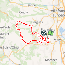
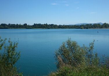
Trail Mountain bike of 29 km to be discovered at Auvergne-Rhône-Alpes, Rhône, Anse. This trail is proposed by tracegps.

Description

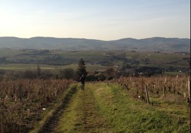
Beau parcours bien équilibré passant par la Voie du Tacot dans le Beaujolais pour cette première édition. Accueil et organisation de bon niveau, rdv l'année prochaine!

Elevation profile

Photos

Positioning

Country:
France
Region :
Auvergne-Rhône-Alpes
Department/Province :
Rhône
Municipality :
Anse
Location:
Unknown
Start:(UTM)
630976 ; 5088556 (31T) N.

Trails nearby

Trail Nordic walking Bagnols - bagnol - Photo
Nordic walking
isabelle.xavier

Nordic walking

Very easy
(1)
Bagnols, Auvergne-Rhône-Alpes, Rhône, France
6.8 km | 8.4 km-effort
1h 40min
Yes
Trail Walking Morancé - morance - Photo
Walking
6974gros

Walking

Very easy
(1)
Morancé, Auvergne-Rhône-Alpes, Rhône, France
7.9 km | 9.7 km-effort
1h 46min
Yes
Trail Horseback riding Les Chères - 5 nov formation - Photo
Horseback riding
HOUDA DRIF

Horseback riding

Easy
(2)
Les Chères, Auvergne-Rhône-Alpes, Rhône, France
13.6 km | 15 km-effort
1h 58min
Yes
Trail Walking Porte des Pierres Dorées - Jarnioux (8,5 km - D. 249 m) - Photo
Walking
Thomasdanielle

Walking

Porte des Pierres Dorées, Auvergne-Rhône-Alpes, Rhône, France
8.5 km | 11.8 km-effort
2h 42min
Yes
Trail Walking Lucenay - Lucenay (69) - 9 km/D. 293 m - Photo
Walking
Thomasdanielle

Walking

Lucenay, Auvergne-Rhône-Alpes, Rhône, France
8.8 km | 12.7 km-effort
2h 50min
Yes
Trail Walking Porte des Pierres Dorées - Jarnioux 10.4 km - Photo
Walking
Thomasdanielle

Walking

Easy
Porte des Pierres Dorées, Auvergne-Rhône-Alpes, Rhône, France
10.4 km | 13.5 km-effort
2h 58min
Yes
Trail Walking Anse - anse - Photo
Walking
aurel69

Walking

Very easy
Anse, Auvergne-Rhône-Alpes, Rhône, France
3.9 km | 4.3 km-effort
47min
No
Trail Walking Limas - Limas - Photo
Walking
thierry13710

Walking

Easy
Limas, Auvergne-Rhône-Alpes, Rhône, France
5.7 km | 7.6 km-effort
1h 37min
Yes
Trail Walking Porte des Pierres Dorées - Chemin du Tacot (1) - Photo
Walking
patrickmarchais

Walking

Medium
(1)
Porte des Pierres Dorées, Auvergne-Rhône-Alpes, Rhône, France
17.5 km | 22 km-effort
Unknown
No


Close
My subscriptions