6.7 km | 8.6 km-effort
st jean thomas AR par terres et sentier littoral
doclocjl
User
Length
14.6 km
Max alt
102 m
Uphill gradient
239 m
Km-Effort
17.8 km
Min alt
9 m
Downhill gradient
238 m
Boucle
Yes
Creation date :
2018-04-18 00:15:35.555
Updated on :
2018-04-18 00:15:35.555
5h26
Difficulty : Easy
FREE GPS app for hiking
About
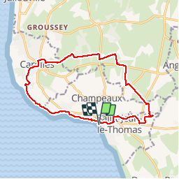
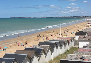
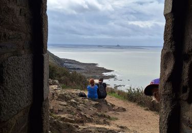
Trail Walking of 14.6 km to be discovered at Normandy, Manche, Saint-Jean-le-Thomas. This trail is proposed by doclocjl.
Description
circuit boisé et retour par sentier littoral
Positioning
Country:
France
Region :
Normandy
Department/Province :
Manche
Municipality :
Saint-Jean-le-Thomas
Location:
Unknown
Start:(Dec)
Start:(UTM)
608179 ; 5398486 (30U) N.
Comments
Trails nearby
Falaises de Carolles
Walking
Very easy
Carolles,
Normandy,
Manche,
France
4.1 km | 5.4 km-effort
1h 6min
Yes
La Baie du Mont Saint Michel
Walking
Medium
Genêts,
Normandy,
Manche,
France
13.1 km | 13.3 km-effort
3h 3min
Yes
Le Bec d’Andaine
Walking
Easy
Dragey-Ronthon,
Normandy,
Manche,
France
10.2 km | 11.2 km-effort
3h 1min
Yes
Baie Mont Saint Michel
Walking
Easy
Genêts,
Normandy,
Manche,
France
13.1 km | 13.3 km-effort
3h 0min
Yes
Cabane Vauban et port du Lude
Walking
Easy
Carolles,
Normandy,
Manche,
France
4.4 km | 5.7 km-effort
2h 17min
Yes
Bouillon Granville VTT
Mountain bike
Medium
Jullouville,
Normandy,
Manche,
France
27 km | 31 km-effort
2h 51min
No