


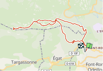


13,3 km | 19,3 km-effort

Gebruiker


Gratisgps-wandelapplicatie
 SityTrail
IGN / Geografische instituten
SityTrail World
De wereld gaat voor u open
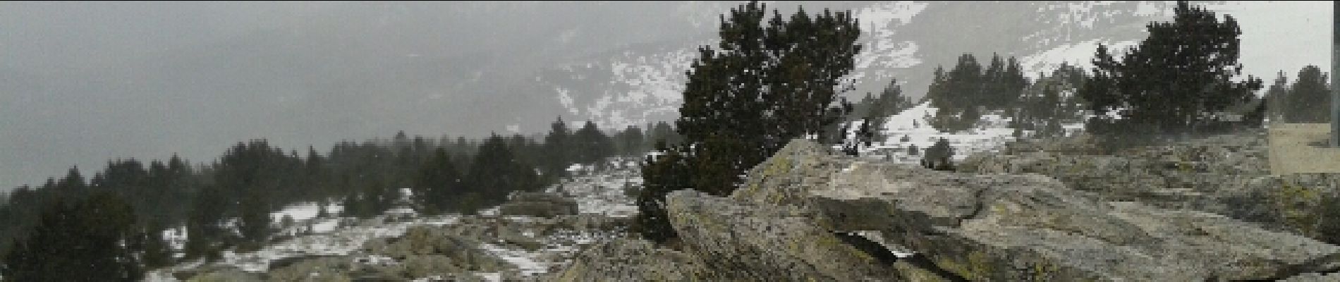
Tocht Sneeuwschoenen van 12,6 km beschikbaar op Occitanië, Pyrénées-Orientales, Font-Romeu-Odeillo-Via. Deze tocht wordt voorgesteld door jpipacific.
raquettes


Stappen

Stappen

Stappen

Sneeuwschoenen

Stappen

Stappen

Stappen

Mountainbike

Stappen