Upper Savoy, Auvergne-Rhône-Alpes, Miscellaneous: Best trails, routes and walks

445 comments

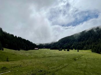
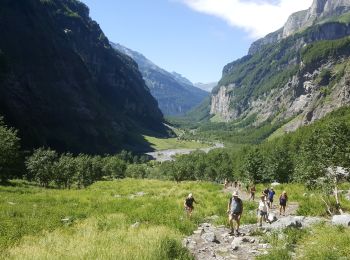
Upper Savoy: Discover the best trails: 8 roller skating, 18 via ferrata, 2 fishing, 2 orienteering and 17 climbing. All these trails, routes and outdoor activities are available in our SityTrail applications for smartphones and tablets.


The best trails (520)

Trail Other activity Chamonix-Mont-Blanc - vallée blanche - Photo
Other activity 19.842
Km

Other activity

Difficult
(1)
Chamonix-Mont-Blanc, Auvergne-Rhône-Alpes, Upper Savoy, France
19.8 km | 30 km-effort
3h 21min
78 m
2728 m
No
jnpollet

• ski

Trail Orienteering Glières-Val-de-Borne - exp_16 juil. 2021 à 08-45-33 - Photo
Orienteering 14.369
Km

Orienteering

Medium
Glières-Val-de-Borne, Auvergne-Rhône-Alpes, Upper Savoy, France
14.4 km | 23 km-effort
5h 30min
644 m
641 m
Yes
Myrostates

Trail Fishing Sixt-Fer-à-Cheval - Sixt fer à cheval - Photo
Fishing 12.07
Km

Fishing

Very easy
Sixt-Fer-à-Cheval, Auvergne-Rhône-Alpes, Upper Savoy, France
12.1 km | 17.9 km-effort
3h 37min
418 m
499 m
No
jeff2

Trail Other activity Annecy - le mont veyrier - Photo
Other activity 18.192
Km

Other activity

Very easy
Annecy, Auvergne-Rhône-Alpes, Upper Savoy, France
18.2 km | 31 km-effort
5h 49min
945 m
946 m
Yes
popo38

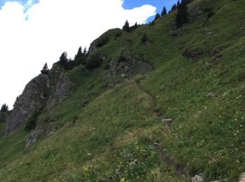
• au depart d'Annecy on s'echappe de la ville pour gravir au Mont Veyrier en passant par des sentiers escarpés, caillou...

Trail Other activity Bellevaux - Rando pointe de La Gay  - Photo
Other activity 10.9
Km

Other activity

Medium
Bellevaux, Auvergne-Rhône-Alpes, Upper Savoy, France
10.9 km | 23 km-effort
4h 39min
875 m
875 m
Yes
leclaude74

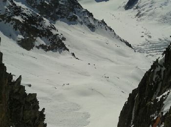
• rando a ski conseiller de faire la descente côté montée car la boucle pour le retour est a faire si beaucoup de neige...

Trail Other activity Vallorcine - le Buet 3108m - Photo
Other activity 20.815
Km

Other activity

Very easy
Vallorcine, Auvergne-Rhône-Alpes, Upper Savoy, France
21 km | 44 km-effort
7h 28min
1747 m
1747 m
Yes
jeff2

• JF départ à 7h15

Trail Other activity Vallorcine - le Buet 3108m - Photo
Other activity 20.815
Km

Other activity

Very easy
Vallorcine, Auvergne-Rhône-Alpes, Upper Savoy, France
21 km | 44 km-effort
7h 28min
1747 m
1747 m
Yes
jeff2

• JF départ à 7h15

Trail Other activity Chamonix-Mont-Blanc - la jonction  - Photo
Other activity 13.749
Km

Other activity

Very easy
Chamonix-Mont-Blanc, Auvergne-Rhône-Alpes, Upper Savoy, France
13.7 km | 33 km-effort
7h 36min
1366 m
1574 m
No
jeff2

• Vero jef

Trail Other activity Les Clefs - Tournette ski - Photo
Other activity 8.52
Km

Other activity

Medium
Les Clefs, Auvergne-Rhône-Alpes, Upper Savoy, France
8.5 km | 24 km-effort
4h 29min
1216 m
1009 m
No
biollay

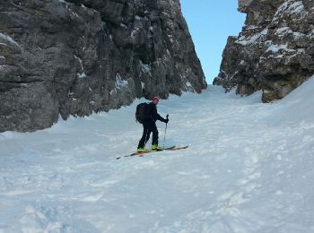
• la tournette voie normale ski rando

Trail Other activity Chamonix-Mont-Blanc - arête des cosmique - Photo
Other activity 4.062
Km

Other activity

Difficult
Chamonix-Mont-Blanc, Auvergne-Rhône-Alpes, Upper Savoy, France
4.1 km | 8.1 km-effort
7h 49min
253 m
438 m
No
bellouelo46

• escalade de neige

Trail Other activity La Chapelle-d'Abondance - chapelle d abondance Trebentaz chapelle d abondance - Photo
Other activity 13.922
Km

Other activity

Difficult
La Chapelle-d'Abondance, Auvergne-Rhône-Alpes, Upper Savoy, France
13.9 km | 28 km-effort
4h 51min
1077 m
1077 m
Yes
patricee2p

• Montée au refuge de Trebentaz avec déjeuner super vue magnifique et descente sur l'autre versant

Trail Other activity Chamonix-Mont-Blanc - Col du Passon - Photo
Other activity 14.604
Km

Other activity

Very easy
Chamonix-Mont-Blanc, Auvergne-Rhône-Alpes, Upper Savoy, France
14.6 km | 30 km-effort
4h 39min
681 m
2437 m
No
marphi

• ski

Trail Other activity La Balme-de-Sillingy - grand tour mandallaz complet V1 - Photo
Other activity 23.984
Km

Other activity

Difficult
(1)
La Balme-de-Sillingy, Auvergne-Rhône-Alpes, Upper Savoy, France
24 km | 35 km-effort
3h 6min
817 m
816 m
Yes
TFOLCHER

Trail Other activity Manigod - etale - Photo
Other activity 7.792
Km

Other activity

Very easy
Manigod, Auvergne-Rhône-Alpes, Upper Savoy, France
7.8 km | 22 km-effort
3h 47min
1098 m
1100 m
Yes
laurentbogain

Trail Other activity Les Clefs - Sulens - Photo
Other activity 5.632
Km

Other activity

Very easy
Les Clefs, Auvergne-Rhône-Alpes, Upper Savoy, France
5.6 km | 12.6 km-effort
3h 36min
525 m
526 m
Yes
denisdeb

• ski de randonnée

Trail Other activity Annecy - Petit guide - Photo
Other activity 9.063
Km

Other activity

Very easy
(1)
Annecy, Auvergne-Rhône-Alpes, Upper Savoy, France
9.1 km | 14 km-effort
1h 40min
372 m
375 m
Yes
arperouse

Trail Other activity Megève - trail - Photo
Other activity 8.237
Km

Other activity

Very easy
Megève, Auvergne-Rhône-Alpes, Upper Savoy, France
8.2 km | 14 km-effort
3h 41min
435 m
416 m
Yes
randostrail

Trail Other activity Chamonix-Mont-Blanc - chardonnay col - Photo
Other activity 5.629
Km

Other activity

Very easy
Chamonix-Mont-Blanc, Auvergne-Rhône-Alpes, Upper Savoy, France
5.6 km | 14.5 km-effort
2h 47min
801 m
250 m
No
diet

• Monte toutadroite

Trail Other activity La Chapelle-d'Abondance - savalenaz - Photo
Other activity 3.225
Km

Other activity

Very easy
La Chapelle-d'Abondance, Auvergne-Rhône-Alpes, Upper Savoy, France
3.2 km | 6.6 km-effort
1h 13min
331 m
12 m
No
jntoreau

Trail Other activity Combloux - Mont Arbois Megeve - Photo
Other activity 5.187
Km

Other activity

Very easy
Combloux, Auvergne-Rhône-Alpes, Upper Savoy, France
5.2 km | 9.6 km-effort
Unknown
431 m
41 m
No
gregouille

20 trails displayed on 520

FREE GPS app for hiking

Logo SityTrail SityTrail

IGN / Geographical institutes

Download SityTrail from the App Store Download SityTrail from Google Play

Logo SityTrail SityTrail World

The world is yours!

Download SityTrail from the App Store Download SityTrail from Google Play Download SityTrail on Huawei AppGallery

Activities

Nearby regions

Close
My subscriptions