La Bréole, Ubaye-Serre-Ponçon: Best trails, routes and walks

2 comments

La Bréole: Discover the best trails: 8 hiking trails and 2 bike and mountain-bike routes. All these trails, routes and outdoor activities are available in our SityTrail applications for smartphones and tablets.


The best trails (10)

Trail Walking Ubaye-Serre-Ponçon - le clôt de la cime. - Photo
Walking 12.473
Km

Walking

Easy
(1)
Ubaye-Serre-Ponçon, Provence-Alpes-Côte d'Azur, Alpes-de-Haute-Provence, France
12.5 km | 19.8 km-effort
4h 0min
548 m
545 m
Yes
GILOU440

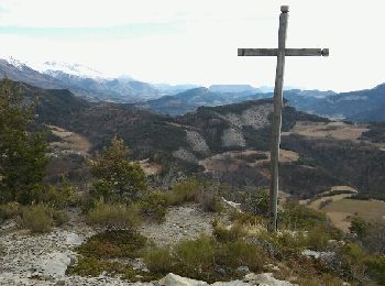
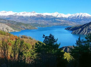
• départ de la routière .le clôt . borne 1400m col de charamel . belle vue sur le lac.

Trail Walking Ubaye-Serre-Ponçon - Clot la Cime - Photo
Walking 6.665
Km
GUIDE

Walking

Very easy
Ubaye-Serre-Ponçon, Provence-Alpes-Côte d'Azur, Alpes-de-Haute-Provence, France
6.7 km | 11.3 km-effort
2h 54min
346 m
349 m
Yes
David25400

Trail Walking Ubaye-Serre-Ponçon - 20191203_Espinasse L'escoubaye - Photo
Walking 16.315
Km

Walking

Medium
Ubaye-Serre-Ponçon, Provence-Alpes-Côte d'Azur, Alpes-de-Haute-Provence, France
16.3 km | 24 km-effort
5h 50min
572 m
572 m
Yes
PapouBertrand

Trail Walking Ubaye-Serre-Ponçon - lac St Léger par les goirands - Photo
Walking 12.254
Km

Walking

Medium
Ubaye-Serre-Ponçon, Provence-Alpes-Côte d'Azur, Alpes-de-Haute-Provence, France
12.3 km | 18.3 km-effort
4h 29min
455 m
458 m
Yes
Yves Locati

Trail Mountain bike Ubaye-Serre-Ponçon - L'Eygaye / st jean Monclar - Photo
Mountain bike 27.425
Km

Mountain bike

Difficult
Ubaye-Serre-Ponçon, Provence-Alpes-Côte d'Azur, Alpes-de-Haute-Provence, France
27 km | 42 km-effort
4h 5min
1073 m
1076 m
Yes
mthomas30

Trail Mountain bike Ubaye-Serre-Ponçon - Charamel - Espinasses - Colombis - Photo
Mountain bike 24.065
Km

Mountain bike

Medium
Ubaye-Serre-Ponçon, Provence-Alpes-Côte d'Azur, Alpes-de-Haute-Provence, France
24 km | 39 km-effort
3h 16min
1228 m
716 m
No
mthomas30

Trail Walking Ubaye-Serre-Ponçon - l escoubaye - Photo
Walking 15.102
Km

Walking

Easy
Ubaye-Serre-Ponçon, Provence-Alpes-Côte d'Azur, Alpes-de-Haute-Provence, France
15.1 km | 23 km-effort
5h 7min
559 m
561 m
Yes
gibello

Trail Walking Ubaye-Serre-Ponçon - Lac de Saint Leger - Photo
Walking 10.303
Km

Walking

Medium
(1)
Ubaye-Serre-Ponçon, Provence-Alpes-Côte d'Azur, Alpes-de-Haute-Provence, France
10.3 km | 16.1 km-effort
3h 19min
434 m
434 m
Yes
saintherant

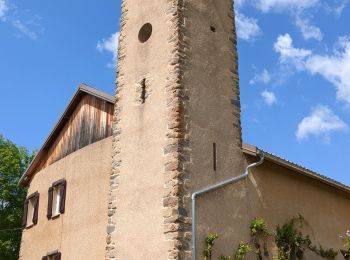
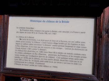
• Au départ de l'Eglise de Costebelle sur la commune de La Bréole, ce circuit adapté aux marcheurs moyens vous emmènera...

Trail Walking Ubaye-Serre-Ponçon - L’escoubaye  - Photo
Walking 5.28
Km

Walking

Easy
Ubaye-Serre-Ponçon, Provence-Alpes-Côte d'Azur, Alpes-de-Haute-Provence, France
5.3 km | 8.4 km-effort
2h 24min
234 m
233 m
Yes
Nuance

Trail Walking Ubaye-Serre-Ponçon - Chaussetive - Photo
Walking 7.22
Km

Walking

Ubaye-Serre-Ponçon, Provence-Alpes-Côte d'Azur, Alpes-de-Haute-Provence, France
7.2 km | 9.6 km-effort
2h 37min
175 m
175 m
Yes
Nuance

10 trails displayed on 10

FREE GPS app for hiking

Logo SityTrail SityTrail

IGN / Geographical institutes

Download SityTrail from the App Store Download SityTrail from Google Play

Logo SityTrail SityTrail World

The world is yours!

Download SityTrail from the App Store Download SityTrail from Google Play Download SityTrail on Huawei AppGallery

Activities

Close
My subscriptions