


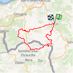

18.8 km | 27 km-effort

User


FREE GPS app for hiking
 SityTrail
IGN / Geographical institutes
SityTrail World
The world is yours!
Trail Mountain bike of 30 km to be discovered at New Aquitaine, Pyrénées-Atlantiques, Ascain. This trail is proposed by tracegps.
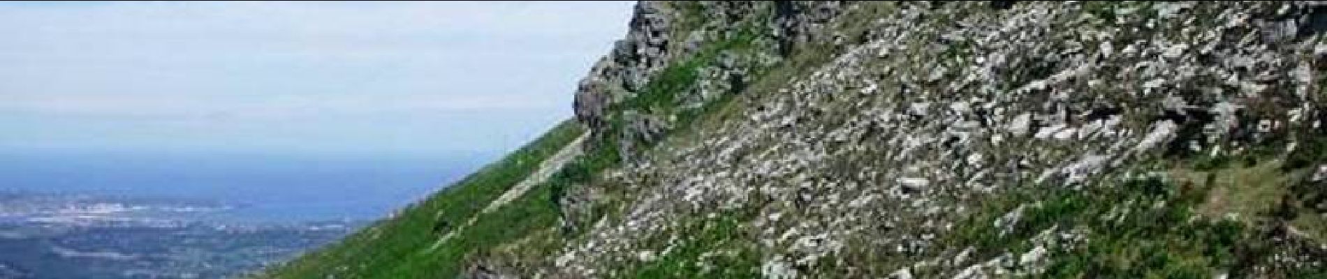
11 Aout 2004 La météo est de mieux en mieux, on décide de monter à le Rhune (900m) qui est rendu accessible aux touristes par un petit train à crémaillère. Les chemins ne permettent pas d'y monter du côté français en vélo, par contre il y a une belle piste très pentue qui monte du côté espagnol. Le problème est de trouver le départ de la piste car il n'y a pas de cartes espagnoles très précises pour préparer le parcours au GPS... Au retour nous sommes allés nous rafraîchir en piquant une tête dans l'océan. D'autres photos sont ICI


Walking
Walking

Walking

Walking

Walking

Walking
Walking
Walking

Mountain bike