


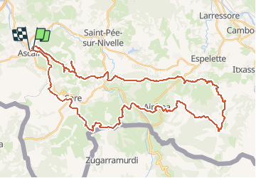

18.8 km | 27 km-effort

User


FREE GPS app for hiking
 SityTrail
IGN / Geographical institutes
SityTrail World
The world is yours!
Trail Mountain bike of 55 km to be discovered at New Aquitaine, Pyrénées-Atlantiques, Ascain. This trail is proposed by tracegps.
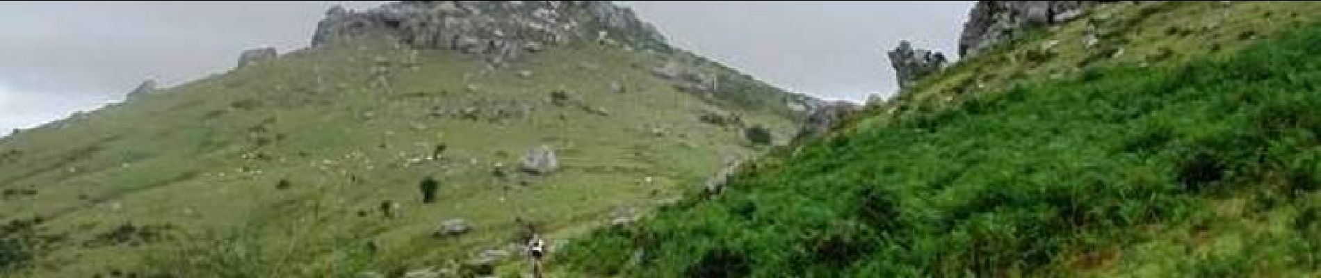
11 Aout 2004 Dernier jour dans le Pays Basque, nous partons du côté Est en prenant la suite du GR10 à partir d'Ascain jusqu'au col de Zuharreteaco. Retour par le GR 8 en restant un peu plus dans le plaine mais les côtes font quand même très mal ! Le sentiment de la journée est qu'il y a un très gros potentiel dans le coin mais il faut aller du côté Espagnol, le plus dur étant de trouver des cartes précises... La suite est ICI


Walking
Walking

Walking

Walking

Walking

Walking
Walking
Walking

Mountain bike