Trail Walking Sauveterre-Saint-Denis - Sauveterre St Denis - Photo
 tracegps
tracegps

User

© OpenStreetMap contributors
Length
Length
30 km
Max alt
Max alt
150 m
Uphill gradient
Uphill gradient
279 m
Km-Effort
Km-Effort  
34 km
Min alt
Min alt
43 m
Downhill gradient
Downhill gradient
283 m
Boucle
Boucle
Yes
Creation date :
2014-12-10 00:00:00.0
Updated on :
2014-12-10 00:00:00.0

(0 Reviews)

Walking
Walking
6h00
Difficulty : Very difficult

Scan this QR Code to open this trail in the SityTrail application

FREE GPS app for hiking

Logo SityTrail SityTrail

IGN / Geographical institutes

Download SityTrail from the App Store Download SityTrail from Google Play

Logo SityTrail SityTrail World

The world is yours!

Download SityTrail from the App Store Download SityTrail from Google Play Download SityTrail on Huawei AppGallery

About

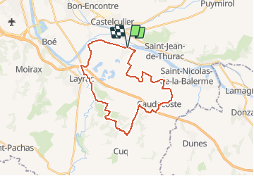
Trail Walking of 30 km to be discovered at New Aquitaine, Lot-et-Garonne, Sauveterre-Saint-Denis. This trail is proposed by tracegps.

Description

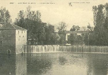
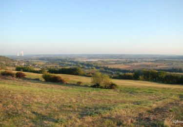
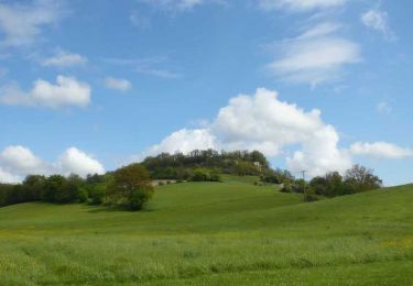
Parcours de 30kms environ. Le début du parcours jusqu'à Caudecoste est plat: chemins de caillou, de terre et petites routes défoncées dans la plaine de Garonne. A partir de Caudecoste, ça se corse un peu avec des parcours en sous-bois plus vallonnés...puis retour de Layrac à Caudecoste dans le maïs et au bord de Garonne.

Elevation profile

Photos

Positioning

Country:
France
Region :
New Aquitaine
Department/Province :
Lot-et-Garonne
Municipality :
Sauveterre-Saint-Denis
Location:
Unknown
Start:(UTM)
316601 ; 4891721 (31T) N.

Trails nearby

Trail Walking Castelculier - Saint-Amans / Saint-Ferréol, deux églises en Agenais - Pays de l'Agenais - Photo
Walking
tracegps

Walking

Medium
(1)
Castelculier, New Aquitaine, Lot-et-Garonne, France
11.1 km | 15 km-effort
3h 0min
Yes
Trail Mountain bike Lafox - super rando du mercredi - Photo
Mountain bike
wardom

Mountain bike

Difficult
(1)
Lafox, New Aquitaine, Lot-et-Garonne, France
21 km | 26 km-effort
1h 29min
Yes
Trail Mountain bike Castelculier - Rando VTT Amans - Laroque Timbaut et le bois de Courties - Agen Bon Encontre - Photo
Mountain bike
tracegps

Mountain bike

Difficult
Castelculier, New Aquitaine, Lot-et-Garonne, France
40 km | 50 km-effort
2h 30min
Yes
Trail Mountain bike Sauveterre-Saint-Denis - Sauveterre St Denis - Photo
Mountain bike
tracegps

Mountain bike

Medium
Sauveterre-Saint-Denis, New Aquitaine, Lot-et-Garonne, France
30 km | 34 km-effort
2h 0min
Yes
Trail Equestrian Saint-Pierre-de-Clairac - Saint-Pierre-de-Clairac, dans la vallée de la Séoune - Pays de l'Agenais - Photo
Equestrian
tracegps

Equestrian

Medium
Saint-Pierre-de-Clairac, New Aquitaine, Lot-et-Garonne, France
10 km | 12.1 km-effort
1h 40min
Yes
Trail Mountain bike Saint-Pierre-de-Clairac - Saint-Pierre-de-Clairac, dans la vallée de la Séoune - Pays de l'Agenais - Photo
Mountain bike
tracegps

Mountain bike

Medium
Saint-Pierre-de-Clairac, New Aquitaine, Lot-et-Garonne, France
10 km | 12.1 km-effort
1h 15min
Yes
Trail Walking Saint-Pierre-de-Clairac - Saint-Pierre-de-Clairac, dans la vallée de la Séoune - Pays de l'Agenais - Photo
Walking
tracegps

Walking

Medium
Saint-Pierre-de-Clairac, New Aquitaine, Lot-et-Garonne, France
10 km | 12.1 km-effort
2h 40min
Yes
Trail Mountain bike Saint-Jean-de-Thurac - Saint-Jean-de-Thurac, du canal aux coteaux de Serres - Pays de l'Agenais - Photo
Mountain bike
tracegps

Mountain bike

Medium
Saint-Jean-de-Thurac, New Aquitaine, Lot-et-Garonne, France
7.1 km | 9.9 km-effort
1h 10min
Yes
Trail Walking Saint-Jean-de-Thurac - Saint-Jean-de-Thurac, du canal aux coteaux de Serres - Pays de l'Agenais - Photo
Walking
tracegps

Walking

Medium
Saint-Jean-de-Thurac, New Aquitaine, Lot-et-Garonne, France
7.1 km | 9.9 km-effort
2h 15min
Yes


Close
My subscriptions