Trail Mountain bike Laragne-Montéglin - Grande Traversée des PréAlpes à VTT : Arzeliers - Ribiers - Photo

Grande Traversée des PréAlpes à VTT : Arzeliers - Ribiers

 tracegps
tracegps

User

© OpenStreetMap contributors
Length
Length
26 km
Max alt
Max alt
736 m
Uphill gradient
Uphill gradient
434 m
Km-Effort
Km-Effort  
33 km
Min alt
Min alt
494 m
Downhill gradient
Downhill gradient
602 m
Boucle
Boucle
No
Creation date :
2014-12-10 00:00:00.0
Updated on :
2014-12-10 00:00:00.0

(0 Reviews)

Mountain bike
Mountain bike
2h30
Difficulty : Difficult

Scan this QR Code to open this trail in the SityTrail application

FREE GPS app for hiking

Logo SityTrail SityTrail

IGN / Geographical institutes

Download SityTrail from the App Store Download SityTrail from Google Play

Logo SityTrail SityTrail World

The world is yours!

Download SityTrail from the App Store Download SityTrail from Google Play Download SityTrail on Huawei AppGallery

About

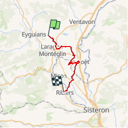
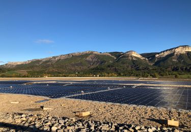
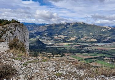
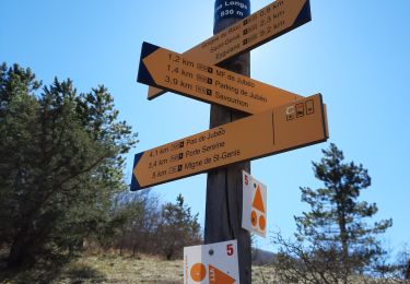
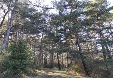
Trail Mountain bike of 26 km to be discovered at Provence-Alpes-Côte d'Azur, Hautes-Alpes, Laragne-Montéglin. This trail is proposed by tracegps.

Description

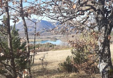
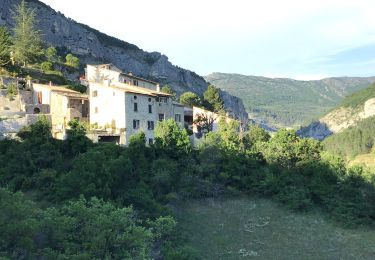
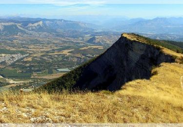
Grande Traversée des Préalpes, les Chemins du Soleil. Parcours officiel labellisé par la Fédération Française de Cyclisme. Parcours Valence – Gap - Sisteron – Tronçon n° 36 Niveau: moyen, avec grosse difficulté entre le point 4 et Upaix: série de petits portages, rythme très cassant. Mesure de prudence: plusieurs traversées de routes. Consultez toutes les informations sur les hébergements et les services associés sur la fiche du tronçon. Retrouvez cette traversée dans l’indispensable topo Guide Chamina Grande Traversée des Préalpes

Elevation profile

Photos

Positioning

Country:
France
Region :
Provence-Alpes-Côte d'Azur
Department/Province :
Hautes-Alpes
Municipality :
Laragne-Montéglin
Location:
Unknown
Start:(UTM)
724168 ; 4913754 (31T) N.

Trails nearby

Trail Walking Garde-Colombe - R33   La Montagne de Saint Genis - Photo
Walking
GUIDE+

Walking

Medium
Garde-Colombe, Provence-Alpes-Côte d'Azur, Hautes-Alpes, France
11.4 km | 19.4 km-effort
3h 59min
Yes
Trail Mountain bike Laragne-Montéglin - Laragne 2008 - Photo
Mountain bike
tracegps

Mountain bike

Difficult
(1)
Laragne-Montéglin, Provence-Alpes-Côte d'Azur, Hautes-Alpes, France
35 km | 47 km-effort
3h 0min
No
Trail Walking Lazer - Le lac de Lazer par La Chapelle StJean - Photo
Walking
babouille

Walking

Medium
Lazer, Provence-Alpes-Côte d'Azur, Hautes-Alpes, France
6.5 km | 7.4 km-effort
1h 40min
Yes
Trail On foot Garde-Colombe - Revuaire - Photo
On foot
Marco05

On foot

Difficult
Garde-Colombe, Provence-Alpes-Côte d'Azur, Hautes-Alpes, France
12.1 km | 21 km-effort
4h 42min
Yes
Trail Walking Garde-Colombe - Le réduire.. gorge du riou - Photo
Walking
gibello

Walking

Medium
Garde-Colombe, Provence-Alpes-Côte d'Azur, Hautes-Alpes, France
12.1 km | 21 km-effort
5h 3min
Yes
Trail Walking Laragne-Montéglin - Vieil Arzellier/Vieil Eyguians.21/02/21. - Photo
Walking
Dervalmarc

Walking

Easy
Laragne-Montéglin, Provence-Alpes-Côte d'Azur, Hautes-Alpes, France
3.5 km | 4.7 km-effort
59min
No
Trail Walking Garde-Colombe - SAINT GENIS Dep lac du Riou . Forte Sereine  gorges du Riou o m s    - Photo
Walking
RobinMicheline

Walking

Medium
Garde-Colombe, Provence-Alpes-Côte d'Azur, Hautes-Alpes, France
10.6 km | 17.4 km-effort
3h 10min
Yes
Trail Mountain bike Garde-Colombe - Pas du Colombier - Photo
Mountain bike
cazycricri

Mountain bike

Very difficult
Garde-Colombe, Provence-Alpes-Côte d'Azur, Hautes-Alpes, France
29 km | 41 km-effort
3h 10min
Yes
Trail Walking Val-Buëch-Méouge - R31   La Montagne de Chabre - Photo
Walking
GUIDE+

Walking

Very easy
(1)
Val-Buëch-Méouge, Provence-Alpes-Côte d'Azur, Hautes-Alpes, France
2.8 km | 4.6 km-effort
1h 10min
Yes


Close
My subscriptions