


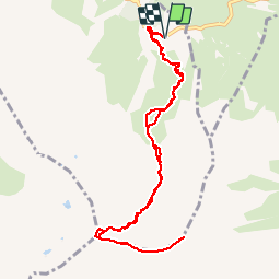

6.7 km | 12.3 km-effort


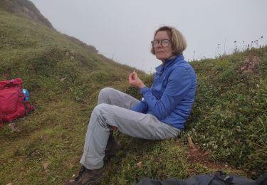
User


FREE GPS app for hiking
 SityTrail
IGN / Geographical institutes
SityTrail World
The world is yours!
Trail Walking of 11.8 km to be discovered at New Aquitaine, Pyrénées-Atlantiques, Béost. This trail is proposed by tracegps.
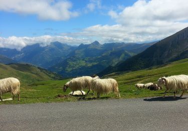
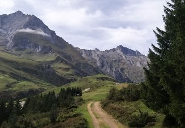
Le Gabizos par le Soulor Distance A/R 12km Altitude départ 1329m Altitude Sommet 2692m (2665m GPS) Dénivelé 1400m (1576m GPS) Montée 2h45 (2h36 GPS) Descente 2h00 Approche Monter au col de Soulor, puis continuer jusqu'à la borne de changement de département. Quand on arrive au panneau "Route du Fromage", il y a un minuscule parking sur la gauche. Sinon on peut laisser la voiture à celui 200m avant, en fait un plat herbeux sur la droite en venant du Soulor. Ne vous laissez pas abuser par les traces du chemin partant du parking. Il faut aller chercher le départ environ 300 pas plus loin sur la route, dans la direction du col de l'Aubisque. Un petit cairn marque l'entrée. Si vous arrivez au tunnel, c'est que vous l'avez manqué. Seule l'entrée est un peu difficile à trouver. Les cairns sont nombreux tout au long du chemin. Jusqu'à la cabane de Larue, il n'y a pas de bifurcation. Le sentier est donc facile à suivre. On arrive à la cabane en 1 heure environ. Elle est à mi-chemin de la crête. Quand on y arrive, un sentier monte à droite que je n'ai pas pris. Un autre randonneur l'a emprunté, il est arrivé au sommet aussi. J'ai pris le sentier qui passe au pied des Taillades Blanques, qui part un peu vers la gauche dans le plat derrière la cabane. Le chemin est peu marqué dans la partie herbeuse, mais là encore les cairns sont nombreux. Il longe ensuite la droite d'un l'éboulis venant du Gabizos et des Taillades. Seul l'endroit ou il faut quitter le pierrier est un peu délicat à trouver. Là encore, levez les yeux et suivez les cairns. Pas de difficulté particulière jusqu'à la crête, ou l'on arrive par une petite pente douce et herbeuse. Visez ... le cairn. Après, c'est à gauche. Il faut une grosse 1/2heure pour suivre la crête des Taillades, puis celle du Gabizos, jusqu'au cairn marquant le sommet. Selon la formule, quelques passages peuvent impressionner, et il convient d'y être prudent.

On foot

Walking
On foot
On foot

Walking
Walking
Walking
Walking
Walking