Trail Mountain bike Lacrouzette - Ronde des Rochers édition 2007 - Photo

Ronde des Rochers édition 2007

 tracegps
tracegps

User

© OpenStreetMap contributors
Length
Length
28 km
Max alt
Max alt
688 m
Uphill gradient
Uphill gradient
608 m
Km-Effort
Km-Effort  
36 km
Min alt
Min alt
484 m
Downhill gradient
Downhill gradient
603 m
Boucle
Boucle
Yes
Creation date :
2014-12-10 00:00:00.0
Updated on :
2014-12-10 00:00:00.0

(0 Reviews)

Mountain bike
Mountain bike
3h00
Difficulty : Difficult

Scan this QR Code to open this trail in the SityTrail application

FREE GPS app for hiking

Logo SityTrail SityTrail

IGN / Geographical institutes

Download SityTrail from the App Store Download SityTrail from Google Play

Logo SityTrail SityTrail World

The world is yours!

Download SityTrail from the App Store Download SityTrail from Google Play Download SityTrail on Huawei AppGallery

About

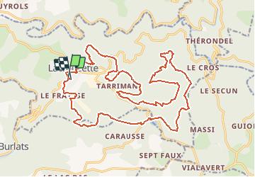
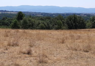
Trail Mountain bike of 28 km to be discovered at Occitania, Tarn, Lacrouzette. This trail is proposed by tracegps.

Description

Grande classique VTT de fin de saison qui se déroule dans le Massif du Sidobre.

Elevation profile

Positioning

Country:
France
Region :
Occitania
Department/Province :
Tarn
Municipality :
Lacrouzette
Location:
Unknown
Start:(UTM)
447211 ; 4834392 (31T) N.

Trails nearby

Trail Walking Lacrouzette - les rochers de sidobre  - Photo
Walking
leroj73

Walking

Very easy
(1)
Lacrouzette, Occitania, Tarn, France
11.9 km | 15.5 km-effort
3h 31min
Yes
Trail Walking Lacrouzette - OR-7523970--Lacrouzette:2017-06-10 Sidobre rocs de crémaussel et Lac du Merle - Photo
Walking
cappelle

Walking

Very difficult
(1)
Lacrouzette, Occitania, Tarn, France
15.6 km | 21 km-effort
4h 39min
Yes
Trail On foot Lacrouzette - les rochers du sidobre - Photo
On foot
leroj73

On foot

Very easy
(1)
Lacrouzette, Occitania, Tarn, France
11.2 km | 15.2 km-effort
Unknown
Yes
Trail Mountain bike Lacrouzette - Lacrouzette VTT 2016 - Photo
Mountain bike
J-Mi

Mountain bike

Easy
(3)
Lacrouzette, Occitania, Tarn, France
32 km | 41 km-effort
2h 36min
Yes
Trail Mountain bike Lacrouzette - Ronde des rochers 2008 - Photo
Mountain bike
tracegps

Mountain bike

Medium
(1)
Lacrouzette, Occitania, Tarn, France
30 km | 39 km-effort
2h 15min
Yes
Trail On foot Burlats - Chemin des Fontaines - Photo
On foot
PRO

On foot

Easy
Burlats, Occitania, Tarn, France
7.3 km | 8.5 km-effort
1h 55min
No
Trail Walking Burlats - Burlats cascade de la truite - Photo
Walking
poisson1103

Walking

Medium
Burlats, Occitania, Tarn, France
19.3 km | 30 km-effort
5h 22min
No
Trail Walking Burlats - billets l'Agout 18kms 577m 4h30 - Photo
Walking
guiller

Walking

Easy
Burlats, Occitania, Tarn, France
18.2 km | 25 km-effort
4h 44min
Yes
Trail Walking Lacrouzette - Sidobre - Photo
Walking
pantin

Walking

Medium
Lacrouzette, Occitania, Tarn, France
14.7 km | 19.1 km-effort
4h 21min
Yes


Close
My subscriptions