Trail Walking Aragnouet - Les granges du Moudang - Photo

Les granges du Moudang

 tracegps
tracegps

User

© OpenStreetMap contributors
Length
Length
5.5 km
Max alt
Max alt
1537 m
Uphill gradient
Uphill gradient
484 m
Km-Effort
Km-Effort  
10.4 km
Min alt
Min alt
1076 m
Downhill gradient
Downhill gradient
26 m
Boucle
Boucle
No
Creation date :
2014-12-10 00:00:00.0
Updated on :
2014-12-10 00:00:00.0

(0 Reviews)

Walking
Walking
2h00
Difficulty : Medium

Scan this QR Code to open this trail in the SityTrail application

FREE GPS app for hiking

Logo SityTrail SityTrail

IGN / Geographical institutes

Download SityTrail from the App Store Download SityTrail from Google Play

Logo SityTrail SityTrail World

The world is yours!

Download SityTrail from the App Store Download SityTrail from Google Play Download SityTrail on Huawei AppGallery

About

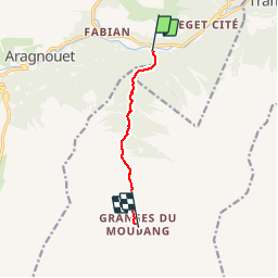
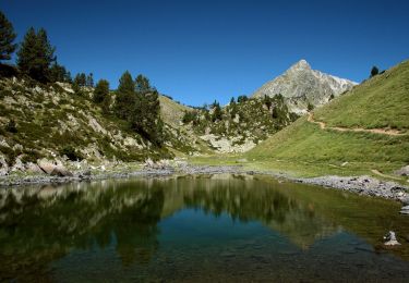
Trail Walking of 5.5 km to be discovered at Occitania, Hautespyrenees, Aragnouet. This trail is proposed by tracegps.

Description

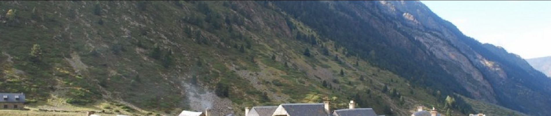
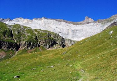
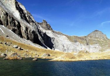
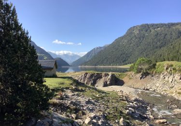
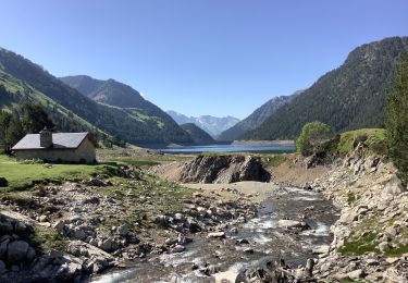
Les granges ne sont habitées que l'été, avec le retour des brebis, le trajet n'a rien de difficile, on suit la route, puis le chemin, tout en longeant le ruisseau.

Elevation profile

Photos

Positioning

Country:
France
Region :
Occitania
Department/Province :
Hautespyrenees
Municipality :
Aragnouet
Location:
Unknown
Start:(UTM)
274640 ; 4740725 (31T) N.

Trails nearby

Trail Walking Aragnouet - Pic Barrosa, Soum Barrosa et Pic de Port de Vieux - Photo
Walking
tracegps

Walking

Very difficult
(1)
Aragnouet, Occitania, Hautespyrenees, France
22 km | 42 km-effort
9h 0min
Yes
Trail Walking Aragnouet - Lac de Barroude par Aragnouet - Photo
Walking
tracegps

Walking

Difficult
(1)
Aragnouet, Occitania, Hautespyrenees, France
8.2 km | 18.3 km-effort
3h 0min
No
Trail Walking Aragnouet - M005-Circuit Barroude-Port Vieux - Photo
Walking
Polo-31

Walking

Difficult
(1)
Aragnouet, Occitania, Hautespyrenees, France
22 km | 41 km-effort
8h 11min
Yes
Trail sport Tramezaïgues - Au dessus de tramezaigues - Photo
sport
PVERTICAL

sport

Very easy
Tramezaïgues, Occitania, Hautespyrenees, France
3 km | 5.8 km-effort
Unknown
Yes
Trail Walking Aragnouet - Lac de catchet - Photo
Walking
PVERTICAL

Walking

Medium
Aragnouet, Occitania, Hautespyrenees, France
4 km | 10.7 km-effort
2h 25min
Yes
Trail On foot Aragnouet - Lacs de Bastan - Photo
On foot
PRO

On foot

Easy
Aragnouet, Occitania, Hautespyrenees, France
6.4 km | 12.2 km-effort
2h 47min
No
Trail Walking Aragnouet - Le lac de l'Oule variante en passant par le bas du barrage - Photo
Walking
jp0065

Walking

Easy
Aragnouet, Occitania, Hautespyrenees, France
10.5 km | 15.8 km-effort
3h 0min
Yes
Trail Walking Aragnouet - Cabane d'Artigusse - Le lac de l'Oule - Photo
Walking
jp0065

Walking

Easy
Aragnouet, Occitania, Hautespyrenees, France
10.4 km | 15.4 km-effort
3h 20min
Yes
Trail Walking Aragnouet - Tour des lacs infra Néouvielle - Photo
Walking
ETMU5496

Walking

Difficult
Aragnouet, Occitania, Hautespyrenees, France
22 km | 38 km-effort
7h 1min
Yes


Close
My subscriptions