Trail Mountain bike Aubignosc - Grande Traversée des PréAlpes à VTT : Aubignosc - Mirabeau - Photo

Grande Traversée des PréAlpes à VTT : Aubignosc - Mirabeau

 tracegps
tracegps

User

© OpenStreetMap contributors
Length
Length
24 km
Max alt
Max alt
750 m
Uphill gradient
Uphill gradient
635 m
Km-Effort
Km-Effort  
32 km
Min alt
Min alt
430 m
Downhill gradient
Downhill gradient
471 m
Boucle
Boucle
No
Creation date :
2014-12-10 00:00:00.0
Updated on :
2014-12-10 00:00:00.0

(0 Reviews)

Mountain bike
Mountain bike
3h30
Difficulty : Medium

Scan this QR Code to open this trail in the SityTrail application

FREE GPS app for hiking

Logo SityTrail SityTrail

IGN / Geographical institutes

Download SityTrail from the App Store Download SityTrail from Google Play

Logo SityTrail SityTrail World

The world is yours!

Download SityTrail from the App Store Download SityTrail from Google Play Download SityTrail on Huawei AppGallery

About

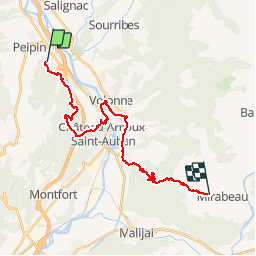
Trail Mountain bike of 24 km to be discovered at Provence-Alpes-Côte d'Azur, Alpes-de-Haute-Provence, Aubignosc. This trail is proposed by tracegps.

Description

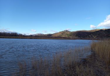
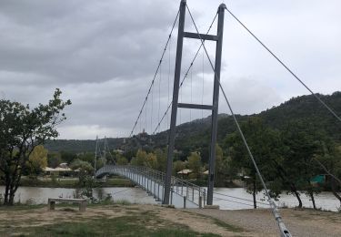
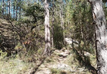
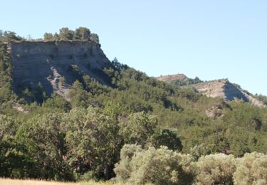
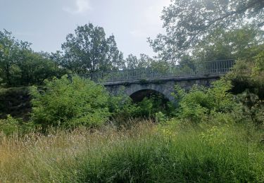
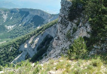
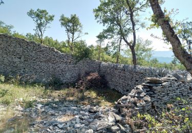
Grande Traversée des Préalpes, les Chemins du Soleil. Parcours officiel labellisé par la Fédération Française de Cyclisme. Vous voici au départ d’Aubignosc où un site préhistorique fut mis au jour aux Ponchonnières. L’heure est à la lecture de paysage et à l’entretien musculaire. Vous allez pouvoir découvrir la forêt de chêne d’Amarines au travers de petits sentiers tortueux, parfois coupés de passages à gué. Cette excursion vous amènera à faire le tour du lac aménagé de Château Arnoux (baignade possible), et enfin rejoindre Mirabeau. Consultez toutes les informations sur les hébergements et les services associés sur la fiche du tronçon.

Elevation profile

Photos

Positioning

Country:
France
Region :
Provence-Alpes-Côte d'Azur
Department/Province :
Alpes-de-Haute-Provence
Municipality :
Aubignosc
Location:
Unknown
Start:(UTM)
737536 ; 4890558 (31T) N.

Trails nearby

Trail Walking Châteauneuf-Val-Saint-Donat - Bergeries en pierres sèches - Châteauneuf Val Saint Donat - Photo
Walking
tracegps

Walking

Medium
(2)
Châteauneuf-Val-Saint-Donat, Provence-Alpes-Côte d'Azur, Alpes-de-Haute-Provence, France
7.6 km | 11.2 km-effort
2h 19min
Yes
Trail Running Volonne - les 2 sommets sr Jean et tigne - Photo
Running
Bruno.r

Running

Medium
(1)
Volonne, Provence-Alpes-Côte d'Azur, Alpes-de-Haute-Provence, France
10.4 km | 16.2 km-effort
1h 7min
Yes
Trail Walking L'Escale - Les Balcons de la Durance 11.2.24 - Photo
Walking
fredetpascale

Walking

Medium
L'Escale, Provence-Alpes-Côte d'Azur, Alpes-de-Haute-Provence, France
14.6 km | 21 km-effort
4h 30min
Yes
Trail Walking Volonne - Tour du lac de Volonne - Photo
Walking
babouille

Walking

Medium
Volonne, Provence-Alpes-Côte d'Azur, Alpes-de-Haute-Provence, France
7.5 km | 8.4 km-effort
1h 54min
Yes
Trail Walking Aubignosc - aubignosc. les canyons. partie basse - Photo
Walking
Roger

Walking

Medium
Aubignosc, Provence-Alpes-Côte d'Azur, Alpes-de-Haute-Provence, France
7.9 km | 11.1 km-effort
2h 50min
Yes
Trail Walking Aubignosc - aubignosc. Le canyon de mourieu  , partie haute  - Photo
Walking
Roger

Walking

Medium
Aubignosc, Provence-Alpes-Côte d'Azur, Alpes-de-Haute-Provence, France
4.9 km | 6.7 km-effort
2h 20min
Yes
Trail Walking Volonne - SALIGNAC . CRETES S MARTIN  . CHAPELLES . O L S - Photo
Walking
RobinMicheline

Walking

Medium
Volonne, Provence-Alpes-Côte d'Azur, Alpes-de-Haute-Provence, France
12.9 km | 19.2 km-effort
3h 32min
Yes
Trail Walking Châteauneuf-Val-Saint-Donat - château neuf val St donat. Le pas de richaud - Photo
Walking
Roger

Walking

Difficult
Châteauneuf-Val-Saint-Donat, Provence-Alpes-Côte d'Azur, Alpes-de-Haute-Provence, France
12.2 km | 22 km-effort
4h 54min
Yes
Trail Walking Châteauneuf-Val-Saint-Donat - château neuf, val St donat - Photo
Walking
Roger

Walking

Medium
Châteauneuf-Val-Saint-Donat, Provence-Alpes-Côte d'Azur, Alpes-de-Haute-Provence, France
6.8 km | 10 km-effort
2h 40min
Yes


Close
My subscriptions