Trail Walking Vic-sur-Aisne - Sur les traces des Poilus - Photo

Sur les traces des Poilus

 tracegps
tracegps

User

© OpenStreetMap contributors
Length
Length
14.1 km
Max alt
Max alt
141 m
Uphill gradient
Uphill gradient
220 m
Km-Effort
Km-Effort  
17.1 km
Min alt
Min alt
41 m
Downhill gradient
Downhill gradient
220 m
Boucle
Boucle
Yes
Creation date :
2014-12-10 00:00:00.0
Updated on :
2014-12-10 00:00:00.0

(1 Reviews)

Walking
Walking
4h30
Difficulty : Very difficult

Scan this QR Code to open this trail in the SityTrail application

FREE GPS app for hiking

Logo SityTrail SityTrail

IGN / Geographical institutes

Download SityTrail from the App Store Download SityTrail from Google Play

Logo SityTrail SityTrail World

The world is yours!

Download SityTrail from the App Store Download SityTrail from Google Play Download SityTrail on Huawei AppGallery

About

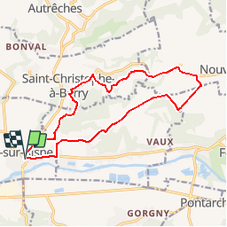
Trail Walking of 14.1 km to be discovered at Hauts-de-France, Aisne, Vic-sur-Aisne. This trail is proposed by tracegps.

Description

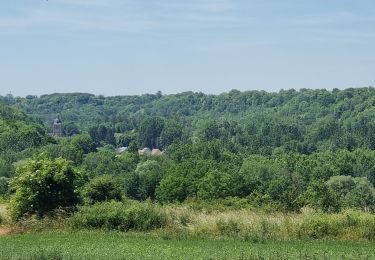
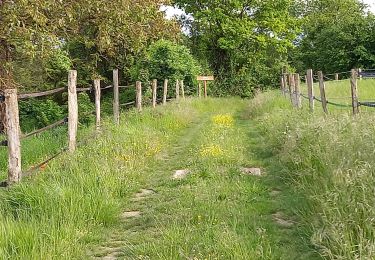
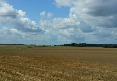
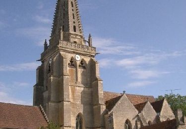
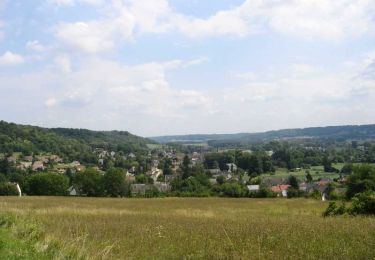
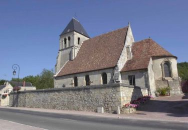
Ce parcours en terrain calcaire associe la découverte de beaux villages à celle, émouvante, du patrimoine de la Première Guerre mondiale, qui a tant marqué la culture de cette région. De vallée en plateau boisé, de coopérative agricole en ancienne ferme monastique, une longue balade pour prendre l'air du Soissonnais. Toutes les infos sont ICI

Elevation profile

Photos

Positioning

Country:
France
Region :
Hauts-de-France
Department/Province :
Aisne
Municipality :
Vic-sur-Aisne
Location:
Unknown
Start:(UTM)
508355 ; 5472576 (31U) N.

Comments

Please log in to post a review or rate the element


Bien


Trails nearby

Trail Walking Ambleny - Ambleny circuit St Martin  - Photo
Walking
José800

Walking

Difficult
Ambleny, Hauts-de-France, Aisne, France
13.3 km | 17 km-effort
3h 32min
Yes
Trail On foot Montigny-Lengrain - Les-hameaux-de-Montigny - Photo
On foot
TURLUPIN2010

On foot

Easy
Montigny-Lengrain, Hauts-de-France, Aisne, France
9.3 km | 11.4 km-effort
2h 35min
Yes
Trail Walking Ambleny - Ambleny  - Photo
Walking
GUIDE
VANDERPUTTENMi

Walking

Very difficult
Ambleny, Hauts-de-France, Aisne, France
20 km | 25 km-effort
5h 23min
Yes
Trail Walking Vic-sur-Aisne - vic sur aisne - Photo
Walking
bohynm

Walking

Medium
(1)
Vic-sur-Aisne, Hauts-de-France, Aisne, France
13.7 km | 16.5 km-effort
3h 12min
Yes
Trail Walking Jaulzy - Promenade à Jaulzy - Photo
Walking
tracegps

Walking

Easy
Jaulzy, Hauts-de-France, Oise, France
3.1 km | 4.3 km-effort
45min
Yes
Trail Walking Hautefontaine - Hautefontaine - Photo
Walking
tracegps

Walking

Easy
Hautefontaine, Hauts-de-France, Oise, France
4.5 km | 5.6 km-effort
1h 10min
Yes
Trail Walking Attichy - Promenade dans Attichy - Photo
Walking
tracegps

Walking

Easy
Attichy, Hauts-de-France, Oise, France
2.6 km | 3.4 km-effort
45min
Yes
Trail Walking Montigny-Lengrain - Les hameaux de Montigny - Photo
Walking
tracegps

Walking

Very difficult
(1)
Montigny-Lengrain, Hauts-de-France, Aisne, France
9.5 km | 11.5 km-effort
2h 45min
Yes
Trail Walking Berny-Rivière - Le bois de Chapeaumont - Photo
Walking
tracegps

Walking

Medium
Berny-Rivière, Hauts-de-France, Aisne, France
5.8 km | 7.5 km-effort
2h 0min
Yes


Close
My subscriptions