Trail Walking Lautenbachzell - Le Markstein - Photo
 tracegps
tracegps

User

© OpenStreetMap contributors
Length
Length
22 km
Max alt
Max alt
1263 m
Uphill gradient
Uphill gradient
956 m
Km-Effort
Km-Effort  
35 km
Min alt
Min alt
504 m
Downhill gradient
Downhill gradient
960 m
Boucle
Boucle
Yes
Creation date :
2014-12-10 00:00:00.0
Updated on :
2014-12-10 00:00:00.0

(1 Reviews)

Walking
Walking
6h00
Difficulty : Difficult

Scan this QR Code to open this trail in the SityTrail application

FREE GPS app for hiking

Logo SityTrail SityTrail

IGN / Geographical institutes

Download SityTrail from the App Store Download SityTrail from Google Play

Logo SityTrail SityTrail World

The world is yours!

Download SityTrail from the App Store Download SityTrail from Google Play Download SityTrail on Huawei AppGallery

About

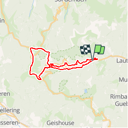
Trail Walking of 22 km to be discovered at Grand Est, Haut-Rhin, Lautenbachzell. This trail is proposed by tracegps.

Description

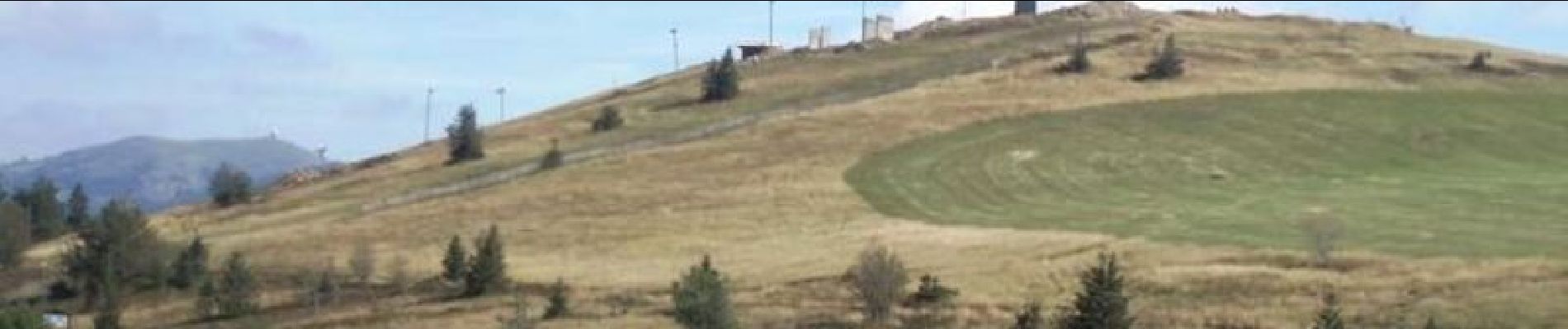
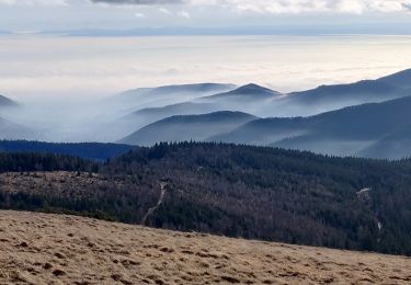
Le Markstein. Une randonnée qui permet de remonter la Lauch jusqu'à son barrage et de grimper ensuite au Markstein en longeant la route des crêtes pour surplomber la chaîne des Vosges. Découvrez la suite sur le site de la Communauté des Crapahuteurs.

Elevation profile

Photos

Positioning

Country:
France
Region :
Grand Est
Department/Province :
Haut-Rhin
Municipality :
Lautenbachzell
Location:
Unknown
Start:(UTM)
358477 ; 5311421 (32T) N.

Comments

Please log in to post a review or rate the element


Belle promenade vosgienne


Trails nearby

Trail Walking Lautenbach - Tour du Petit Ballon - Photo
Walking
VacheKiri67

Walking

Medium
(1)
Lautenbach, Grand Est, Haut-Rhin, France
12.7 km | 20 km-effort
4h 46min
Yes
Trail Walking Linthal - Markstein - Photo
Walking
VacheKiri67

Walking

Medium
(1)
Linthal, Grand Est, Haut-Rhin, France
14 km | 19.8 km-effort
4h 45min
Yes
Trail Walking Linthal - Tour de la grande Vallée de Munster (refuge du Hilsen - Munster) - Photo
Walking
tracegps

Walking

Difficult
(1)
Linthal, Grand Est, Haut-Rhin, France
18.1 km | 24 km-effort
5h 0min
No
Trail Walking Linthal - SityTrail - Remspach-Hilsen - Photo
Walking

Walking

Medium
(1)
Linthal, Grand Est, Haut-Rhin, France
9.9 km | 14.6 km-effort
3h 3min
Yes
Trail On foot Wasserbourg - Boenlesgrab - Drei Schöpf - Bannwald - Chalet St Hubert - Brunnemaëttlé - Wassmatt - Hansen et retour - Photo
On foot
patrickbeyrath

On foot

Medium
(1)
Wasserbourg, Grand Est, Haut-Rhin, France
10.2 km | 14.2 km-effort
Unknown
Yes
Trail Walking Wasserbourg - SityTrail - Boenlesgrab- Strohberg - Photo
Walking

Walking

Difficult
(1)
Wasserbourg, Grand Est, Haut-Rhin, France
9.6 km | 15.1 km-effort
3h 0min
Yes
Trail On foot Lautenbachzell - Parking Bellevue - Hundsrucken - Markstein - Photo
On foot
patrickbeyrath

On foot

Medium
(1)
Lautenbachzell, Grand Est, Haut-Rhin, France
9.4 km | 13 km-effort
Unknown
Yes
Trail Walking Sondernach - 2020-01-02 Marche Landersen Petit Ballon - Photo
Walking
GUIDE
holtzv

Walking

Difficult
Sondernach, Grand Est, Haut-Rhin, France
17.6 km | 28 km-effort
3h 4min
Yes
Trail Walking Soultz-Haut-Rhin - Rando Marcheurs..04/04_2025 - Photo
Walking
boubou68

Walking

Very difficult
Soultz-Haut-Rhin, Grand Est, Haut-Rhin, France
21 km | 35 km-effort
4h 42min
Yes


Close
My subscriptions