


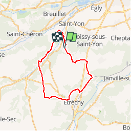

23 km | 29 km-effort

User


FREE GPS app for hiking
 SityTrail
IGN / Geographical institutes
SityTrail World
The world is yours!
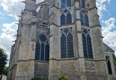
Trail Walking of 22 km to be discovered at Ile-de-France, Essonne, Saint-Sulpice-de-Favières. This trail is proposed by tracegps.
Circuit proposé par le Comité Départemental de Randonnée des Hauts de Seine. Particularités : auberge accueillant les randonneurs, La Ferronnière à Saint Sulpice de Favières. Descriptif : Saint-Sulpice-de-Favières... nb, la Garenne, Mauchamps, les Poiriers Rouges, pont sur N20, les Cinq Fermes, Vieille Poste, nb, Chamarande, D146, Cocatrix ...PR, la Folie, Butte Boigneuse, cote150 ... nb, les Longs Réages, bois de la Grigneraie, Souzy-la-Briche, le Moulin de l'Ecurie, la remise de Saint Sulpice ... GR1, les Silleris ... nb, Feugères, Segrez Château ...GR1, Saint-Sulpice-de-Favières. Des sentiers ont pu être modifiés depuis la dernière validation et les itinéraires proposés n’engagent pas la responsabilité du Comité. Signalez-nous les modifications rencontrées pour mise à jour de la randothèque.


Walking
On foot

Walking
Walking
Walking
Walking
Walking
Walking
Walking
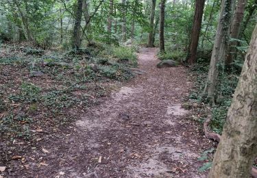
Le délai prévu est bien évalué pour des bons marcheurs. La première partie n'est pas vraiment intéressante, surtout du côté de Chamarande car on marche beaucoup en bord de route.Par contre, à partir d'Etrechy on marche uniquement sur chemins et c'est plus joli.