Trail Mountain bike Nérac - Gélise, frontière des sables - Pays d'Albret - Photo

Gélise, frontière des sables - Pays d'Albret

 tracegps
tracegps

User

© OpenStreetMap contributors
Length
Length
10.2 km
Max alt
Max alt
133 m
Uphill gradient
Uphill gradient
186 m
Km-Effort
Km-Effort  
12.7 km
Min alt
Min alt
43 m
Downhill gradient
Downhill gradient
184 m
Boucle
Boucle
Yes
Creation date :
2014-12-10 00:00:00.0
Updated on :
2014-12-10 00:00:00.0

(0 Reviews)

Mountain bike
Mountain bike
1h00
Difficulty : Medium

Scan this QR Code to open this trail in the SityTrail application

FREE GPS app for hiking

Logo SityTrail SityTrail

IGN / Geographical institutes

Download SityTrail from the App Store Download SityTrail from Google Play

Logo SityTrail SityTrail World

The world is yours!

Download SityTrail from the App Store Download SityTrail from Google Play Download SityTrail on Huawei AppGallery

About

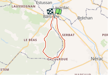
Trail Mountain bike of 10.2 km to be discovered at New Aquitaine, Lot-et-Garonne, Nérac. This trail is proposed by tracegps.

Description

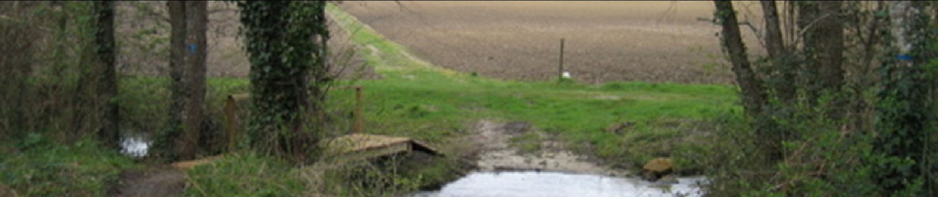
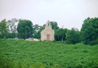
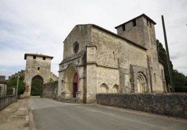
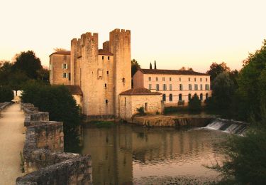
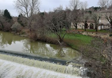
Gélise, frontière des sables - Pays d'Albret. Moulin des Tours / Cauderoue Cté de Communes du Val d’Albret La rivière balise les dernières dunes du massif landais. L’itinéraire permet de longer et de franchir, cette étroite frontière, des riches coteaux agricoles à la vieille forêt mixte. Téléchargez la fiche de cette randonnée sur le site du Tourisme du Lot et Garonne.

Elevation profile

Photos

Positioning

Country:
France
Region :
New Aquitaine
Department/Province :
Lot-et-Garonne
Municipality :
Nérac
Location:
Unknown
Start:(UTM)
283373 ; 4894163 (31T) N.

Trails nearby

Trail Walking Barbaste - Cauderoue et Ste-Catherine, les pieds dans la Gélise - Pays d'Albret - Photo
Walking
tracegps

Walking

Medium
(1)
Barbaste, New Aquitaine, Lot-et-Garonne, France
6.8 km | 8.5 km-effort
2h 0min
Yes
Trail Walking Nérac - Gélise, frontière des sables - Pays d'Albret - Photo
Walking
tracegps

Walking

Medium
(1)
Nérac, New Aquitaine, Lot-et-Garonne, France
10.2 km | 12.7 km-effort
2h 30min
Yes
Trail Walking Feugarolles - Limon, vignobles et vergers d'Albret - Pays d'Albret - Photo
Walking
tracegps

Walking

Medium
(1)
Feugarolles, New Aquitaine, Lot-et-Garonne, France
11.7 km | 15.9 km-effort
3h 15min
Yes
Trail On foot Nérac - Mézin, vers Nérac, avec le petit train touristique 19.6 km - Photo
On foot
PRO

On foot

Medium
Nérac, New Aquitaine, Lot-et-Garonne, France
17.3 km | 21 km-effort
4h 42min
No
Trail On foot Barbaste - La Randonnée des Bastides et Châteaux en Albret - 21.4 km - Photo
On foot
PRO

On foot

Easy
Barbaste, New Aquitaine, Lot-et-Garonne, France
11 km | 14.2 km-effort
3h 13min
No
Trail On foot Lavardac - Estussan, balade panoramique en Albret - 4.5 km - Photo
On foot
PRO

On foot

Easy
Lavardac, New Aquitaine, Lot-et-Garonne, France
4.2 km | 5.7 km-effort
1h 17min
Yes
Trail On foot Barbaste - Barbaste, la randonnée de Béas et Lausseignan - 15.5 km - Photo
On foot
PRO

On foot

Easy
Barbaste, New Aquitaine, Lot-et-Garonne, France
15.4 km | 19.7 km-effort
4h 28min
Yes
Trail On foot Pompiey - De Xaintrailles à Pompiey, lectures de paysage - 10.7 km - Photo
On foot
PRO

On foot

Easy
Pompiey, New Aquitaine, Lot-et-Garonne, France
11.6 km | 14.7 km-effort
3h 20min
Yes
Trail Walking Barbaste - Cauderoue Ste Catherine Cauderoue - Photo
Walking
Forsans

Walking

Easy
Barbaste, New Aquitaine, Lot-et-Garonne, France
6.4 km | 8.3 km-effort
2h 6min
Yes


Close
My subscriptions