Trail Walking Tinchebray-Bocage - Michelot Moulin - Pays de Tinchebray - Photo

Michelot Moulin - Pays de Tinchebray

 tracegps
tracegps

User

© OpenStreetMap contributors
Length
Length
12.4 km
Max alt
Max alt
320 m
Uphill gradient
Uphill gradient
225 m
Km-Effort
Km-Effort  
15.4 km
Min alt
Min alt
204 m
Downhill gradient
Downhill gradient
223 m
Boucle
Boucle
Yes
Creation date :
2014-12-10 00:00:00.0
Updated on :
2014-12-10 00:00:00.0

(0 Reviews)

Walking
Walking
3h00
Difficulty : Medium

Scan this QR Code to open this trail in the SityTrail application

FREE GPS app for hiking

Logo SityTrail SityTrail

IGN / Geographical institutes

Download SityTrail from the App Store Download SityTrail from Google Play

Logo SityTrail SityTrail World

The world is yours!

Download SityTrail from the App Store Download SityTrail from Google Play Download SityTrail on Huawei AppGallery

About

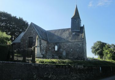
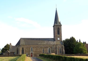
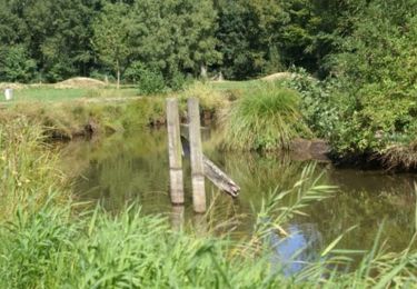
Trail Walking of 12.4 km to be discovered at Normandy, Orne, Tinchebray-Bocage. This trail is proposed by tracegps.

Description

Michelot Moulin - Pays de Tinchebray. Départ de Saint Jean des Bois, du parking de la salle polyvalente, Balisage jaune de 1 à 2, blanc et rouge de 2 à 3, jaune de 3 à 6 , blanc et rouge ensuite. Retrouvez les Coup de Cœur Randonnée dans l’Orne en Normandie.

Elevation profile

Photos

Positioning

Country:
France
Region :
Normandy
Department/Province :
Orne
Municipality :
Tinchebray-Bocage
Location:
Saint-Jean-des-Bois
Start:(UTM)
662450 ; 5398951 (30U) N.

Trails nearby

Trail Walking Tinchebray-Bocage - Chemin de l'Egrenne (n° 9) - Beauchêne  - Photo
Walking
tracegps

Walking

Medium
(1)
Tinchebray-Bocage, Normandy, Orne, France
11.2 km | 14.6 km-effort
2h 49min
Yes
Trail On foot Saint-Christophe-de-Chaulieu - La Forêt - Photo
On foot
PRO

On foot

Easy
Saint-Christophe-de-Chaulieu, Normandy, Orne, France
6 km | 7.6 km-effort
1h 43min
No
Trail Mountain bike Saint-Christophe-de-Chaulieu - La Forêt (n° 13)  - Saint Christophe de Chaulieu - Photo
Mountain bike
tracegps

Mountain bike

Easy
Saint-Christophe-de-Chaulieu, Normandy, Orne, France
6.5 km | 8.4 km-effort
34min
Yes
Trail Walking Saint-Christophe-de-Chaulieu - La Forêt (n° 13)  - Saint Christophe de Chaulieu - Photo
Walking
tracegps

Walking

Easy
Saint-Christophe-de-Chaulieu, Normandy, Orne, France
6.5 km | 8.4 km-effort
1h 40min
Yes
Trail On foot Tinchebray-Bocage - Le Ruslé - Photo
On foot
PRO

On foot

Easy
Tinchebray-Bocage, Normandy, Orne, France
5.4 km | 6.9 km-effort
1h 34min
No
Trail Walking Tinchebray-Bocage - Randonnée pédestre organisée - Sur les pas des Chouans - Tinchebray - Photo
Walking
tracegps

Walking

Difficult
Tinchebray-Bocage, Normandy, Orne, France
44 km | 54 km-effort
8h 0min
Yes
Trail On foot Tinchebray-Bocage - Chemin de l'Egrenne - Photo
On foot
PRO

On foot

Easy
Tinchebray-Bocage, Normandy, Orne, France
10.6 km | 14 km-effort
3h 10min
Yes
Trail Walking Tinchebray-Bocage - Tinchebray Plan D'eau - Photo
Walking
svread

Walking

Easy
Tinchebray-Bocage, Normandy, Orne, France
1.4 km | 1.6 km-effort
23min
Yes
Trail Walking Tinchebray-Bocage - Le Ruslé  (n° 11)  - Yvrandes - Photo
Walking
tracegps

Walking

Easy
Tinchebray-Bocage, Normandy, Orne, France
5.7 km | 7.3 km-effort
1h 30min
Yes


Close
My subscriptions