Trail Walking Sernhac - 30 sernhac pont du gard - Photo

30 sernhac pont du gard

© OpenStreetMap contributors
Length
Length
14.6 km
Max alt
Max alt
140 m
Uphill gradient
Uphill gradient
376 m
Km-Effort
Km-Effort  
19.6 km
Min alt
Min alt
29 m
Downhill gradient
Downhill gradient
367 m
Boucle
Boucle
Yes
Creation date :
2019-05-06 16:50:23.556
Updated on :
2019-05-06 16:50:23.556

(0 Reviews)

Walking
Walking
5h06
Difficulty : Easy

Scan this QR Code to open this trail in the SityTrail application

FREE GPS app for hiking

Logo SityTrail SityTrail

IGN / Geographical institutes

Download SityTrail from the App Store Download SityTrail from Google Play

Logo SityTrail SityTrail World

The world is yours!

Download SityTrail from the App Store Download SityTrail from Google Play Download SityTrail on Huawei AppGallery

About

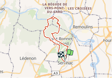
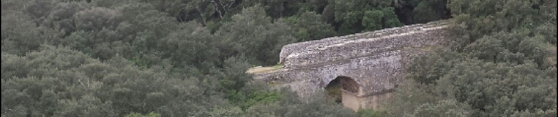
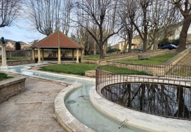
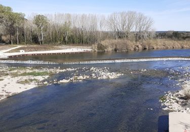
Trail Walking of 14.6 km to be discovered at Occitania, Gard, Sernhac. This trail is proposed by himba26100.

Description

08 03 19 a faire sens horaire
belle rando

Elevation profile

Photos

Points of interest

Point of interest Sernhac - tunnel - Photo
himba26100
SERNHAC 
Point of interest Sernhac - tunnel - Photo
himba26100
SERNHAC 
Point of interest Remoulins - Point 4 - Photo
himba26100
REMOULINS 
Point of interest Remoulins - grotte - Photo
himba26100
REMOULINS 
Point of interest Remoulins - Pont ecroule - Photo
himba26100
REMOULINS 
Point of interest Remoulins - Pont ecroule - Photo
himba26100
REMOULINS 
Point of interest Remoulins - tunnel - Photo
himba26100
REMOULINS 

Positioning

Country:
France
Region :
Occitania
Department/Province :
Gard
Municipality :
Sernhac
Location:
Unknown
Start:(UTM)
624569 ; 4863480 (31T) N.

Trails nearby

Trail Walking Vers-Pont-du-Gard - Rando pont du Gard - Photo
Walking
SabetMick

Walking

Easy
(1)
Vers-Pont-du-Gard, Occitania, Gard, France
6.8 km | 8.6 km-effort
2h 49min
No
Trail Walking Saint-Bonnet-du-Gard - Le Pont du Gard - Photo
Walking
VacheKiri67

Walking

Difficult
(2)
Saint-Bonnet-du-Gard, Occitania, Gard, France
18.6 km | 24 km-effort
5h 30min
Yes
Trail Walking Saint-Bonnet-du-Gard - Chemins oubliés de l'Aqueduc  - Photo
Walking
GUIDE
nadinebondoux

Walking

Medium
Saint-Bonnet-du-Gard, Occitania, Gard, France
12.7 km | 16.5 km-effort
3h 39min
Yes
Trail Walking Lédenon - Sernhac / Saint Bonnet /Pont du Gard/ Ledenon - Photo
Walking
GUIDE
nadinebondoux

Walking

Medium
Lédenon, Occitania, Gard, France
18.7 km | 25 km-effort
5h 23min
Yes
Trail Walking Saint-Bonnet-du-Gard - SAINT BONNET DU GARD - PONT DU GARD - Variante - 15.8Km 05h00 - Dénivelé 410 m - Photo
Walking
dansmabulle

Walking

Difficult
(3)
Saint-Bonnet-du-Gard, Occitania, Gard, France
15.8 km | 21 km-effort
4h 30min
Yes
Trail Walking Saint-Bonnet-du-Gard - Pont du gard 2 - Photo
Walking
mpalatan

Walking

Very easy
(3)
Saint-Bonnet-du-Gard, Occitania, Gard, France
14.5 km | 18.8 km-effort
4h 1min
Yes
Trail Walking Saint-Bonnet-du-Gard - s'y bonnet et pont du Gard - Photo
Walking
dan69390

Walking

Very easy
(1)
Saint-Bonnet-du-Gard, Occitania, Gard, France
9.1 km | 11.8 km-effort
2h 39min
Yes
Trail Walking Sernhac - Sernhac - tunnels Court - Photo
Walking
rando30129

Walking

Medium
(1)
Sernhac, Occitania, Gard, France
5.8 km | 7.1 km-effort
1h 26min
Yes
Trail Walking Remoulins -  Remoulins aqueducs - Photo
Walking
Manoune

Walking

Easy
Remoulins, Occitania, Gard, France
9.2 km | 11.3 km-effort
3h 10min
Yes


Close
My subscriptions