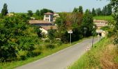
Trail Walking Saint-Aubin-de-Branne - Circuit du port - Saint Aubin de Branne - Photo

Circuit du port - Saint Aubin de Branne

 tracegps
tracegps

User

© OpenStreetMap contributors
Length
Length
6.7 km
Max alt
Max alt
80 m
Uphill gradient
Uphill gradient
120 m
Km-Effort
Km-Effort  
8.3 km
Min alt
Min alt
3 m
Downhill gradient
Downhill gradient
118 m
Boucle
Boucle
Yes
Creation date :
2014-12-10 00:00:00.0
Updated on :
2014-12-10 00:00:00.0

(5 Reviews)

Walking
Walking
1h40
Difficulty : Easy

Scan this QR Code to open this trail in the SityTrail application

FREE GPS app for hiking

Logo SityTrail SityTrail

IGN / Geographical institutes

Download SityTrail from the App Store Download SityTrail from Google Play

Logo SityTrail SityTrail World

The world is yours!

Download SityTrail from the App Store Download SityTrail from Google Play Download SityTrail on Huawei AppGallery

About

Trail Walking of 6.7 km to be discovered at New Aquitaine, Gironde, Saint-Aubin-de-Branne. This trail is proposed by tracegps.

Description

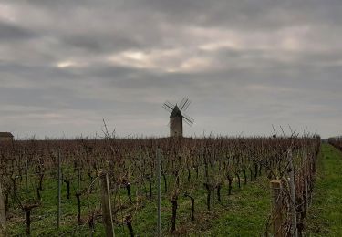
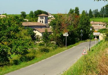
Circuit proposé par la communauté de communes du Brannais. Départ du parking de la mairie de St Aubin de Branne. La boucle locale de Saint Aubin de Branne permet de se promener dans un paysage viticole vallonné. Les beaux points de vue ainsi que les éléments patrimoniaux arrêtent le randonneur tout au long du parcours. Les viticulteur, les artisans ou le centre équestre seront heureux de vous accueillir. Retrouvez la fiche descriptive du circuit sur le site de la communauté de communes du Brannais.

Elevation profile

Photos

Positioning

Country:
France
Region :
New Aquitaine
Department/Province :
Gironde
Municipality :
Saint-Aubin-de-Branne
Location:
Unknown
Start:(UTM)
723681 ; 4965582 (30T) N.

Comments

Please log in to post a review or rate the element


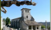
Aucun problème sur la partie routière, mais il y a un problème au niveau du premier chemin : en suivant ce chemin, on a rapidement un message informant qu’on est en dehors de la randonné ? (dans le doute, j'ai fait demi-tour). Dommage car on commence par une église du XIème siècle en se stationnant à la Mairie, j'imagine qu'il doit y avoir des choses sympathiques à voir.


Trails nearby

Trail Walking Cabara - Cabara - Photo
Walking
bedous

Walking

Difficult
Cabara, New Aquitaine, Gironde, France
14.6 km | 17.3 km-effort
4h 4min
Yes
Trail Walking Saint-Aubin-de-Branne - Circuit du tour de Saint Aubin de Branne - Photo
Walking
tracegps

Walking

Medium
(2)
Saint-Aubin-de-Branne, New Aquitaine, Gironde, France
11.8 km | 14.2 km-effort
3h 0min
Yes
Trail Walking Sainte-Terre - Sainte Terre - Photo
Walking
jgu5108

Walking

Easy
Sainte-Terre, New Aquitaine, Gironde, France
23 km | 25 km-effort
5h 56min
Yes
Trail Walking Naujan-et-Postiac - G27_Naujan_et_Postiac - Photo
Walking
bedous

Walking

Difficult
Naujan-et-Postiac, New Aquitaine, Gironde, France
12.2 km | 14 km-effort
3h 11min
Yes
Trail Running Rauzan - toto nono - Photo
Running
thomgrimaud

Running

Very easy
Rauzan, New Aquitaine, Gironde, France
10.6 km | 12.7 km-effort
52min
Yes
Trail Walking Rauzan - rauzan - Photo
Walking
danielletara

Walking

Medium
Rauzan, New Aquitaine, Gironde, France
9.6 km | 0 m-effort
2h 32min
Yes
Trail Walking Saint-Aubin-de-Branne - st aubin de branne - Photo
Walking
danielletara

Walking

Difficult
Saint-Aubin-de-Branne, New Aquitaine, Gironde, France
12.1 km | 14.5 km-effort
3h 0min
Yes
Trail Walking Saint-Aubin-de-Branne - saint aubin de branne - Photo
Walking
danielletara

Walking

Medium
(1)
Saint-Aubin-de-Branne, New Aquitaine, Gironde, France
12.5 km | 14.9 km-effort
3h 15min
Yes
Trail Walking Moulon - Moulon - Photo
Walking
leglisemichel

Walking

Difficult
Moulon, New Aquitaine, Gironde, France
11.3 km | 12.8 km-effort
3h 18min
Yes


Close
My subscriptions