Trail Walking Le Bourdet - Le Bourdet . Deux-Sèvres. 79 - Photo

Le Bourdet . Deux-Sèvres. 79

 olaze
olaze

User

© OpenStreetMap contributors
Length
Length
8.6 km
Max alt
Max alt
26 m
Uphill gradient
Uphill gradient
41 m
Km-Effort
Km-Effort  
9.2 km
Min alt
Min alt
6 m
Downhill gradient
Downhill gradient
41 m
Boucle
Boucle
Yes
Creation date :
2014-12-10 00:00:00.0
Updated on :
2014-12-10 00:00:00.0

(0 Reviews)

Walking
Walking
2h09
Difficulty : Easy

Scan this QR Code to open this trail in the SityTrail application

FREE GPS app for hiking

Logo SityTrail SityTrail

IGN / Geographical institutes

Download SityTrail from the App Store Download SityTrail from Google Play

Logo SityTrail SityTrail World

The world is yours!

Download SityTrail from the App Store Download SityTrail from Google Play Download SityTrail on Huawei AppGallery

About

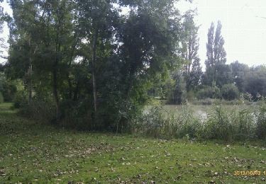
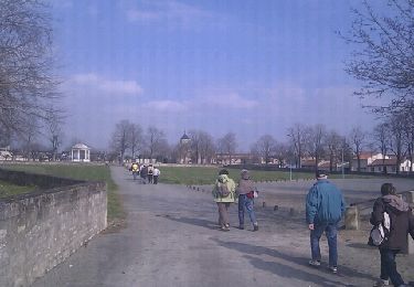
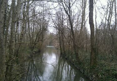
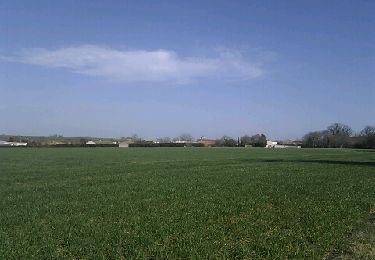
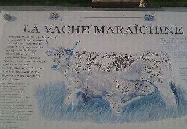
Trail Walking of 8.6 km to be discovered at New Aquitaine, Deux-Sèvres, Le Bourdet. This trail is proposed by olaze.

Description

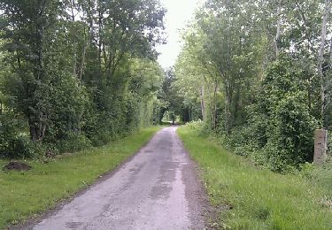
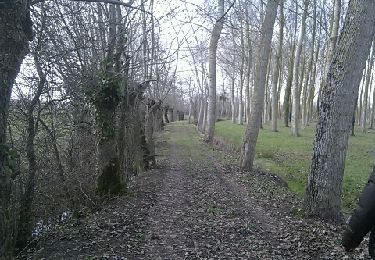
Promenade au départ et retour du Bourdet, dans campagne, Lîle Bapaume.
club rando Bessines*

Elevation profile

Positioning

Country:
France
Region :
New Aquitaine
Department/Province :
Deux-Sèvres
Municipality :
Le Bourdet
Location:
Unknown
Start:(UTM)
683266 ; 5122883 (30T) N.

Trails nearby

Trail Walking Épannes - Epannes. plan d'eau .(9km) - Photo
Walking
olaze

Walking

Very easy
Épannes, New Aquitaine, Deux-Sèvres, France
10.2 km | 10.9 km-effort
2h 12min
Yes
Trail Walking Mauzé-sur-le-Mignon - Mauzé sur le Mignon village - Photo
Walking
olaze

Walking

Easy
(1)
Mauzé-sur-le-Mignon, New Aquitaine, Deux-Sèvres, France
10.7 km | 11.5 km-effort
2h 32min
Yes
Trail Walking Épannes - Epannes . (fougerit) - Photo
Walking
olaze

Walking

Easy
Épannes, New Aquitaine, Deux-Sèvres, France
9.7 km | 10.3 km-effort
2h 18min
Yes
Trail Walking Sansais - Sansais (9,6km) - Photo
Walking
olaze

Walking

Easy
Sansais, New Aquitaine, Deux-Sèvres, France
9.6 km | 10.5 km-effort
2h 25min
Yes
Trail Walking La Rochénard - La Rochenard - Photo
Walking
olaze

Walking

Very easy
La Rochénard, New Aquitaine, Deux-Sèvres, France
3 km | 3.3 km-effort
1h 18min
Yes
Trail Walking Saint-Georges-de-Rex - saint Georges de Rex 29/07/2022  - Photo
Walking
ericbou

Walking

Difficult
Saint-Georges-de-Rex, New Aquitaine, Deux-Sèvres, France
14 km | 15 km-effort
3h 37min
Yes
Trail Walking Le Bourdet - Le Bourdet - 10km - Photo
Walking
olaze

Walking

Easy
Le Bourdet, New Aquitaine, Deux-Sèvres, France
10.5 km | 11.1 km-effort
2h 28min
Yes
Trail Walking Épannes - Epannes (plan d'eau). 6,8km - Photo
Walking
olaze

Walking

Easy
Épannes, New Aquitaine, Deux-Sèvres, France
6.8 km | 7.2 km-effort
1h 49min
Yes
Trail Walking Épannes - Epannes (Le Bourdet). 9,3km - Photo
Walking
olaze

Walking

Easy
Épannes, New Aquitaine, Deux-Sèvres, France
9.3 km | 9.8 km-effort
2h 22min
Yes


Close
My subscriptions