Trail Mountain bike La Motte-Servolex - Tour de l'OUTHERAN - Photo
 baudrine
baudrine

User

© OpenStreetMap contributors
Length
Length
55 km
Max alt
Max alt
1515 m
Uphill gradient
Uphill gradient
1968 m
Km-Effort
Km-Effort  
81 km
Min alt
Min alt
253 m
Downhill gradient
Downhill gradient
1967 m
Boucle
Boucle
Yes
Creation date :
2014-12-10 00:00:00.0
Updated on :
2014-12-10 00:00:00.0

(0 Reviews)

Mountain bike
Mountain bike
6h18
Difficulty : Difficult

Scan this QR Code to open this trail in the SityTrail application

FREE GPS app for hiking

Logo SityTrail SityTrail

IGN / Geographical institutes

Download SityTrail from the App Store Download SityTrail from Google Play

Logo SityTrail SityTrail World

The world is yours!

Download SityTrail from the App Store Download SityTrail from Google Play Download SityTrail on Huawei AppGallery

About

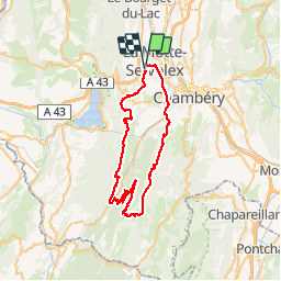
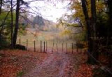
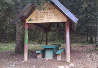
Trail Mountain bike of 55 km to be discovered at Auvergne-Rhône-Alpes, Savoy, La Motte-Servolex. This trail is proposed by baudrine.

Description

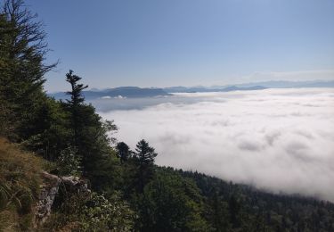
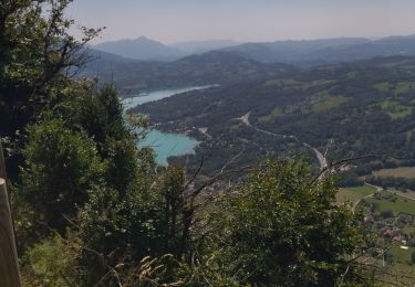
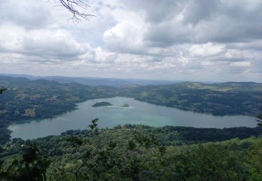
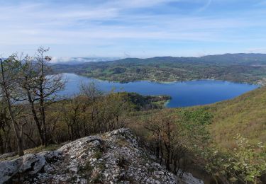
Superbe sortie sur une bonne partie de la journée (tjrs pareil, tout dépend de la condition physique de chacun). Peu de portage. Magnifique et extra-longue la descente du Col du Mollard jusqu'à Chambéry. Attention très humide.

Elevation profile

Photos

Points of interest

Point of interest Entremont-le-Vieux - Col du Grapillon - Photo
baudrine
ENTREMONT-LE-VIEUX 
Point of interest Entremont-le-Vieux - Vue Granier - Photo
baudrine
ENTREMONT-LE-VIEUX 

Positioning

Country:
France
Region :
Auvergne-Rhône-Alpes
Department/Province :
Savoy
Municipality :
La Motte-Servolex
Location:
Unknown
Start:(UTM)
723530 ; 5052640 (31T) N.

Trails nearby

Trail Mountain bike Le Bourget-du-Lac - Chartreuse - Col du Crucifix - Photo
Mountain bike
tracegps

Mountain bike

Difficult
(2)
Le Bourget-du-Lac, Auvergne-Rhône-Alpes, Savoy, France
27 km | 40 km-effort
4h 0min
Yes
Trail Trail La Motte-Servolex - Château Richard et croix du Signal  - Photo
Trail
GUIDE
nadd73

Trail

Medium
La Motte-Servolex, Auvergne-Rhône-Alpes, Savoy, France
11.1 km | 20 km-effort
2h 1min
Yes
Trail Mountain bike Cognin - Autour du Corbeley - Photo
Mountain bike
baudrine

Mountain bike

Medium
(1)
Cognin, Auvergne-Rhône-Alpes, Savoy, France
25 km | 38 km-effort
2h 23min
Yes
Trail Walking La Motte-Servolex - 73 Croix du signal via Château Renard  - Photo
Walking
jeanlucm88

Walking

Medium
La Motte-Servolex, Auvergne-Rhône-Alpes, Savoy, France
12.3 km | 19.9 km-effort
4h 2min
Yes
Trail Walking Aiguebelette-le-Lac - 73 aiguebelette zel - Photo
Walking
GUIDE
randodyssée

Walking

Medium
Aiguebelette-le-Lac, Auvergne-Rhône-Alpes, Savoy, France
14.2 km | 27 km-effort
5h 22min
No
Trail Walking Aiguebelette-le-Lac - Montagne de l'Epine 2.6.24 - Photo
Walking
GUIDE
fredetpascale

Walking

Medium
Aiguebelette-le-Lac, Auvergne-Rhône-Alpes, Savoy, France
6.9 km | 12 km-effort
2h 45min
Yes
Trail Walking Aiguebelette-le-Lac - Mont Grêle  - Photo
Walking
Zasa

Walking

Medium
Aiguebelette-le-Lac, Auvergne-Rhône-Alpes, Savoy, France
16.3 km | 30 km-effort
5h 0min
Yes
Trail Walking Saint-Sulpice - st Sulpice - croix de crucifix - Aiguebelette - Photo
Walking
GUIDE
GEGERANDO17

Walking

Very difficult
Saint-Sulpice, Auvergne-Rhône-Alpes, Savoy, France
18.7 km | 28 km-effort
5h 45min
No
Trail Walking Aiguebelette-le-Lac - Belvédère du Rocher du Corbeau - Photo
Walking
GuyVachet

Walking

Difficult
(1)
Aiguebelette-le-Lac, Auvergne-Rhône-Alpes, Savoy, France
5 km | 9.3 km-effort
2h 7min
Yes


Close
My subscriptions