


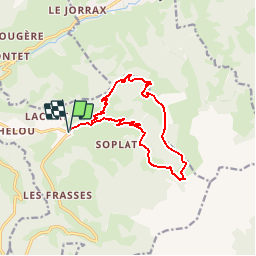

10.2 km | 17.6 km-effort


User


FREE GPS app for hiking
 SityTrail
IGN / Geographical institutes
SityTrail World
The world is yours!
Trail Walking of 13.3 km to be discovered at Auvergne-Rhône-Alpes, Savoy, Notre-Dame-de-Bellecombe. This trail is proposed by albertville.
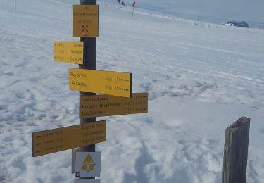
Ban Rouge
Walking
Walking

Walking

Walking
Walking
Snowshoes
Walking
Walking
On foot
Belle balade assez physique. Le parking pourrait etre dans le hameau du Cret.
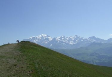
Randonnée d'environ 6 h à 4 avec nos enfants de 7 ans et 15 mois (avec porte bébé) faite l'été. Magnifique..entre forêts et crêtes...quelques vaches :)avec, si le beau temps le permet, une vue splendide sur le mont blanc...et croisement d'une ferme où de la tome de Savoie est en vente... A recommander !
Randonnée d'environ.