Trail Walking Courmayeur - courmayeur bertone bonatti - Photo

courmayeur bertone bonatti

© OpenStreetMap contributors
Length
Length
11.9 km
Max alt
Max alt
2034 m
Uphill gradient
Uphill gradient
1092 m
Km-Effort
Km-Effort  
24 km
Min alt
Min alt
1203 m
Downhill gradient
Downhill gradient
273 m
Boucle
Boucle
No
Creation date :
2014-12-10 00:00:00.0
Updated on :
2014-12-10 00:00:00.0

(0 Reviews)

Walking
Walking
--
Difficulty : Medium

Scan this QR Code to open this trail in the SityTrail application

FREE GPS app for hiking

Logo SityTrail SityTrail

IGN / Geographical institutes

Download SityTrail from the App Store Download SityTrail from Google Play

Logo SityTrail SityTrail World

The world is yours!

Download SityTrail from the App Store Download SityTrail from Google Play Download SityTrail on Huawei AppGallery

About

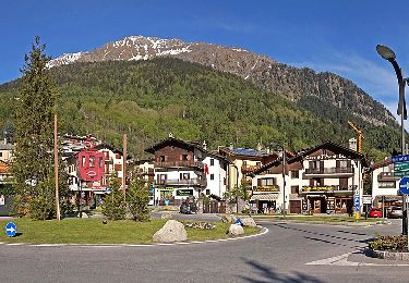
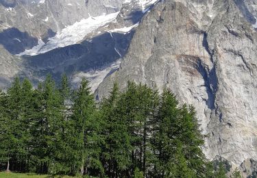
Trail Walking of 11.9 km to be discovered at Aosta Valley, Unknown, Courmayeur. This trail is proposed by lebail.frederic.

Description

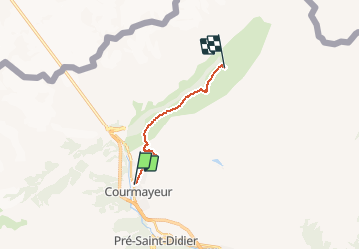
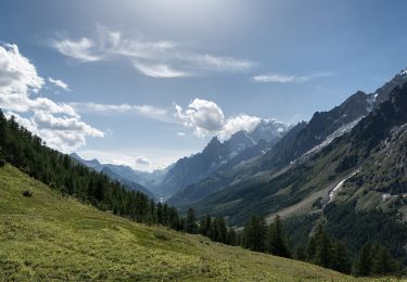
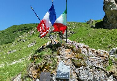
Etapa del Tour del Mont Blanc, entre la localidad de Courmayeur y el Refugio Walter Bonatti (Alpes, Italia).

Desde Courmayeur ascendemos al Refugio G. Bertone, continuamos a media ladera, y tras pasar por Arpe Leche y Arpe Secheron, llegamos al Refugio W. Bonatti.

*** Datos Ruta ***
Ruta: Courmayeur (1.210 mts) – Ref. Bertone (1.989 mts) – Ref. Bonatti (2.022 mts)
Distancia: 5’6 kmts – 7’8 kmts = 13’4 kmts
Desnivel Ascendido: 780 mts - 315 mts = 1.095 mts
Desnivel Descendido: 0 mts - 285 mts = 285 mts
Tiempo (sin paradas): 2h – 3h = 5h

Elevation profile

Points of interest

Point of interest Courmayeur - Arpe Leche - Photo
lebail.frederic
COURMAYEUR 
Point of interest Courmayeur - Arpe Secheron - Photo
lebail.frederic
COURMAYEUR 
Point of interest Courmayeur - Courmayeur - Photo
lebail.frederic
COURMAYEUR 
Point of interest Courmayeur - Ref Bertone - Photo
lebail.frederic
COURMAYEUR 
Point of interest Courmayeur - Ref Bonatti - Photo
lebail.frederic
COURMAYEUR 

Positioning

Country:
Italy
Region :
Aosta Valley
Department/Province :
Unknown
Municipality :
Courmayeur
Location:
Unknown
Start:(UTM)
342257 ; 5072829 (32T) N.

Trails nearby

Trail On foot Courmayeur - Alta Via n. 2 della Valle d'Aosta - Tappa 1 - Photo
On foot
PRO

On foot

Difficult
Courmayeur, Aosta Valley, Unknown, Italy
15.2 km | 32 km-effort
7h 15min
No
Trail On foot Courmayeur - (SI F08) Courmayeur - Rifugio Bonatti - Photo
On foot
PRO

On foot

Medium
Courmayeur, Aosta Valley, Unknown, Italy
11.9 km | 24 km-effort
5h 22min
No
Trail Walking Morgex - arpy . lac d arpy . arpy 2h50 - Photo
Walking
stef789

Walking

Very easy
Morgex, Aosta Valley, Unknown, Italy
10.3 km | 16.1 km-effort
3h 36min
Yes
Trail Walking Courmayeur - étape monte Bianco mottets - Photo
Walking
Bernadette Noirant

Walking

Difficult
Courmayeur, Aosta Valley, Unknown, Italy
21 km | 38 km-effort
8h 17min
No
Trail Walking Courmayeur - TMB J5 Ref. BIANCO - LES MOTTETS - Photo
Walking
GerardBouche

Walking

Difficult
Courmayeur, Aosta Valley, Unknown, Italy
20 km | 38 km-effort
7h 49min
No
Trail Walking Courmayeur - TMB - Etape 5 - Photo
Walking
maxime.ranchin@aliceadsl.fr

Walking

Difficult
(1)
Courmayeur, Aosta Valley, Unknown, Italy
16.5 km | 34 km-effort
6h 47min
No
Trail Walking Courmayeur - TMB 05 - Courmayeur -> Arnouva (chalet du Val Ferret) - Photo
Walking
uru2010

Walking

Difficult
Courmayeur, Aosta Valley, Unknown, Italy
17.6 km | 32 km-effort
6h 59min
No
Trail Walking Morgex - Lac d'Arpy et le lac Di Pietra Rossa... - Photo
Walking
Alfredy

Walking

Very difficult
Morgex, Aosta Valley, Unknown, Italy
15.3 km | 28 km-effort
5h 37min
Yes
Trail Walking Morgex - Lac d'Arpy - Photo
Walking
Alfredy

Walking

Difficult
(1)
Morgex, Aosta Valley, Unknown, Italy
10.3 km | 15.9 km-effort
3h 17min
Yes


Close
My subscriptions