Trail Running Grospierres - autour du centre Pierre et vacances en Ardèche- grospierre le rouret - Photo

autour du centre Pierre et vacances en Ardèche- grospierre le rouret

 sabert84
sabert84

User

© OpenStreetMap contributors
Length
Length
12.4 km
Max alt
Max alt
476 m
Uphill gradient
Uphill gradient
397 m
Km-Effort
Km-Effort  
17.7 km
Min alt
Min alt
141 m
Downhill gradient
Downhill gradient
397 m
Boucle
Boucle
Yes
Creation date :
2014-12-10 00:00:00.0
Updated on :
2014-12-10 00:00:00.0

(0 Reviews)

Running
Running
1h23
Difficulty : Easy

Scan this QR Code to open this trail in the SityTrail application

FREE GPS app for hiking

Logo SityTrail SityTrail

IGN / Geographical institutes

Download SityTrail from the App Store Download SityTrail from Google Play

Logo SityTrail SityTrail World

The world is yours!

Download SityTrail from the App Store Download SityTrail from Google Play Download SityTrail on Huawei AppGallery

About

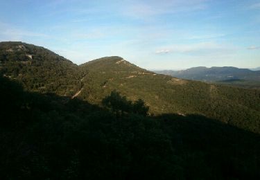
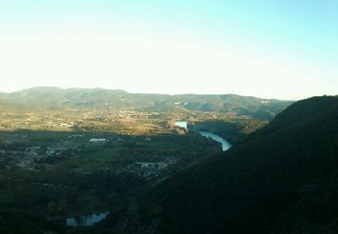
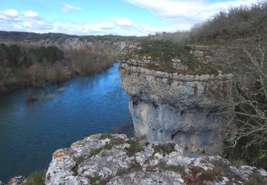
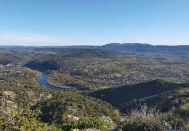
Trail Running of 12.4 km to be discovered at Auvergne-Rhône-Alpes, Ardèche, Grospierres. This trail is proposed by sabert84.

Description

Très bon parcours. Agréable à pratiquer car les chemins sont interdits aux véhicules motorisés.

Elevation profile

Photos

Positioning

Country:
France
Region :
Auvergne-Rhône-Alpes
Department/Province :
Ardèche
Municipality :
Grospierres
Location:
Unknown
Start:(UTM)
601626 ; 4914812 (31T) N.

Trails nearby

Trail Walking Grospierres - Grospierres - col de la Cize - Photo
Walking
pb07

Walking

Medium
(1)
Grospierres, Auvergne-Rhône-Alpes, Ardèche, France
12.2 km | 17.5 km-effort
3h 35min
Yes
Trail Nordic walking Grospierres - YG Grospierres - Photo
Nordic walking
yago1404

Nordic walking

Medium
(1)
Grospierres, Auvergne-Rhône-Alpes, Ardèche, France
13.4 km | 20 km-effort
3h 0min
Yes
Trail Walking Sampzon - Sampzon - Pas des pigeons - Photo
Walking
pb07

Walking

Easy
(3)
Sampzon, Auvergne-Rhône-Alpes, Ardèche, France
11.6 km | 17.1 km-effort
3h 11min
Yes
Trail Walking Bessas - Le Puy Lacher par les crêtes  - Photo
Walking
csy95

Walking

Difficult
(2)
Bessas, Auvergne-Rhône-Alpes, Ardèche, France
10.2 km | 16.3 km-effort
3h 10min
Yes
Trail Walking Chandolas - 3 - Maisoneuve Ron Redon Chandolas 8041m - Photo
Walking
ganinette

Walking

Medium
Chandolas, Auvergne-Rhône-Alpes, Ardèche, France
8 km | 9.4 km-effort
2h 7min
Yes
Trail Walking Grospierres - sampzon - Photo
Walking
Gisele Denaes

Walking

Very difficult
Grospierres, Auvergne-Rhône-Alpes, Ardèche, France
14.7 km | 19.2 km-effort
2h 27min
No
Trail Walking Chandolas - vallon de Fontgraze  ARDE`CHE GPS - Photo
Walking
silvestreclaudine

Walking

Easy
Chandolas, Auvergne-Rhône-Alpes, Ardèche, France
15.1 km | 18.2 km-effort
5h 39min
Yes
Trail Walking Bessas - Le Puy Lacher - Bessas - Photo
Walking
tracegps

Walking

Medium
Bessas, Auvergne-Rhône-Alpes, Ardèche, France
18.3 km | 27 km-effort
5h 0min
Yes
Trail Walking Grospierres - font vive  gropierre - Photo
Walking
marquet

Walking

Very easy
Grospierres, Auvergne-Rhône-Alpes, Ardèche, France
10.2 km | 13.8 km-effort
3h 27min
No


Close
My subscriptions