Trail Walking Colmars - Cascade de Chaumié - Photo
© OpenStreetMap contributors
Length
Length
2.6 km
Max alt
Max alt
1638 m
Uphill gradient
Uphill gradient
232 m
Km-Effort
Km-Effort  
5.7 km
Min alt
Min alt
1419 m
Downhill gradient
Downhill gradient
232 m
Boucle
Boucle
Yes
Creation date :
2014-12-10 00:00:00.0
Updated on :
2024-04-26 06:53:07.347

(0 Reviews)

Walking
Walking
1h17
Difficulty : Easy

Scan this QR Code to open this trail in the SityTrail application

FREE GPS app for hiking

Logo SityTrail SityTrail

IGN / Geographical institutes

Download SityTrail from the App Store Download SityTrail from Google Play

Logo SityTrail SityTrail World

The world is yours!

Download SityTrail from the App Store Download SityTrail from Google Play Download SityTrail on Huawei AppGallery

About

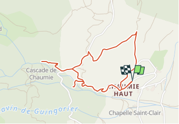
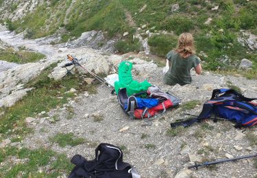
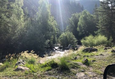
Trail Walking of 2.6 km to be discovered at Provence-Alpes-Côte d'Azur, Alpes-de-Haute-Provence, Colmars. This trail is proposed by jmheydorff.

Description

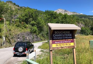
Pkg près de la chapelle St Clair à Chaumié haut.
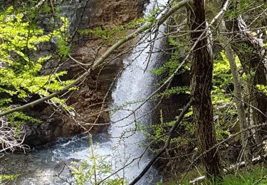
remonter le ruisseau de la Cascade sur 1km, et revenir par un sentier au Nord de Chaumié haut.

Elevation profile

Positioning

Country:
France
Region :
Provence-Alpes-Côte d'Azur
Department/Province :
Alpes-de-Haute-Provence
Municipality :
Colmars
Location:
Unknown
Start:(UTM)
310680 ; 4897453 (32T) N.

Trails nearby

Trail Walking Colmars - Col de l
Walking
Marchopier

Walking

Very difficult
Colmars, Provence-Alpes-Côte d'Azur, Alpes-de-Haute-Provence, France
17.1 km | 31 km-effort
7h 8min
Yes
Trail Walking Colmars - col de l'encombrette pas de L'Echellette - Photo
Walking
Joel26400

Walking

Very difficult
Colmars, Provence-Alpes-Côte d'Azur, Alpes-de-Haute-Provence, France
17.5 km | 32 km-effort
6h 11min
Yes
Trail Walking Colmars - l autupie Colmars les Alpes belvédères des gardettes - Photo
Walking
Joel26400

Walking

Very difficult
(1)
Colmars, Provence-Alpes-Côte d'Azur, Alpes-de-Haute-Provence, France
17.8 km | 33 km-effort
6h 0min
No
Trail Walking Villars-Colmars - Chasse - Photo
Walking
GUIDE
harydh

Walking

Easy
Villars-Colmars, Provence-Alpes-Côte d'Azur, Alpes-de-Haute-Provence, France
10.8 km | 19.5 km-effort
4h 33min
Yes
Trail Walking Allos - lac d allos - Photo
Walking
Mariephil

Walking

Very easy
Allos, Provence-Alpes-Côte d'Azur, Alpes-de-Haute-Provence, France
12.3 km | 19.8 km-effort
4h 49min
Yes
Trail Walking Villars-Colmars - Chalet - Les Espiniers - l'Adroit- Colmars - Photo
Walking
soca

Walking

Difficult
(1)
Villars-Colmars, Provence-Alpes-Côte d'Azur, Alpes-de-Haute-Provence, France
11.1 km | 20 km-effort
4h 7min
Yes
Trail Snowshoes Colmars - LAUPON 23.02.19 - Photo
Snowshoes
BLAIVE

Snowshoes

Difficult
Colmars, Provence-Alpes-Côte d'Azur, Alpes-de-Haute-Provence, France
13.7 km | 29 km-effort
8h 37min
Yes
Trail 4x4 Allos - Piste de Bouchier - Photo
4x4
pascal06300

4x4

Very easy
Allos, Provence-Alpes-Côte d'Azur, Alpes-de-Haute-Provence, France
3.6 km | 5.8 km-effort
Unknown
No
Trail 4x4 Villars-Colmars - Piste de chasse  - Photo
4x4
pascal06300

4x4

Very easy
Villars-Colmars, Provence-Alpes-Côte d'Azur, Alpes-de-Haute-Provence, France
5.9 km | 7.2 km-effort
32min
No


Close
My subscriptions