Trail Mountain bike Saint-Amand-les-Eaux - Saint amand les eaux - montage du nord - Photo

Saint amand les eaux - montage du nord

 bve9600
bve9600

User

© OpenStreetMap contributors
Length
Length
29 km
Max alt
Max alt
27 m
Uphill gradient
Uphill gradient
125 m
Km-Effort
Km-Effort  
30 km
Min alt
Min alt
11 m
Downhill gradient
Downhill gradient
125 m
Boucle
Boucle
Yes
Creation date :
2018-07-26 11:01:15.127
Updated on :
2018-07-26 13:50:13.758

(0 Reviews)

Mountain bike
Mountain bike
2h45
Difficulty : Easy

Scan this QR Code to open this trail in the SityTrail application

FREE GPS app for hiking

Logo SityTrail SityTrail

IGN / Geographical institutes

Download SityTrail from the App Store Download SityTrail from Google Play

Logo SityTrail SityTrail World

The world is yours!

Download SityTrail from the App Store Download SityTrail from Google Play Download SityTrail on Huawei AppGallery

About

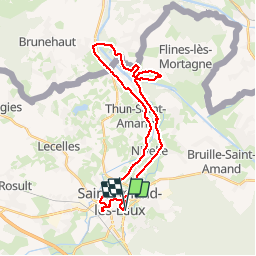
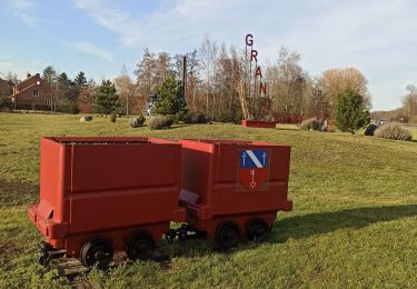
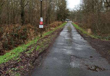
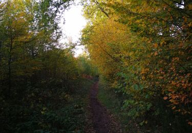
Trail Mountain bike of 29 km to be discovered at Hauts-de-France, Nord, Saint-Amand-les-Eaux. This trail is proposed by bve9600.

Description

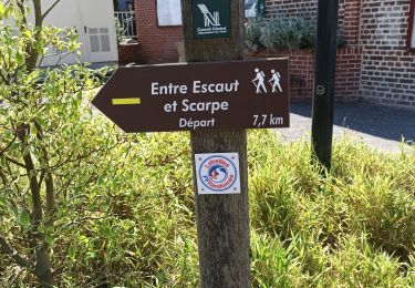
le long de l'eau et retour par route normale

Elevation profile

Photos

Positioning

Country:
France
Region :
Hauts-de-France
Department/Province :
Nord
Municipality :
Saint-Amand-les-Eaux
Location:
Unknown
Start:(UTM)
531344 ; 5588023 (31U) N.

Trails nearby

Trail Walking Saint-Amand-les-Eaux - terril vicoigne - Photo
Walking
papiou

Walking

Easy
Saint-Amand-les-Eaux, Hauts-de-France, Nord, France
8.7 km | 9.7 km-effort
2h 0min
Yes
Trail Walking Saint-Amand-les-Eaux - notre dame d'amour(NDA), propose par VDN - Photo
Walking
papiou

Walking

Medium
Saint-Amand-les-Eaux, Hauts-de-France, Nord, France
9.7 km | 10.6 km-effort
2h 16min
Yes
Trail Walking Nivelle - Nivelle- circuit Nivelle-Mortagne-Chateau l'abbaye - Photo
Walking
papiou

Walking

Easy
(1)
Nivelle, Hauts-de-France, Nord, France
11.5 km | 12.2 km-effort
2h 30min
Yes
Trail Walking Château-l'Abbaye - château l'abbaye. entre Escaut et Scarpe - Photo
Walking
papiou

Walking

Medium
Château-l'Abbaye, Hauts-de-France, Nord, France
8 km | 8.4 km-effort
1h 27min
Yes
Trail Walking Wallers - tour d'Hasnon par forêt et ruisseau - Photo
Walking
papiou

Walking

Easy
Wallers, Hauts-de-France, Nord, France
9.8 km | 10.6 km-effort
2h 8min
Yes
Trail Walking Saint-Amand-les-Eaux - Mesnil, version plus longue - Photo
Walking
papiou

Walking

Easy
Saint-Amand-les-Eaux, Hauts-de-France, Nord, France
9.9 km | 11.1 km-effort
2h 2min
Yes
Trail Walking Saint-Amand-les-Eaux - Mesnil. st Amand - Photo
Walking
papiou

Walking

Easy
Saint-Amand-les-Eaux, Hauts-de-France, Nord, France
8.5 km | 9.6 km-effort
1h 28min
Yes
Trail Walking Nivelle - le tour de Nivelle par Thun et écluses de Mortagne - Photo
Walking
papiou

Walking

Easy
Nivelle, Hauts-de-France, Nord, France
10.5 km | 11.1 km-effort
2h 0min
Yes
Trail Walking Nivelle - Boucle au départ du Ranch de Nivelles - Photo
Walking
Pascal Catenne

Walking

Easy
Nivelle, Hauts-de-France, Nord, France
10.3 km | 11.5 km-effort
1h 49min
Yes


Close
My subscriptions