Trail Walking Montgenèvre - La Bergerie par le vallon de l'Alpet - Photo

La Bergerie par le vallon de l'Alpet

 lviallet
lviallet

User

© OpenStreetMap contributors
Length
Length
7.4 km
Max alt
Max alt
2445 m
Uphill gradient
Uphill gradient
597 m
Km-Effort
Km-Effort  
14.4 km
Min alt
Min alt
1852 m
Downhill gradient
Downhill gradient
319 m
Boucle
Boucle
No
Creation date :
2019-03-17 15:43:23.271
Updated on :
2020-07-28 14:17:33.916

(0 Reviews)

Walking
Walking
2h59
Difficulty : Medium
Snowshoes
Snowshoes
3h30
Difficulty : Difficult

Scan this QR Code to open this trail in the SityTrail application

FREE GPS app for hiking

Logo SityTrail SityTrail

IGN / Geographical institutes

Download SityTrail from the App Store Download SityTrail from Google Play

Logo SityTrail SityTrail World

The world is yours!

Download SityTrail from the App Store Download SityTrail from Google Play Download SityTrail on Huawei AppGallery

About

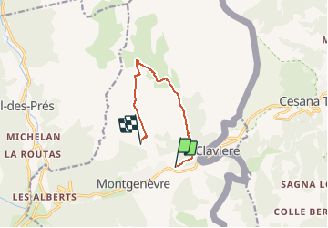
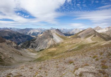
Trail Walking of 7.4 km to be discovered at Provence-Alpes-Côte d'Azur, Hautes-Alpes, Montgenèvre. This trail is proposed by lviallet.

Description

Le 18 mars 2019
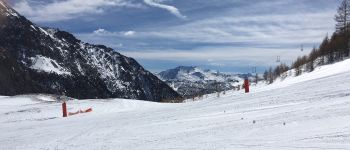
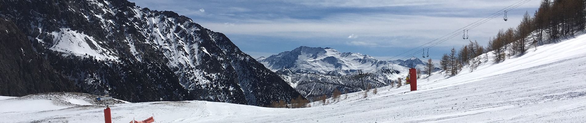
Randonnée d'hiver le long de pistes de skis (bleu)
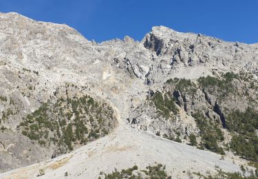
Les 300 derniers mètres en téléphérique (absence de neige)

Elevation profile

Photos

Points of interest

Point of interest Montgenèvre - Vallon de l'Alpet - Photo
lviallet
MONTGENÈVRE 
Point of interest Montgenèvre - Col de l'Alpet - Photo
lviallet
MONTGENÈVRE 

Positioning

Country:
France
Region :
Provence-Alpes-Côte d'Azur
Department/Province :
Hautes-Alpes
Municipality :
Montgenèvre
Location:
Unknown
Start:(UTM)
321217 ; 4978157 (32T) N.

Trails nearby

Trail Walking Montgenèvre - Le Chaberton - Photo
Walking
GUIDE
R@ph

Walking

Difficult
(2)
Montgenèvre, Provence-Alpes-Côte d'Azur, Hautes-Alpes, France
15.4 km | 32 km-effort
6h 15min
Yes
Trail Mountain bike Val-des-Prés - Montgenèvre et col de la Lauze - Photo
Mountain bike
tracegps

Mountain bike

Very difficult
(1)
Val-des-Prés, Provence-Alpes-Côte d'Azur, Hautes-Alpes, France
38 km | 57 km-effort
3h 30min
Yes
Trail Walking Montgenèvre - le mont Chaberton - Photo
Walking
GUIDE
amiral13

Walking

Medium
(1)
Montgenèvre, Provence-Alpes-Côte d'Azur, Hautes-Alpes, France
16.4 km | 33 km-effort
8h 48min
Yes
Trail Walking Montgenèvre - Les crêtes du Chalvet - Photo
Walking
GUIDE
amiral13

Walking

Medium
Montgenèvre, Provence-Alpes-Côte d'Azur, Hautes-Alpes, France
12 km | 23 km-effort
6h 3min
Yes
Trail Walking Val-des-Prés - le Chenaillet et le grand charvia - Photo
Walking
GUIDE
amiral13

Walking

Medium
Val-des-Prés, Provence-Alpes-Côte d'Azur, Hautes-Alpes, France
11.3 km | 19.5 km-effort
4h 17min
No
Trail Walking Montgenèvre - le sommet de Château Jouan et le fort de Janus - Photo
Walking
GUIDE
amiral13

Walking

Difficult
Montgenèvre, Provence-Alpes-Côte d'Azur, Hautes-Alpes, France
13.8 km | 24 km-effort
4h 15min
Yes
Trail Mountain bike Montgenèvre - tour de montgenevre - Photo
Mountain bike
Vincentetourmy

Mountain bike

Very difficult
(1)
Montgenèvre, Provence-Alpes-Côte d'Azur, Hautes-Alpes, France
32 km | 50 km-effort
3h 15min
Yes
Trail Walking Montgenèvre - Mont Chaberton (Hautes-Alpes) - Photo
Walking
toutankhcarton

Walking

Difficult
Montgenèvre, Provence-Alpes-Côte d'Azur, Hautes-Alpes, France
15 km | 32 km-effort
5h 7min
Yes
Trail Walking Montgenèvre - Tête des Fournéous - Photo
Walking
astro45

Walking

Difficult
Montgenèvre, Provence-Alpes-Côte d'Azur, Hautes-Alpes, France
4.5 km | 12.1 km-effort
2h 44min
No


Close
My subscriptions