Trail Walking Bédoin - DEMOISELLES COIFFEES  A BEDOIN - Photo

DEMOISELLES COIFFEES A BEDOIN

© OpenStreetMap contributors
Length
Length
18.8 km
Max alt
Max alt
716 m
Uphill gradient
Uphill gradient
468 m
Km-Effort
Km-Effort  
25 km
Min alt
Min alt
352 m
Downhill gradient
Downhill gradient
471 m
Boucle
Boucle
Yes
Creation date :
2019-04-25 07:35:33.355
Updated on :
2019-04-28 05:49:49.253

(1 Reviews)

Walking
Walking
6h01
Difficulty : Medium

Scan this QR Code to open this trail in the SityTrail application

FREE GPS app for hiking

Logo SityTrail SityTrail

IGN / Geographical institutes

Download SityTrail from the App Store Download SityTrail from Google Play

Logo SityTrail SityTrail World

The world is yours!

Download SityTrail from the App Store Download SityTrail from Google Play Download SityTrail on Huawei AppGallery

About

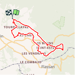
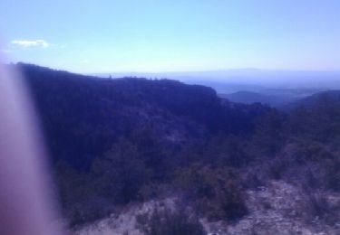
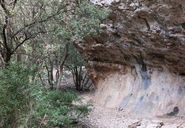
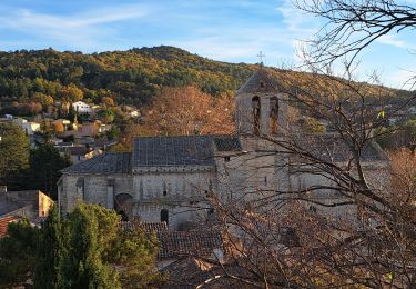
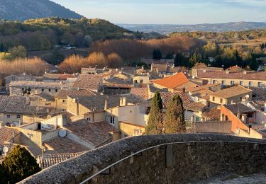
Trail Walking of 18.8 km to be discovered at Provence-Alpes-Côte d'Azur, Vaucluse, Bédoin. This trail is proposed by FLORENSAC.

Description

Nous avons suivi la trace posté par losjo
nous nous sommes trompées 3 fois (4 kms en plus )
pour voir les ruines gallo romaines il faut vraiment s'avancer et descendre la piste , remonter ensuite pour reprendre le parcours
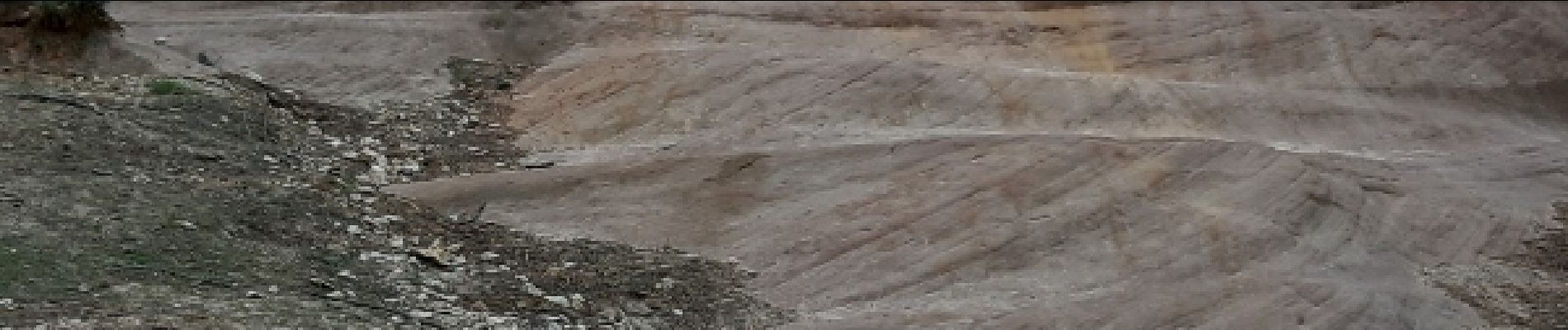
au lieu-dit LES FATIGONS plus de chemin il faut couper a travers la vigne pour rejoindre la route plus bas allez jusqu'à st Colombe
continuer jusqu'au BAUX
après la visite des demoiselles coiffées
traverser le chemin des Tournillayres et prendre le chemin privé
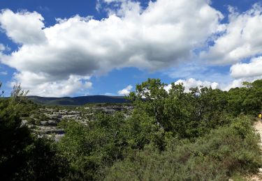
avec plein de petits cairns sur votre droite tout le long du chemin
arriver a la sortie du bois devant une grande étendue de vigne
soit vous traversez celle ci
soit vous remontez sur votre droite jusqu' à la piste
tourner à gauche et revenir au parking du départ
Heureusement que nous avions le tracé sur le téléphone


Elevation profile

Photos

Points of interest

Point of interest Bédoin - FOUILLES GALLO ROMAINES - Photo
FLORENSAC

Positioning

Country:
France
Region :
Provence-Alpes-Côte d'Azur
Department/Province :
Vaucluse
Municipality :
Bédoin
Location:
Unknown
Start:(UTM)
675856 ; 4889610 (31T) N.

Comments

Please log in to post a review or rate the element


Trails nearby

Trail Walking Bédoin - Le Mont Ventoux en randonnée par Saint Colombe - Photo
Walking
tracegps

Walking

Difficult
(1)
Bédoin, Provence-Alpes-Côte d'Azur, Vaucluse, France
24 km | 44 km-effort
6h 49min
Yes
Trail Walking Beaumont-du-Ventoux - Sentier de découverte au Mont Serein - Photo
Walking
tracegps

Walking

Medium
(2)
Beaumont-du-Ventoux, Provence-Alpes-Côte d'Azur, Vaucluse, France
6.3 km | 8.2 km-effort
2h 0min
Yes
Trail Walking Bédoin - Sud Ventoux et Combe de Curnier  - Photo
Walking
GUIDE
nadinebondoux

Walking

Difficult
Bédoin, Provence-Alpes-Côte d'Azur, Vaucluse, France
16 km | 29 km-effort
6h 28min
Yes
Trail Walking Bédoin - P.Partie Ventoux sud - Photo
Walking
MarcLEBARON

Walking

Difficult
(1)
Bédoin, Provence-Alpes-Côte d'Azur, Vaucluse, France
19.3 km | 35 km-effort
5h 49min
Yes
Trail Walking Bédoin - Bedoin Le Gros Pata - Photo
Walking
alainbarrot

Walking

Medium
(1)
Bédoin, Provence-Alpes-Côte d'Azur, Vaucluse, France
13.7 km | 19.6 km-effort
4h 6min
Yes
Trail Walking Malaucène - Campagne de Malaucène - Photo
Walking
tracegps

Walking

Easy
(2)
Malaucène, Provence-Alpes-Côte d'Azur, Vaucluse, France
6.6 km | 8.1 km-effort
1h 30min
Yes
Trail Walking Bédoin - Baume du Chat final par les Siarres - Photo
Walking
supercolas

Walking

Medium
Bédoin, Provence-Alpes-Côte d'Azur, Vaucluse, France
8.3 km | 15.6 km-effort
2h 27min
Yes
Trail Walking Malaucène - Autour de Malaucène  - Photo
Walking
GUIDE
nadinebondoux

Walking

Difficult
Malaucène, Provence-Alpes-Côte d'Azur, Vaucluse, France
18.3 km | 27 km-effort
5h 53min
Yes
Trail Walking Malaucène - Malaucène  - Photo
Walking
GUIDE
Roger Philippe Wallez

Walking

Very difficult
Malaucène, Provence-Alpes-Côte d'Azur, Vaucluse, France
18.6 km | 27 km-effort
6h 32min
Yes


Close
My subscriptions