


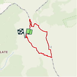

11.4 km | 13.7 km-effort


User


FREE GPS app for hiking
 SityTrail
IGN / Geographical institutes
SityTrail World
The world is yours!
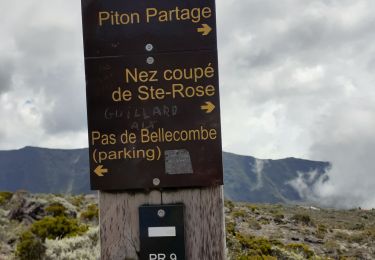
Trail Walking of 16.2 km to be discovered at Réunion, Unknown, Saint-Joseph. This trail is proposed by lgmalherbe.
Boucles avec des passages hors sentier qui sont difficiles. GPS impératif et à ne pas faire quand il y a du brouillard.


Other activity
Walking

Walking

Walking
Walking
Walking
Walking
Walking
Walking