


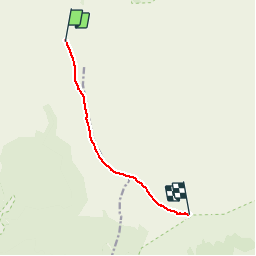


11.4 km | 13.7 km-effort


User


FREE GPS app for hiking
 SityTrail
IGN / Geographical institutes
SityTrail World
The world is yours!
Trail Walking of 8.9 km to be discovered at Réunion, Unknown, Sainte-Rose. This trail is proposed by olive2b.
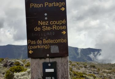
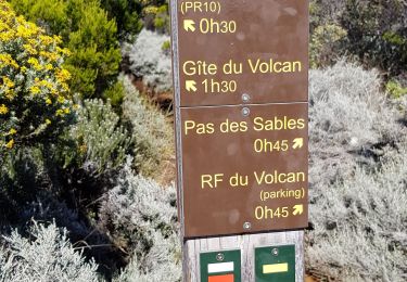
Départ du parking de Foc Foc.
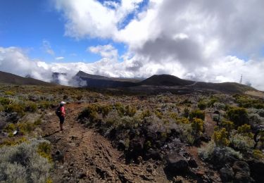
Trajet sous la pluie, le brouillard et le froid (entre 5° et 10°).


Other activity

Walking
Walking
Walking
Walking
Walking
Walking

Walking
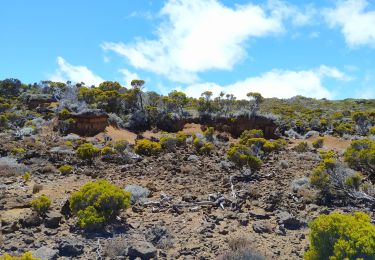
Superbe vue sur les dernières coulées. Sentier facile.