Trail Walking Saint-Lary - Mines de Pale Rase par l'Osque du Couret (St Lary) - Photo

Mines de Pale Rase par l'Osque du Couret (St Lary)

 eric09
eric09

User

© OpenStreetMap contributors
Length
Length
10.6 km
Max alt
Max alt
1752 m
Uphill gradient
Uphill gradient
593 m
Km-Effort
Km-Effort  
18.5 km
Min alt
Min alt
1186 m
Downhill gradient
Downhill gradient
592 m
Boucle
Boucle
Yes
Creation date :
2019-07-08 09:23:32.542
Updated on :
2019-07-08 10:57:48.291

(0 Reviews)

Walking
Walking
3h45
Difficulty : Easy

Scan this QR Code to open this trail in the SityTrail application

FREE GPS app for hiking

Logo SityTrail SityTrail

IGN / Geographical institutes

Download SityTrail from the App Store Download SityTrail from Google Play

Logo SityTrail SityTrail World

The world is yours!

Download SityTrail from the App Store Download SityTrail from Google Play Download SityTrail on Huawei AppGallery

About

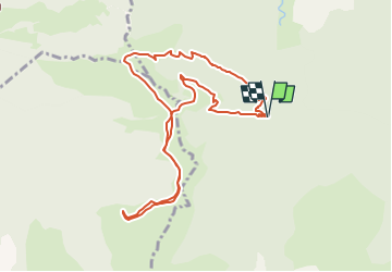
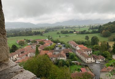
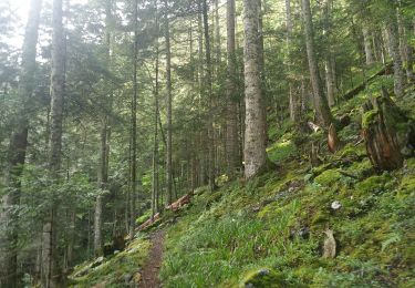
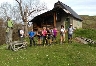
Trail Walking of 10.6 km to be discovered at Occitania, Ariège, Saint-Lary. This trail is proposed by eric09.

Description

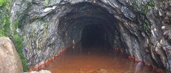
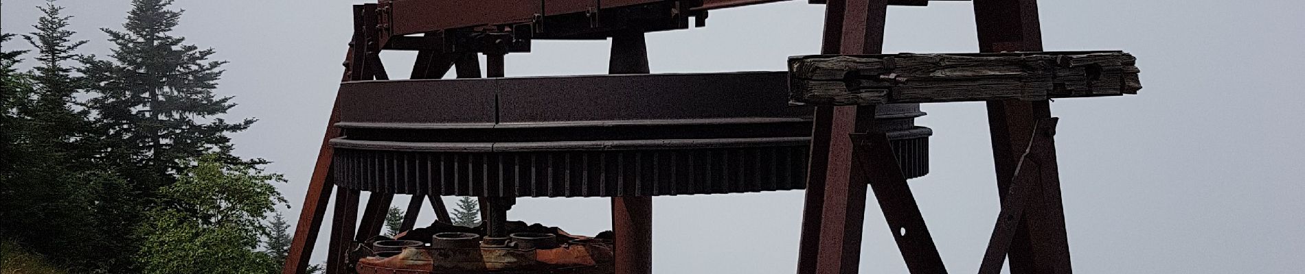
L'itinéraire est facile mais mais hors sentiers balisés. Attention, sur le site des mines il y a de nombreux trous plus ou moins visible dans lesquels il ne faut surtout pas tomber.

Elevation profile

Photos

Points of interest

Point of interest Melles - Mines de Pale Rase - Photo
eric09

Positioning

Country:
France
Region :
Occitania
Department/Province :
Ariège
Municipality :
Saint-Lary
Location:
Unknown
Start:(UTM)
324907 ; 4751409 (31T) N.

Trails nearby

Trail Walking Portet-d'Aspet - 2023 09 21 CHEMIN du PIÉMONT PYRÉNÉEN - 14ème étape : Portet-d’Aspet - le Col - Juzet-d’Izaut - St  Pet-d’Ardet - Barbazan - Valcabrère - st Bertrand de Comminges - Photo
Walking
LEGUE

Walking

Very difficult
Portet-d'Aspet, Occitania, Haute-Garonne, France
46 km | 67 km-effort
8h 46min
No
Trail Walking Saint-Lary - pic de la Calabasse en boucles depuis le parking de l'Osque Couret - Photo
Walking
chrisgps

Walking

Medium
(1)
Saint-Lary, Occitania, Ariège, France
13.4 km | 28 km-effort
7h 13min
Yes
Trail Walking Boutx - Cap de Gauch (2148m) depuis Coulédoux - Photo
Walking
Rouzier

Walking

Medium
Boutx, Occitania, Haute-Garonne, France
15 km | 32 km-effort
5h 54min
Yes
Trail Walking Saint-Lary - stlary nereagreable - Photo
Walking
Bernard24

Walking

Medium
Saint-Lary, Occitania, Ariège, France
11.5 km | 19.5 km-effort
6h 4min
No
Trail Walking Boutx - du coueou pale Paillé par czbane piejeau - Photo
Walking
martoche

Walking

Medium
Boutx, Occitania, Haute-Garonne, France
11.7 km | 24 km-effort
5h 55min
Yes
Trail On foot Antras - Boucle de la chapelle de l'isard - Photo
On foot
PRO

On foot

Easy
Antras, Occitania, Ariège, France
7 km | 9.9 km-effort
2h 14min
No
Trail Walking Boutx - piejeau - Photo
Walking
Laffont Philippe

Walking

Very easy
Boutx, Occitania, Haute-Garonne, France
5.5 km | 10.8 km-effort
1h 52min
No
Trail Walking Saint-Lary - pic de la Calabasse en 2 boucles - Photo
Walking
chrisgps

Walking

Medium
Saint-Lary, Occitania, Ariège, France
12.6 km | 27 km-effort
7h 10min
Yes
Trail Walking Saint-Lary - Cap de gauch - Photo
Walking
dawed311

Walking

Difficult
Saint-Lary, Occitania, Ariège, France
12.4 km | 26 km-effort
4h 10min
Yes


Close
My subscriptions