Trail Walking Entraigues - Entraigues-Lac Gary- 1er jour - Photo

Entraigues-Lac Gary- 1er jour

 orpins
orpins

User

© OpenStreetMap contributors
Length
Length
7.9 km
Max alt
Max alt
2486 m
Uphill gradient
Uphill gradient
1720 m
Km-Effort
Km-Effort  
26 km
Min alt
Min alt
820 m
Downhill gradient
Downhill gradient
157 m
Boucle
Boucle
No
Creation date :
2014-12-10 00:00:00.0
Updated on :
2014-12-10 00:00:00.0

(1 Reviews)

Walking
Walking
5h15
Difficulty : Difficult

Scan this QR Code to open this trail in the SityTrail application

FREE GPS app for hiking

Logo SityTrail SityTrail

IGN / Geographical institutes

Download SityTrail from the App Store Download SityTrail from Google Play

Logo SityTrail SityTrail World

The world is yours!

Download SityTrail from the App Store Download SityTrail from Google Play Download SityTrail on Huawei AppGallery

About

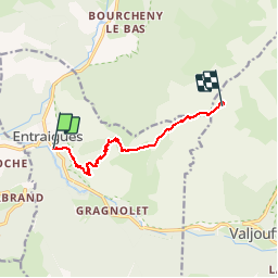
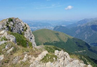
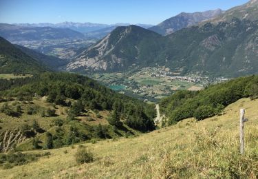
Trail Walking of 7.9 km to be discovered at Auvergne-Rhône-Alpes, Isère, Entraigues. This trail is proposed by orpins.

Description

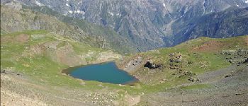
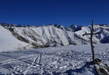
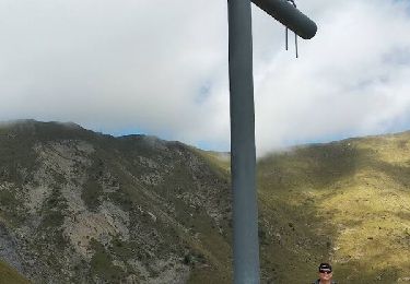
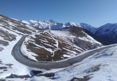
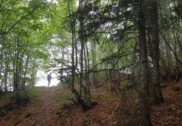
rando sur 2 jours. 1er jour bivouac au lac Gary-autonomie complète-sac a dos 15k - montée difficile a partir de la cabane du Vet

Elevation profile

Photos

Points of interest

Point of interest Valjouffrey - lac Gary - Photo
orpins
VALJOUFFREY 
Point of interest Chantepérier - col blanc - Photo
orpins
CHANTEPÉRIER 

Positioning

Country:
France
Region :
Auvergne-Rhône-Alpes
Department/Province :
Isère
Municipality :
Entraigues
Location:
Unknown
Start:(UTM)
733014 ; 4976035 (31T) N.

Comments

Please log in to post a review or rate the element


Trails nearby

Trail Walking Entraigues - gargas en partant du villard - Photo
Walking
bailleulherve

Walking

Very easy
(1)
Entraigues, Auvergne-Rhône-Alpes, Isère, France
15.1 km | 34 km-effort
5h 40min
Yes
Trail Walking Saint-Michel-en-Beaumont - 2022-07-20_17h09m05_ND Salette - Photo
Walking
Maryma

Walking

Medium
(1)
Saint-Michel-en-Beaumont, Auvergne-Rhône-Alpes, Isère, France
14.3 km | 23 km-effort
5h 10min
Yes
Trail Walking Sainte-Luce - Côte Rouge  - Photo
Walking
GuyVachet

Walking

Very difficult
Sainte-Luce, Auvergne-Rhône-Alpes, Isère, France
10.7 km | 21 km-effort
6h 59min
Yes
Trail Walking La Salette-Fallavaux - La Salette-Fallavaux Marche à pied - Photo
Walking
Krystoff Radisson

Walking

Medium
La Salette-Fallavaux, Auvergne-Rhône-Alpes, Isère, France
6.6 km | 10.2 km-effort
2h 7min
No
Trail Touring skiing La Salette-Fallavaux - côté belle et Gargas - Photo
Touring skiing
nadd73

Touring skiing

Medium
La Salette-Fallavaux, Auvergne-Rhône-Alpes, Isère, France
6.3 km | 17.4 km-effort
4h 11min
Yes
Trail Walking Chantepérier - Circuit de Gaudissart au départ du Périer - Photo
Walking
patjobou

Walking

Medium
Chantepérier, Auvergne-Rhône-Alpes, Isère, France
10.2 km | 0 m-effort
5h 2min
Yes
Trail Walking Chantepérier - Boucle Vallon Touret - Photo
Walking
GuyVachet

Walking

Difficult
Chantepérier, Auvergne-Rhône-Alpes, Isère, France
14.1 km | 29 km-effort
7h 30min
Yes
Trail Walking Saint-Michel-en-Beaumont - PARQUETOUT-Col d'HURETIERE-Col du LIERRE -22-08-2017 - Photo
Walking
RD78-38

Walking

Very easy
Saint-Michel-en-Beaumont, Auvergne-Rhône-Alpes, Isère, France
11.4 km | 18.3 km-effort
4h 3min
Yes
Trail Walking Saint-Michel-en-Beaumont - Valbonnais Cols de Parquetout-d'Hurtieres - Photo
Walking
Orcal37

Walking

Medium
(1)
Saint-Michel-en-Beaumont, Auvergne-Rhône-Alpes, Isère, France
14.5 km | 23 km-effort
5h 20min
Yes


Close
My subscriptions