Trail Walking Deux-Verges - Le Puy de la Tuile - Photo
 neitag61
neitag61

User

© OpenStreetMap contributors
Length
Length
8.9 km
Max alt
Max alt
1289 m
Uphill gradient
Uphill gradient
274 m
Km-Effort
Km-Effort  
12.5 km
Min alt
Min alt
1023 m
Downhill gradient
Downhill gradient
274 m
Boucle
Boucle
Yes
Creation date :
2019-09-18 11:42:21.795
Updated on :
2019-10-18 10:03:48.233

(0 Reviews)

Walking
Walking
3h00
Difficulty : Medium

Scan this QR Code to open this trail in the SityTrail application

FREE GPS app for hiking

Logo SityTrail SityTrail

IGN / Geographical institutes

Download SityTrail from the App Store Download SityTrail from Google Play

Logo SityTrail SityTrail World

The world is yours!

Download SityTrail from the App Store Download SityTrail from Google Play Download SityTrail on Huawei AppGallery

About

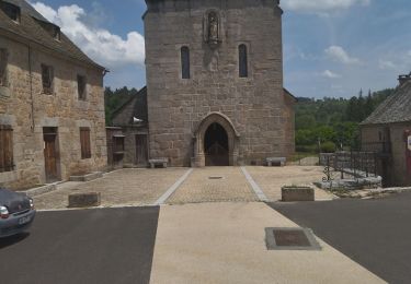
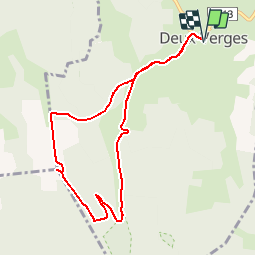
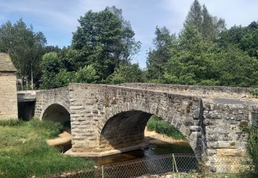
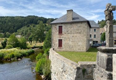
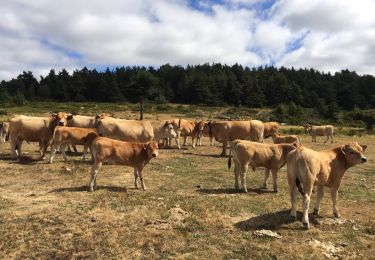
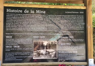
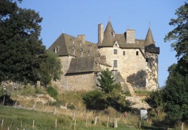
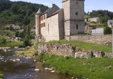
Trail Walking of 8.9 km to be discovered at Auvergne-Rhône-Alpes, Cantal, Deux-Verges. This trail is proposed by neitag61.

Description

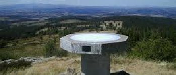
Superbe circuit avec un panorama à couper le souffle

Elevation profile

Photos

Points of interest

Point of interest Deux-Verges - Variante été - Photo
neitag61
DEUX-VERGES 
Point of interest Jabrun - Puy de la Tuile - Photo
neitag61
Point of interest Deux-Verges - 2 - Photo
neitag61
DEUX-VERGES 
Point of interest Deux-Verges - 3 - Photo
neitag61
DEUX-VERGES 
Point of interest Deux-Verges - 4 - Photo
neitag61
DEUX-VERGES 
Point of interest Deux-Verges - 5 - Photo
neitag61
DEUX-VERGES 
Point of interest Deux-Verges - 6 - Photo
neitag61
DEUX-VERGES 
Point of interest Deux-Verges - 7 - Photo
neitag61
DEUX-VERGES 

Positioning

Country:
France
Region :
Auvergne-Rhône-Alpes
Department/Province :
Cantal
Municipality :
Deux-Verges
Location:
Unknown
Start:(UTM)
501899 ; 4961422 (31T) N.

Trails nearby

Trail On foot Chauchailles - 2022-05-31_19h34m27_gpx-trace - Photo
On foot
audier

On foot

Difficult
(1)
Chauchailles, Occitania, Lozère, France
22 km | 31 km-effort
7h 7min
Yes
Trail Walking Chauchailles - sentier des espagnols  - Photo
Walking
GUIDE
nadinebondoux

Walking

Difficult
Chauchailles, Occitania, Lozère, France
22 km | 32 km-effort
6h 48min
Yes
Trail Walking Chauchailles - Gorges du Bèz sentier des espagnols - Photo
Walking
GUIDE
Roger Philippe Wallez

Walking

Very difficult
Chauchailles, Occitania, Lozère, France
22 km | 31 km-effort
7h 34min
Yes
Trail Walking Brion - La chaldette  - Photo
Walking
GUIDE
antignacs

Walking

Medium
Brion, Occitania, Lozère, France
19.9 km | 26 km-effort
5h 22min
Yes
Trail Walking Chaudes-Aigues - Chemin de la mine  - Photo
Walking
nicolasdresse

Walking

(1)
Chaudes-Aigues, Auvergne-Rhône-Alpes, Cantal, France
4.3 km | 6.1 km-effort
2h 11min
Yes
Trail Walking Brion - LA CHALDETTE 48 - Le Fau - Le Truc du Cheylaret - Reyrac - Photo
Walking
jeff66

Walking

Medium
(1)
Brion, Occitania, Lozère, France
10.5 km | 13.9 km-effort
2h 44min
Yes
Trail Walking Brion - De La Chaldette à Fournels - Photo
Walking
tracegps

Walking

Difficult
Brion, Occitania, Lozère, France
14.8 km | 19.6 km-effort
3h 16min
No
Trail Walking Chauchailles - Les Gorges du Bes - Photo
Walking
tracegps

Walking

Difficult
(1)
Chauchailles, Occitania, Lozère, France
21 km | 30 km-effort
7h 0min
Yes
Trail Walking Brion - chaldette termes - Photo
Walking
himba26100

Walking

Medium
Brion, Occitania, Lozère, France
22 km | 30 km-effort
7h 23min
No


Close
My subscriptions