


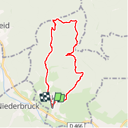

19.9 km | 34 km-effort

User


FREE GPS app for hiking
 SityTrail
IGN / Geographical institutes
SityTrail World
The world is yours!
Trail Walking of 7.6 km to be discovered at Grand Est, Haut-Rhin, Sickert. This trail is proposed by helmut68.
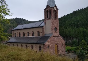
Départ place de la mairie et de l'église de Sickert puis suivre le balisage "disque bleu " jusqu'à l'abri " Gaugler " où vous pourrez passer un moment agréable ( détente , repas ,...etc ).
Au départ de l'abri empruntez le balisage " rectangle jaune blanc jaune " puis le balisage " triangle rouge " jusqu'au Luttersberg . N'oubliez pas le point de vue du " Rocher de la Croix " vous pourrez admirer la belle vallée de la Doller .Pour finir utilisez le balisage " anneau rouge" jusqu'à la Kutzakapalala ( chapelle ) et Sickert.


Walking
Walking

Walking
Walking

Walking

On foot

Walking

Walking

Walking