Trail Walking Névache - J4 G1 Fontcouverte Lac et Col Sud Chardonnet Col Nord Chardonnet Beraudes Col des Béraudes Lac des Béraudes Lac Rouge Parking Laval - Photo

J4 G1 Fontcouverte Lac et Col Sud Chardonnet Col Nord Chardonnet Beraudes Col des Béraudes Lac des Béraudes Lac Rouge Parking Laval

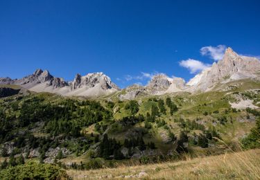
La Clarée un must pour randonner alors à nous d'en profiter ....

© OpenStreetMap contributors
Length
Length
15.3 km
Max alt
Max alt
2767 m
Uphill gradient
Uphill gradient
1302 m
Km-Effort
Km-Effort  
32 km
Min alt
Min alt
1864 m
Downhill gradient
Downhill gradient
1143 m
Boucle
Boucle
No
Creation date :
2019-11-19 13:28:40.815
Updated on :
2019-11-21 13:55:19.022

(0 Reviews)

Walking
Walking
3h00
Difficulty : Difficult

Scan this QR Code to open this trail in the SityTrail application

FREE GPS app for hiking

Logo SityTrail SityTrail

IGN / Geographical institutes

Download SityTrail from the App Store Download SityTrail from Google Play

Logo SityTrail SityTrail World

The world is yours!

Download SityTrail from the App Store Download SityTrail from Google Play Download SityTrail on Huawei AppGallery

About

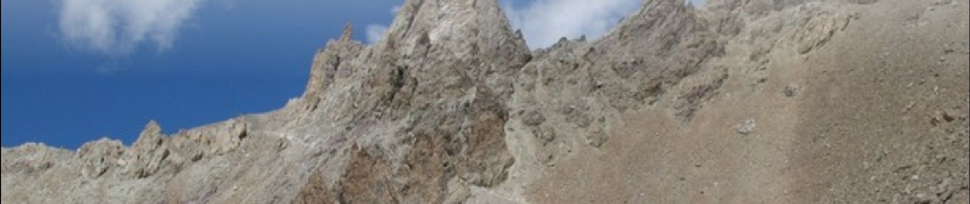
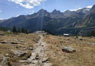
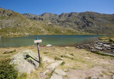
Trail Walking of 15.3 km to be discovered at Provence-Alpes-Côte d'Azur, Hautes-Alpes, Névache. This trail is proposed by Névache Aout 2020 REV 83.

Description

Séjour REV nNvache 2020
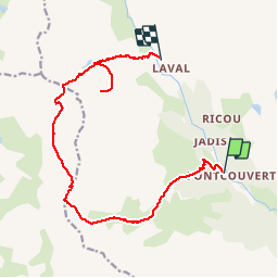
J4 G1 Parking Fontcouverte Lac du Chardonnet Col Sud et Nord Chardonnet Col et lac des Beraudes Lac Rouge Parking Laval

Elevation profile

Photos

Positioning

Country:
France
Region :
Provence-Alpes-Côte d'Azur
Department/Province :
Hautes-Alpes
Municipality :
Névache
Location:
Unknown
Start:(UTM)
306648 ; 4989657 (32T) N.

Trails nearby

Trail Walking Névache - Briançonnais Lac du Serpent - Photo
Walking
Orcal37

Walking

Medium
(2)
Névache, Provence-Alpes-Côte d'Azur, Hautes-Alpes, France
10 km | 18 km-effort
3h 10min
Yes
Trail Walking Névache - Col du Chardonnet - Névache - Photo
Walking
tracegps

Walking

Medium
(3)
Névache, Provence-Alpes-Côte d'Azur, Hautes-Alpes, France
12.3 km | 23 km-effort
4h 0min
Yes
Trail Walking Névache - Via Alpina - R127: Névache > Le Monêtier-les-Bains - Photo
Walking
tracegps

Walking

Difficult
(1)
Névache, Provence-Alpes-Côte d'Azur, Hautes-Alpes, France
15.5 km | 28 km-effort
5h 0min
No
Trail Walking Névache - la roche du Chardonnet - Photo
Walking
GUIDE
amiral13

Walking

Medium
Névache, Provence-Alpes-Côte d'Azur, Hautes-Alpes, France
16.6 km | 29 km-effort
7h 26min
Yes
Trail Walking Névache - Lacs Laramon et Serpent - Photo
Walking
neoroll44

Walking

Medium
(2)
Névache, Provence-Alpes-Côte d'Azur, Hautes-Alpes, France
10.4 km | 21 km-effort
6h 0min
Yes
Trail Walking Névache - lacs laramon, du serpent, des gardioles et pic du lac blanc - Photo
Walking
GUIDE
amiral13

Walking

Medium
(1)
Névache, Provence-Alpes-Côte d'Azur, Hautes-Alpes, France
15.8 km | 31 km-effort
7h 30min
Yes
Trail Walking Névache - LA CLAREE: balcon de la claree - Photo
Walking
lebarbe_b@hotmail.fr

Walking

Medium
Névache, Provence-Alpes-Côte d'Azur, Hautes-Alpes, France
14.2 km | 23 km-effort
4h 7min
Yes
Trail Walking Névache - Lac Laramon - Refuge Ricou - Photo
Walking
astro45

Walking

Medium
Névache, Provence-Alpes-Côte d'Azur, Hautes-Alpes, France
3.5 km | 8.4 km-effort
1h 54min
No
Trail Walking Névache - Lac Long - Lac Rond - Refuge des Drayères - La Clarée - Photo
Walking
astro45

Walking

Very difficult
Névache, Provence-Alpes-Côte d'Azur, Hautes-Alpes, France
12.7 km | 19.3 km-effort
4h 23min
No


Close
My subscriptions