Trail Walking Oppède - Oppède le Vieux - Est - Photo
© OpenStreetMap contributors
Length
Length
12.5 km
Max alt
Max alt
726 m
Uphill gradient
Uphill gradient
659 m
Km-Effort
Km-Effort  
21 km
Min alt
Min alt
223 m
Downhill gradient
Downhill gradient
673 m
Boucle
Boucle
Yes
Creation date :
2014-12-10 00:00:00.0
Updated on :
2014-12-10 00:00:00.0

(0 Reviews)

Walking
Walking
3h26
Difficulty : Medium

Scan this QR Code to open this trail in the SityTrail application

FREE GPS app for hiking

Logo SityTrail SityTrail

IGN / Geographical institutes

Download SityTrail from the App Store Download SityTrail from Google Play

Logo SityTrail SityTrail World

The world is yours!

Download SityTrail from the App Store Download SityTrail from Google Play Download SityTrail on Huawei AppGallery

About

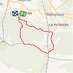
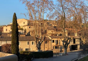
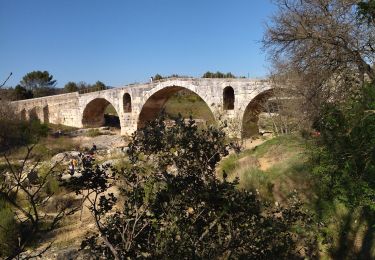
Trail Walking of 12.5 km to be discovered at Provence-Alpes-Côte d'Azur, Vaucluse, Oppède. This trail is proposed by MarcLEBARON.

Description

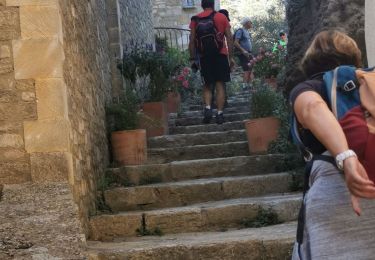
Boucle - 2,8 km de montée par le GR, çà grimpe un peu raide.
Puis récupération sur la piste goudronnée de crête.
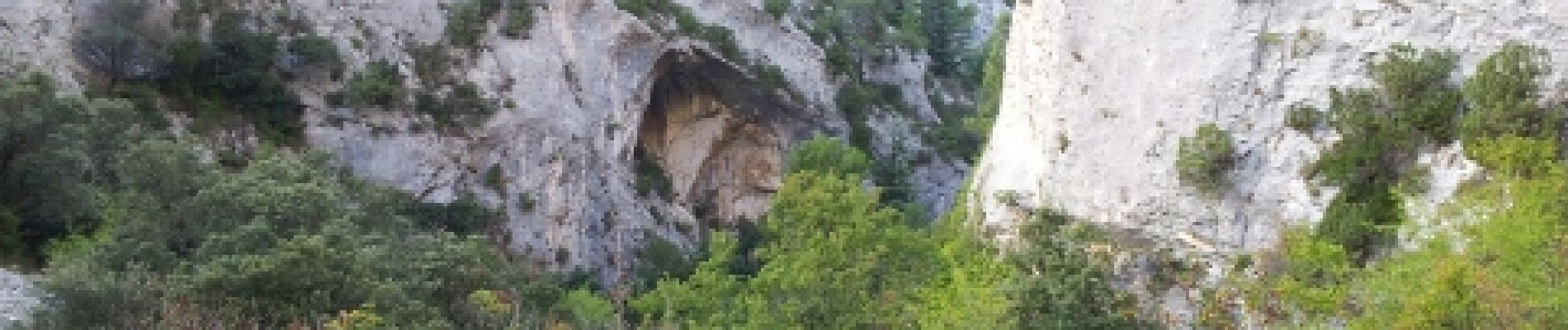
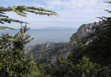
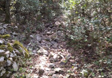
Descente par le vallon du Bausset, le départ passe par une piste de débardage forestière puis basculer pour retrouver le talweg naturel. Descente par sentier plutôt fermé mais avec de jolies vues sur les falaises environnantes (baumes, arches, etc...).
Le retour un peu longué réserve encore quelques "coup de cul"...

Elevation profile

Photos

Positioning

Country:
France
Region :
Provence-Alpes-Côte d'Azur
Department/Province :
Vaucluse
Municipality :
Oppède
Location:
Unknown
Start:(UTM)
673902 ; 4854958 (31T) N.

Trails nearby

Trail Walking Robion - petit luberon - Photo
Walking
GUIDE
nadinebondoux

Walking

Difficult
(1)
Robion, Provence-Alpes-Côte d'Azur, Vaucluse, France
16.7 km | 27 km-effort
6h 23min
Yes
Trail Walking Oppède - PF-Oppède - Le Vallon de Combrès - Le Sautadou du Bausset - Photo
Walking
MicDul

Walking

Difficult
(1)
Oppède, Provence-Alpes-Côte d'Azur, Vaucluse, France
13.6 km | 23 km-effort
4h 45min
Yes
Trail Walking Taillades - taillades - Photo
Walking
fireman84

Walking

Very easy
(1)
Taillades, Provence-Alpes-Côte d'Azur, Vaucluse, France
7.6 km | 9.8 km-effort
1h 36min
Yes
Trail Mountain bike Beaumettes - vttpll_47_LES_BEAUMETTES_Du_Calavon_au_col_de_Gordes - Photo
Mountain bike
denel

Mountain bike

Easy
(1)
Beaumettes, Provence-Alpes-Côte d'Azur, Vaucluse, France
13.1 km | 16.6 km-effort
1h 8min
Yes
Trail Mountain bike Maubec - Luberon - Grande Traversée de Vaucluse - de Maubec / Robion à Mérindol - Photo
Mountain bike
GUIDE+

Mountain bike

Difficult
(1)
Maubec, Provence-Alpes-Côte d'Azur, Vaucluse, France
32 km | 42 km-effort
2h 47min
No
Trail Walking Robion - Robion - Photo
Walking
GUIDE
Roger Philippe Wallez

Walking

Very difficult
Robion, Provence-Alpes-Côte d'Azur, Vaucluse, France
19 km | 24 km-effort
6h 2min
Yes
Trail Walking Maubec - maubec - Photo
Walking
michel.roig

Walking

Difficult
Maubec, Provence-Alpes-Côte d'Azur, Vaucluse, France
11.6 km | 17.1 km-effort
4h 12min
Yes
Trail Walking Ménerbes - 84 Vallon du bausset (menerbes) et arche - Photo
Walking
himba26100

Walking

Easy
Ménerbes, Provence-Alpes-Côte d'Azur, Vaucluse, France
8.5 km | 14.9 km-effort
4h 25min
Yes
Trail Road bike Ménerbes - 84 menerbes saignon Apt voie verte - Photo
Road bike
himba26100

Road bike

Medium
Ménerbes, Provence-Alpes-Côte d'Azur, Vaucluse, France
90 km | 109 km-effort
8h 55min
No


Close
My subscriptions