


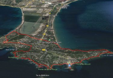
11.9 km | 14.2 km-effort


User


FREE GPS app for hiking
 SityTrail
IGN / Geographical institutes
SityTrail World
The world is yours!
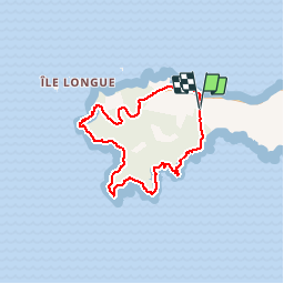
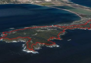
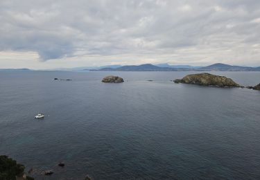
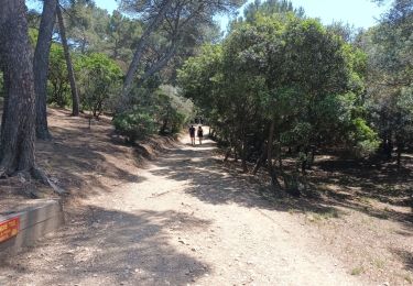
Trail Running of 6.8 km to be discovered at Provence-Alpes-Côte d'Azur, Var, Hyères. This trail is proposed by will83.
Entrainement spécifique trail (court mais physique, prévoir 1h00). La première partie est très technique avec sentes escarpées. Vous ne pourrez pas courir tout le temps, mais idéal pour s'échauffer sur les raidillons. La seconde partie (à partir de la pointe de Salis) est "roulante". Départ : parking des Darboussières.
Walking
Walking
Walking

Walking

Walking

Walking
Walking
Walking
Walking