Trail On foot Le Saix - le Saix (1) - Photo
© OpenStreetMap contributors
Length
Length
11.1 km
Max alt
Max alt
1316 m
Uphill gradient
Uphill gradient
517 m
Km-Effort
Km-Effort  
18 km
Min alt
Min alt
810 m
Downhill gradient
Downhill gradient
511 m
Boucle
Boucle
Yes
Creation date :
2020-03-06 16:42:07.723
Updated on :
2020-09-19 13:58:36.135

(0 Reviews)

On foot
On foot
4m
Difficulty : Medium

Scan this QR Code to open this trail in the SityTrail application

FREE GPS app for hiking

Logo SityTrail SityTrail

IGN / Geographical institutes

Download SityTrail from the App Store Download SityTrail from Google Play

Logo SityTrail SityTrail World

The world is yours!

Download SityTrail from the App Store Download SityTrail from Google Play Download SityTrail on Huawei AppGallery

About

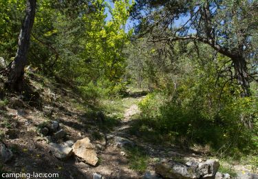
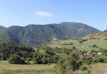
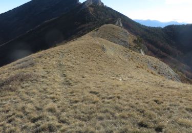
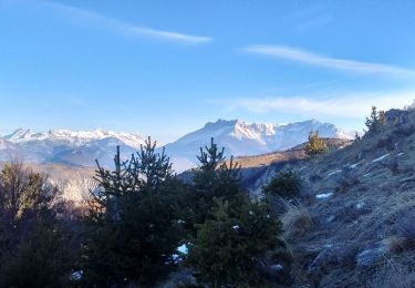
Trail On foot of 11.1 km to be discovered at Provence-Alpes-Côte d'Azur, Hautes-Alpes, Le Saix. This trail is proposed by RobinMicheline.

Description

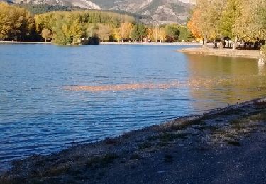
Agreable , sentiers sympas , abbaye en cours de renovation

Elevation profile

Positioning

Country:
France
Region :
Provence-Alpes-Côte d'Azur
Department/Province :
Hautes-Alpes
Municipality :
Le Saix
Location:
Unknown
Start:(UTM)
724458 ; 4928367 (31T) N.

Trails nearby

Trail Walking Le Saix - R08 La boucle des cascades jaunes - Photo
Walking
GUIDE+

Walking

Very easy
(1)
Le Saix, Provence-Alpes-Côte d'Azur, Hautes-Alpes, France
5.5 km | 10.3 km-effort
2h 10min
Yes
Trail Mountain bike Veynes - VTT14 - Les crêtes de la Longeagne - Photo
Mountain bike
GUIDE+

Mountain bike

Very difficult
(1)
Veynes, Provence-Alpes-Côte d'Azur, Hautes-Alpes, France
39 km | 57 km-effort
3h 15min
Yes
Trail Mountain bike Veynes - VTT03 - Tous les Eygaux - Photo
Mountain bike
GUIDE+

Mountain bike

Medium
(2)
Veynes, Provence-Alpes-Côte d'Azur, Hautes-Alpes, France
23 km | 31 km-effort
1h 31min
Yes
Trail Walking Le Saix - R07   le fai - Photo
Walking
GUIDE+

Walking

Easy
(4)
Le Saix, Provence-Alpes-Côte d'Azur, Hautes-Alpes, France
5.1 km | 8 km-effort
1h 42min
Yes
Trail Running Veynes - Trail 05 - Le Défi des Argouses - Photo
Running
GUIDE+

Running

Difficult
(3)
Veynes, Provence-Alpes-Côte d'Azur, Hautes-Alpes, France
9 km | 11.9 km-effort
48min
Yes
Trail Road bike Veynes - C23 - Les cols de Veynes - Photo
Road bike
GUIDE+

Road bike

Medium
(1)
Veynes, Provence-Alpes-Côte d'Azur, Hautes-Alpes, France
58 km | 83 km-effort
4h 26min
Yes
Trail Running Le Saix - Trail 10 - La Traversée d'Aujour - Photo
Running
GUIDE+

Running

Difficult
Le Saix, Provence-Alpes-Côte d'Azur, Hautes-Alpes, France
16.4 km | 31 km-effort
3h 0min
Yes
Trail Running Saint-Auban-d'Oze - Trail 01 - Le Cirque de Villauret - Photo
Running
GUIDE+

Running

Difficult
Saint-Auban-d'Oze, Provence-Alpes-Côte d'Azur, Hautes-Alpes, France
9.6 km | 19.9 km-effort
2h 0min
Yes
Trail Walking Le Saix - R36 - Aujour depuis Clausonne - Photo
Walking
GUIDE+

Walking

Difficult
Le Saix, Provence-Alpes-Côte d'Azur, Hautes-Alpes, France
11.9 km | 22 km-effort
4h 27min
Yes


Close
My subscriptions