Trail Mountain bike Veynes - VTT14 - Les crêtes de la Longeagne - Photo

VTT14 - Les crêtes de la Longeagne

Les Hautes Alpes à découvrir ! GUIDE+

© OpenStreetMap contributors
Length
Length
39 km
Max alt
Max alt
1561 m
Uphill gradient
Uphill gradient
1320 m
Km-Effort
Km-Effort  
57 km
Min alt
Min alt
753 m
Downhill gradient
Downhill gradient
1319 m
Boucle
Boucle
Yes
Creation date :
2018-03-23 05:40:32.052
Updated on :
2022-05-26 07:20:55.438

(1 Reviews)

Mountain bike
Mountain bike
3h15
Difficulty : Very difficult

Scan this QR Code to open this trail in the SityTrail application

FREE GPS app for hiking

Logo SityTrail SityTrail

IGN / Geographical institutes

Download SityTrail from the App Store Download SityTrail from Google Play

Logo SityTrail SityTrail World

The world is yours!

Download SityTrail from the App Store Download SityTrail from Google Play Download SityTrail on Huawei AppGallery

About

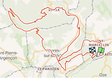
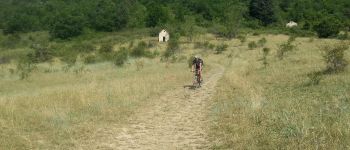
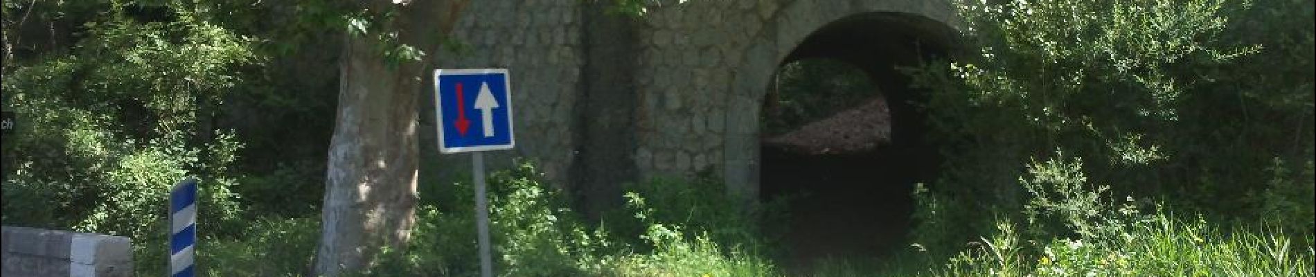
Trail Mountain bike of 39 km to be discovered at Provence-Alpes-Côte d'Azur, Hautes-Alpes, Veynes. This trail is proposed by Camping Les Rives du Lac.

Description

Strenuous hike: count more than 2 hours of climb from the campsite to reach the summit.
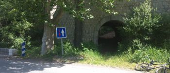
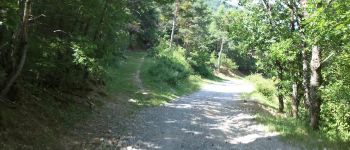
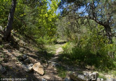
Beautiful forest track. Only the last 10 minutes on the trail require pushing the bike. It is possible to avoid pushing the bike and follow at the last junction the sign "VTT07" but it's a shame because it deprives you of the arrival on the most western part of the ridge of the Longeagne, who is beautiful.
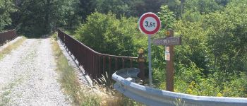
You follow (mostly downhill) the ridge to the Marjariès pass. (you will see the MTB07 sign).
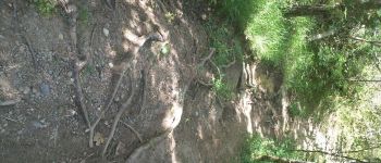
The descent is technical, especially at the beginning. From the second part, it is very rolling and you will remember for a long time the passage in forest which leads to black marl!
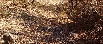
Return via Aspres, the Eygaux with the traditional descent on the water.
It is possible to leave Aspres on Buëch and win 1h.

Elevation profile

Photos

Points of interest

Point of interest Aspres-sur-Buëch - Fin du Single du Pont - Photo
CampingLesRivesduLac
ASPRES-SUR-BUËCH 
Point of interest Aspres-sur-Buëch - Le Col du Pignon - Photo
CampingLesRivesduLac
ASPRES-SUR-BUËCH 
Point of interest Aspres-sur-Buëch - Pont Train - Photo
CampingLesRivesduLac
ASPRES-SUR-BUËCH 
Point of interest Veynes - Fin descente plan d'eau - Photo
CampingLesRivesduLac
Point of interest Aspres-sur-Buëch - Single du pont - Photo
CampingLesRivesduLac
ASPRES-SUR-BUËCH 
Point of interest Veynes - Single Pont - Photo
CampingLesRivesduLac
VEYNES 
Point of interest La Faurie - Crête de la Longeagne - Photo
CampingLesRivesduLac

Positioning

Country:
France
Region :
Provence-Alpes-Côte d'Azur
Department/Province :
Hautes-Alpes
Municipality :
Veynes
Location:
Unknown
Start:(UTM)
722375 ; 4933284 (31T) N.

Comments

Please log in to post a review or rate the element


superbe descente intégralement ben single avec des passages un peu techniques.


Trails nearby

Trail Walking Le Saix - R08 La boucle des cascades jaunes - Photo
Walking
GUIDE+

Walking

Very easy
(1)
Le Saix, Provence-Alpes-Côte d'Azur, Hautes-Alpes, France
5.5 km | 10.3 km-effort
2h 10min
Yes
Trail Mountain bike Veynes - VTT29 - Rando famille - Photo
Mountain bike
GUIDE+

Mountain bike

Easy
(1)
Veynes, Provence-Alpes-Côte d'Azur, Hautes-Alpes, France
10.9 km | 13.6 km-effort
54min
Yes
Trail Mountain bike Veynes - VTT03 - Tous les Eygaux - Photo
Mountain bike
GUIDE+

Mountain bike

Medium
(2)
Veynes, Provence-Alpes-Côte d'Azur, Hautes-Alpes, France
23 km | 31 km-effort
1h 31min
Yes
Trail Mountain bike Veynes - VTT02 - Aiguebelle - Photo
Mountain bike
GUIDE+

Mountain bike

Easy
(2)
Veynes, Provence-Alpes-Côte d'Azur, Hautes-Alpes, France
16.7 km | 21 km-effort
1h 23min
Yes
Trail Mountain bike Veynes - VTT01 - Les Eygaux - Photo
Mountain bike
GUIDE+

Mountain bike

Easy
(3)
Veynes, Provence-Alpes-Côte d'Azur, Hautes-Alpes, France
14.1 km | 19.2 km-effort
1h 13min
Yes
Trail Walking Veynes - R10   Le tour des Eygaux - Photo
Walking
GUIDE+

Walking

Very easy
(4)
Veynes, Provence-Alpes-Côte d'Azur, Hautes-Alpes, France
7.8 km | 11.3 km-effort
2h 24min
Yes
Trail Walking Veynes - R09   Le tour de Veynes - Photo
Walking
GUIDE+

Walking

Very easy
(3)
Veynes, Provence-Alpes-Côte d'Azur, Hautes-Alpes, France
9.5 km | 12.3 km-effort
2h 40min
Yes
Trail Walking Le Saix - R07   le fai - Photo
Walking
GUIDE+

Walking

Easy
(4)
Le Saix, Provence-Alpes-Côte d'Azur, Hautes-Alpes, France
5.1 km | 8 km-effort
1h 42min
Yes
Trail Walking Veynes - R06   glaise - Photo
Walking
GUIDE+

Walking

Easy
(1)
Veynes, Provence-Alpes-Côte d'Azur, Hautes-Alpes, France
9.1 km | 14.9 km-effort
3h 4min
Yes


Close
My subscriptions