Trail Walking Jurançon - chapelle de rousse 2013 - Photo
 potofe
potofe

User

© OpenStreetMap contributors
Length
Length
12.2 km
Max alt
Max alt
331 m
Uphill gradient
Uphill gradient
403 m
Km-Effort
Km-Effort  
17.4 km
Min alt
Min alt
175 m
Downhill gradient
Downhill gradient
351 m
Boucle
Boucle
No
Creation date :
2018-09-07 19:24:18.516
Updated on :
2018-09-07 19:24:18.516

(0 Reviews)

Walking
Walking
3h26
Difficulty : Easy

Scan this QR Code to open this trail in the SityTrail application

FREE GPS app for hiking

Logo SityTrail SityTrail

IGN / Geographical institutes

Download SityTrail from the App Store Download SityTrail from Google Play

Logo SityTrail SityTrail World

The world is yours!

Download SityTrail from the App Store Download SityTrail from Google Play Download SityTrail on Huawei AppGallery

About

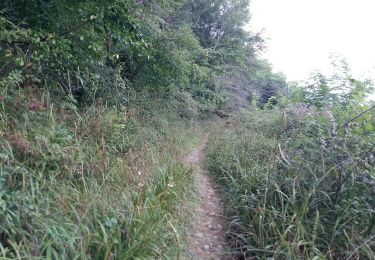
Trail Walking of 12.2 km to be discovered at New Aquitaine, Pyrénées-Atlantiques, Jurançon. This trail is proposed by potofe.

Elevation profile

Positioning

Country:
France
Region :
New Aquitaine
Department/Province :
Pyrénées-Atlantiques
Municipality :
Jurançon
Location:
Unknown
Start:(UTM)
709077 ; 4792633 (30T) N.

Comments

Please log in to post a review or rate the element


itinéraire à déconseiller surtout sur la deuxième partie car le sentier à disparu dans la forêt.


Trails nearby

Trail Walking Aubertin - AUBERTIN (PPT) de la hélère à la baïse  fait (G3)  2641287 - Photo
Walking
GUIDE
marmotte65

Walking

Easy
Aubertin, New Aquitaine, Pyrénées-Atlantiques, France
12 km | 17.1 km-effort
3h 13min
Yes
Trail On foot Pau - PAU terra aventura
On foot
GUIDE
marmotte65

On foot

Easy
Pau, New Aquitaine, Pyrénées-Atlantiques, France
4.2 km | 5.2 km-effort
1h 10min
No
Trail Walking Pau - GR 782 B pont du 14 juillet artiguelouve
Walking
GUIDE
marmotte65

Walking

Medium
Pau, New Aquitaine, Pyrénées-Atlantiques, France
10.4 km | 11.4 km-effort
2h 38min
No
Trail Walking Billère - BILLERE   RS les villas Anglo Americaine - Photo
Walking
GUIDE
marmotte65

Walking

Easy
Billère, New Aquitaine, Pyrénées-Atlantiques, France
3.3 km | 3.8 km-effort
1h 5min
Yes
Trail Other activity Gan - GAN ecomobolite Patrimoine et geologie   3162323 - Photo
Other activity
GUIDE
marmotte65

Other activity

Very easy
Gan, New Aquitaine, Pyrénées-Atlantiques, France
5 km | 5.7 km-effort
1h 37min
Yes
Trail Walking Jurançon - JURANÇON les coteaux  M1  2902947  - Photo
Walking
GUIDE
marmotte65

Walking

Easy
Jurançon, New Aquitaine, Pyrénées-Atlantiques, France
9 km | 13.2 km-effort
2h 26min
Yes
Trail On foot Pau - PAU de la gare / a Laroin - Photo
On foot
GUIDE
marmotte65

On foot

Easy
Pau, New Aquitaine, Pyrénées-Atlantiques, France
8.9 km | 10.4 km-effort
2h 21min
No
Trail Walking Pau - PAU  parc du chateau - Photo
Walking
GUIDE
marmotte65

Walking

Very easy
Pau, New Aquitaine, Pyrénées-Atlantiques, France
3.2 km | 3.7 km-effort
1h 14min
Yes
Trail Walking Pau - PAU de la ville au gave descriptif -fait pour PPT
Walking
GUIDE
marmotte65

Walking

Very easy
Pau, New Aquitaine, Pyrénées-Atlantiques, France
6.1 km | 6.7 km-effort
48min
Yes


Close
My subscriptions