Trail On foot Louvie-Juzon - SityTrail - 1071647 - louvie-juzon-pe-de-hourat-boucle-de-la-cabane-de-coigts-fait-et-nettoyexe - Photo

SityTrail - 1071647 - louvie-juzon-pe-de-hourat-boucle-de-la-cabane-de-coigts-fait-et-nettoyexe

 marmotte65
marmotte65

User GUIDE

© OpenStreetMap contributors
Length
Length
11.2 km
Max alt
Max alt
1018 m
Uphill gradient
Uphill gradient
628 m
Km-Effort
Km-Effort  
19.5 km
Min alt
Min alt
417 m
Downhill gradient
Downhill gradient
627 m
Boucle
Boucle
Yes
Creation date :
2020-03-21 11:17:41.116
Updated on :
2020-03-22 17:24:27.721

(0 Reviews)

On foot
On foot
--
Difficulty : Difficult

Scan this QR Code to open this trail in the SityTrail application

FREE GPS app for hiking

Logo SityTrail SityTrail

IGN / Geographical institutes

Download SityTrail from the App Store Download SityTrail from Google Play

Logo SityTrail SityTrail World

The world is yours!

Download SityTrail from the App Store Download SityTrail from Google Play Download SityTrail on Huawei AppGallery

About

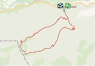
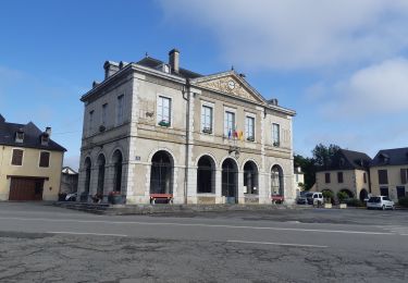
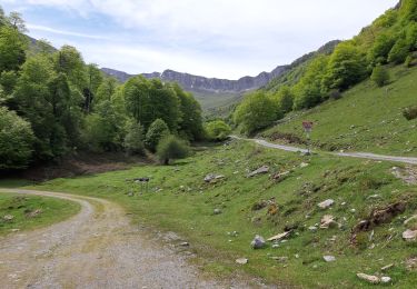
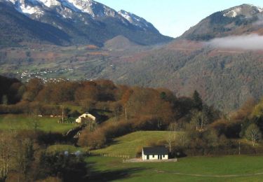
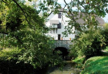
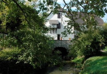
Trail On foot of 11.2 km to be discovered at New Aquitaine, Pyrénées-Atlantiques, Louvie-Juzon. This trail is proposed by marmotte65.

Description

Coordonées de départ :
N 43 05 30.7
W 000 20 07.4
cette trace a été nettoyée et doit être contrôlé sur le terrain avant d'emmener un quelconque groupe
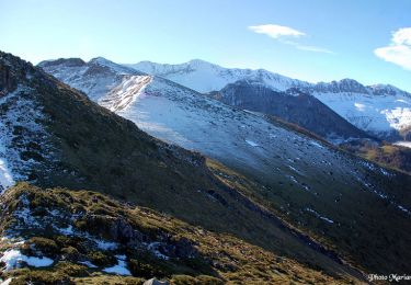
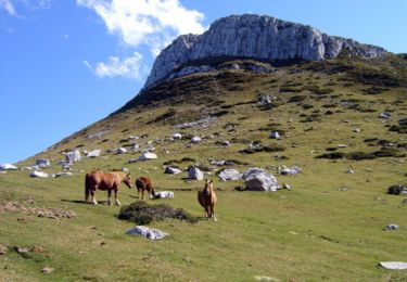
à faire en été sur terrain sec ou presque secteur à l'ombre en permanence (juill et Août )
11.1 km et 629m
cette cabane a été visitée 2 fois a l’occasion des huîtres de noel avec les 4 groupes

Elevation profile

Positioning

Country:
France
Region :
New Aquitaine
Department/Province :
Pyrénées-Atlantiques
Municipality :
Louvie-Juzon
Location:
Unknown
Start:(UTM)
716863 ; 4774469 (30T) N.

Trails nearby

Trail On foot Bruges-Capbis-Mifaget - BRUGES  BALISAGE gr78 b - Photo
On foot
GUIDE
marmotte65

On foot

Easy
Bruges-Capbis-Mifaget, New Aquitaine, Pyrénées-Atlantiques, France
6 km | 7.7 km-effort
1h 44min
No
Trail On foot Louvie-Juzon - Le tour du Rey - Photo
On foot
PRO

On foot

Medium
Louvie-Juzon, New Aquitaine, Pyrénées-Atlantiques, France
10.6 km | 22 km-effort
4h 55min
Yes
Trail Walking Castet - Le Port de Castet en étoile - G4 - Photo
Walking
mitch1952

Walking

Medium
Castet, New Aquitaine, Pyrénées-Atlantiques, France
9.5 km | 13.6 km-effort
4h 0min
Yes
Trail Running Castet - Le tour du Rey - Castet - Photo
Running
tracegps

Running

Difficult
Castet, New Aquitaine, Pyrénées-Atlantiques, France
10.9 km | 22 km-effort
2h 15min
Yes
Trail Walking Castet - Le tour du Rey - Castet - Photo
Walking
tracegps

Walking

Difficult
Castet, New Aquitaine, Pyrénées-Atlantiques, France
10.9 km | 22 km-effort
4h 30min
Yes
Trail Walking Bruges-Capbis-Mifaget - Chemin du Piémont Pyrénéen - De Bruges à Buzy - Photo
Walking
tracegps

Walking

Difficult
Bruges-Capbis-Mifaget, New Aquitaine, Pyrénées-Atlantiques, France
21 km | 29 km-effort
5h 0min
No
Trail Walking Bruges-Capbis-Mifaget - Bruges Mifaget - Photo
Walking
tracegps

Walking

Medium
Bruges-Capbis-Mifaget, New Aquitaine, Pyrénées-Atlantiques, France
10.4 km | 12.9 km-effort
3h 45min
Yes
Trail Walking Castet - Le Mail 1665m et le Pic Durban 1700m - Photo
Walking
tracegps

Walking

Medium
Castet, New Aquitaine, Pyrénées-Atlantiques, France
11.1 km | 22 km-effort
5h 0min
Yes
Trail Walking Castet - Pic de Durban - Photo
Walking
tracegps

Walking

Difficult
Castet, New Aquitaine, Pyrénées-Atlantiques, France
11.1 km | 22 km-effort
5h 0min
Yes


Close
My subscriptions