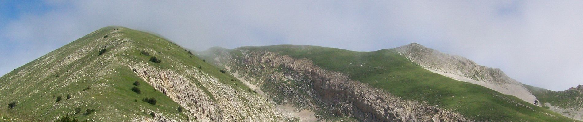
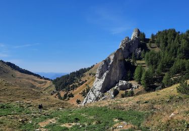
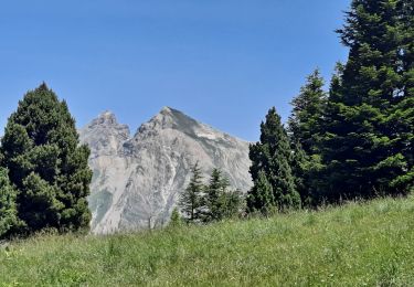
Trail Walking Saint-Julien-en-Beauchêne - Chamousset (Lus-La-Croix-Haute) - Photo
© OpenStreetMap contributors
Length
Length
12 km
Max alt
Max alt
2081 m
Uphill gradient
Uphill gradient
944 m
Km-Effort
Km-Effort  
25 km
Min alt
Min alt
1321 m
Downhill gradient
Downhill gradient
944 m
Boucle
Boucle
Yes
Creation date :
2020-10-24 17:52:32.088
Updated on :
2020-10-25 19:37:03.756

(0 Reviews)

Walking
Walking
4h30
Difficulty : Difficult

Scan this QR Code to open this trail in the SityTrail application

FREE GPS app for hiking

Logo SityTrail SityTrail

IGN / Geographical institutes

Download SityTrail from the App Store Download SityTrail from Google Play

Logo SityTrail SityTrail World

The world is yours!

Download SityTrail from the App Store Download SityTrail from Google Play Download SityTrail on Huawei AppGallery

About

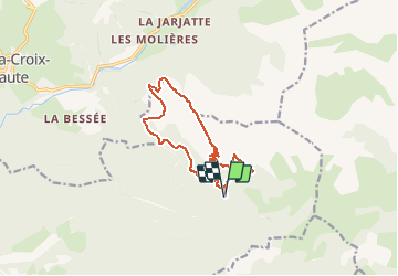
Trail Walking of 12 km to be discovered at Provence-Alpes-Côte d'Azur, Hautes-Alpes, Saint-Julien-en-Beauchêne. This trail is proposed by Philindy26.

Description

Départ du parking des Chabottes (1330 m) à Lus-La-Croix-Haute...
Géolocalisation (Google Maps) : https://goo.gl/maps/ut89nePWDMqPtLkx7 à 05140 Saint-Julien-en-Beauchêne.

Prendre la direction du vallon de Garnesier et montée par la Grande Côte sur Chamousset (2089 m).
Continuer sur le Grand Chamousset (1930 m) et le Petit Chamousset.
Retour par le roc de Rimat (1573 m), le Serre Sambue (1626 m) et le col de Pré Pinel (1452 m).

Elevation profile

Photos

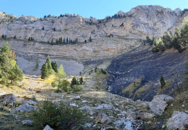
30 photos in total. Please click on a photo to see them all in the gallery.

Positioning

Country:
France
Region :
Provence-Alpes-Côte d'Azur
Department/Province :
Hautes-Alpes
Municipality :
Saint-Julien-en-Beauchêne
Location:
Unknown
Start:(UTM)
719991 ; 4946374 (31T) N.

Trails nearby

Trail Walking Lus-la-Croix-Haute - R38   Col des Aiguilles depuis Lus - Photo
Walking
GUIDE+

Walking

Medium
Lus-la-Croix-Haute, Auvergne-Rhône-Alpes, Drôme, France
5.6 km | 15 km-effort
2h 53min
Yes
Trail Walking Saint-Julien-en-Beauchêne - tour des 4 cols - Photo
Walking
GuyVachet

Walking

Very difficult
Saint-Julien-en-Beauchêne, Provence-Alpes-Côte d'Azur, Hautes-Alpes, France
13.2 km | 24 km-effort
5h 25min
Yes
Trail Walking Saint-Julien-en-Beauchêne - Montagne de Durbonas - Photo
Walking
Marco05

Walking

Difficult
Saint-Julien-en-Beauchêne, Provence-Alpes-Côte d'Azur, Hautes-Alpes, France
12.3 km | 23 km-effort
5h 16min
Yes
Trail Walking Saint-Julien-en-Beauchêne - Chamousset - Photo
Walking
Marco05

Walking

Difficult
Saint-Julien-en-Beauchêne, Provence-Alpes-Côte d'Azur, Hautes-Alpes, France
11.2 km | 22 km-effort
5h 1min
Yes
Trail Walking Le Dévoluy - cabane col des Aiguilles La Jarjatte  - Photo
Walking
Atchoum26

Walking

Difficult
Le Dévoluy, Provence-Alpes-Côte d'Azur, Hautes-Alpes, France
12.8 km | 21 km-effort
5h 32min
No
Trail Walking Lus-la-Croix-Haute - MAS REBUFAT - POINTE FEUILLETTE  - Photo
Walking
RD78-38

Walking

Medium
Lus-la-Croix-Haute, Auvergne-Rhône-Alpes, Drôme, France
11.7 km | 20 km-effort
3h 33min
Yes
Trail Walking Lus-la-Croix-Haute - Pic de l'Aigle en circuit - Photo
Walking
Emelle

Walking

Medium
Lus-la-Croix-Haute, Auvergne-Rhône-Alpes, Drôme, France
7.4 km | 16.2 km-effort
4h 17min
Yes
Trail Walking Saint-Julien-en-Beauchêne - les 4 cols - Photo
Walking
elibelle

Walking

Medium
Saint-Julien-en-Beauchêne, Provence-Alpes-Côte d'Azur, Hautes-Alpes, France
13.7 km | 23 km-effort
5h 12min
Yes
Trail Walking Lus-la-Croix-Haute - 26 jarjate cascade - Photo
Walking
guy07

Walking

Very easy
(1)
Lus-la-Croix-Haute, Auvergne-Rhône-Alpes, Drôme, France
9.9 km | 15.6 km-effort
3h 40min
Yes


Close
My subscriptions