Trail Walking Val-Buëch-Méouge - Covid 23 - Photo
© OpenStreetMap contributors
Length
Length
7.1 km
Max alt
Max alt
551 m
Uphill gradient
Uphill gradient
85 m
Km-Effort
Km-Effort  
8.2 km
Min alt
Min alt
487 m
Downhill gradient
Downhill gradient
84 m
Boucle
Boucle
Yes
Creation date :
2020-11-11 11:49:35.595
Updated on :
2020-11-11 14:03:58.451

(0 Reviews)

Walking
Walking
2h02
Difficulty : Very easy

Scan this QR Code to open this trail in the SityTrail application

FREE GPS app for hiking

Logo SityTrail SityTrail

IGN / Geographical institutes

Download SityTrail from the App Store Download SityTrail from Google Play

Logo SityTrail SityTrail World

The world is yours!

Download SityTrail from the App Store Download SityTrail from Google Play Download SityTrail on Huawei AppGallery

About

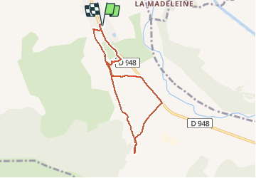
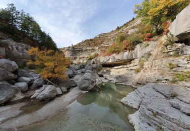
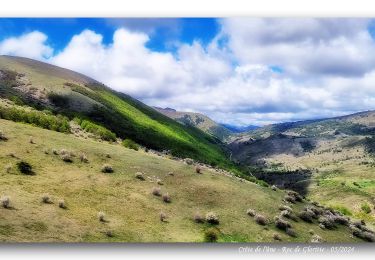
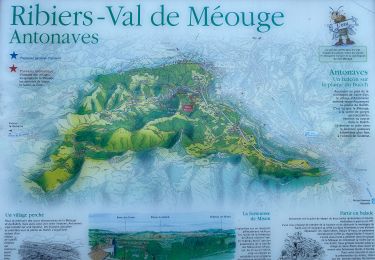
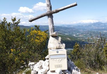
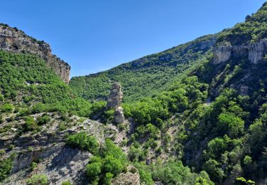
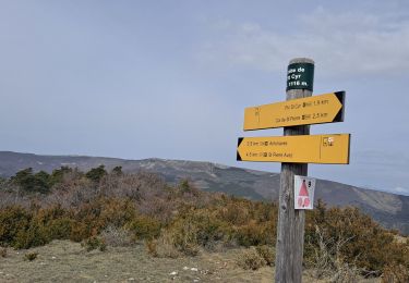
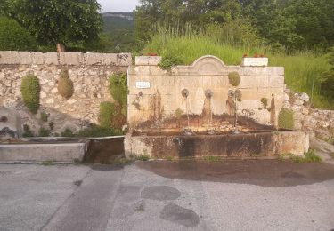
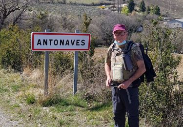
Trail Walking of 7.1 km to be discovered at Provence-Alpes-Côte d'Azur, Hautes-Alpes, Val-Buëch-Méouge. This trail is proposed by claude nier.

Description

Sympa...

Elevation profile

Photos

Positioning

Country:
France
Region :
Provence-Alpes-Côte d'Azur
Department/Province :
Hautes-Alpes
Municipality :
Val-Buëch-Méouge
Location:
Unknown
Start:(UTM)
728544 ; 4900681 (31T) N.

Trails nearby

Trail Walking Val-Buëch-Méouge - les gorges de la Méouge - Photo
Walking
GUIDE
amiral13

Walking

Medium
Val-Buëch-Méouge, Provence-Alpes-Côte d'Azur, Hautes-Alpes, France
13.1 km | 21 km-effort
5h 40min
Yes
Trail Walking Val-Buëch-Méouge - Crête de l'âne, des Planes et Roc de Gloritte Via Plaugiers - Photo
Walking
PapouBertrand

Walking

Very difficult
Val-Buëch-Méouge, Provence-Alpes-Côte d'Azur, Hautes-Alpes, France
11.1 km | 23 km-effort
5h 19min
Yes
Trail Walking Val-Buëch-Méouge - Anti a es - Photo
Walking
GUIDE
Roger Philippe Wallez

Walking

Very difficult
Val-Buëch-Méouge, Provence-Alpes-Côte d'Azur, Hautes-Alpes, France
13.5 km | 25 km-effort
5h 3min
Yes
Trail Walking Val-Buëch-Méouge - Rocher de pierre Impie, roc de l'aigle,  pas de Berches  - Photo
Walking
nadd73

Walking

Medium
Val-Buëch-Méouge, Provence-Alpes-Côte d'Azur, Hautes-Alpes, France
12.4 km | 23 km-effort
6h 1min
No
Trail Walking Val-Buëch-Méouge - Gorges de la Méouge - Photo
Walking
Marco05

Walking

Difficult
Val-Buëch-Méouge, Provence-Alpes-Côte d'Azur, Hautes-Alpes, France
11.9 km | 19.5 km-effort
4h 26min
Yes
Trail Walking Val-Buëch-Méouge - Pic de Saint-Cyr - Photo
Walking
Marco05

Walking

Medium
Val-Buëch-Méouge, Provence-Alpes-Côte d'Azur, Hautes-Alpes, France
10.7 km | 20 km-effort
4h 21min
Yes
Trail Walking Val-Buëch-Méouge - ANTONAVES,  LES GORGES DE LA MEOUGE ,  ROCHER DU CHATEAU o s - Photo
Walking
RobinMicheline

Walking

Medium
(1)
Val-Buëch-Méouge, Provence-Alpes-Côte d'Azur, Hautes-Alpes, France
11 km | 17.2 km-effort
3h 12min
Yes
Trail Walking Val-Buëch-Méouge - Boucle du Mt Ourouze depart Antonaves 415 + - Photo
Walking
claude nier

Walking

Easy
Val-Buëch-Méouge, Provence-Alpes-Côte d'Azur, Hautes-Alpes, France
10.9 km | 16.5 km-effort
13h 7min
Yes
Trail Hybrid bike Val-Buëch-Méouge - Gorge de la Meouge et Chabre depart Ribiers  702 + - Photo
Hybrid bike
claude nier

Hybrid bike

Easy
Val-Buëch-Méouge, Provence-Alpes-Côte d'Azur, Hautes-Alpes, France
40 km | 50 km-effort
5h 41min
Yes


Close
My subscriptions