Trail Walking Allauch - Le tour des Grands Ubacs au départ de Pichauris - Photo

Le tour des Grands Ubacs au départ de Pichauris

 Coqorico
Coqorico

User

© OpenStreetMap contributors
Length
Length
13.3 km
Max alt
Max alt
665 m
Uphill gradient
Uphill gradient
517 m
Km-Effort
Km-Effort  
20 km
Min alt
Min alt
273 m
Downhill gradient
Downhill gradient
516 m
Boucle
Boucle
Yes
Creation date :
2021-01-18 11:04:31.556
Updated on :
2021-01-18 13:00:57.942

(1 Reviews)

Walking
Walking
4h25
Difficulty : Easy

Scan this QR Code to open this trail in the SityTrail application

FREE GPS app for hiking

Logo SityTrail SityTrail

IGN / Geographical institutes

Download SityTrail from the App Store Download SityTrail from Google Play

Logo SityTrail SityTrail World

The world is yours!

Download SityTrail from the App Store Download SityTrail from Google Play Download SityTrail on Huawei AppGallery

About

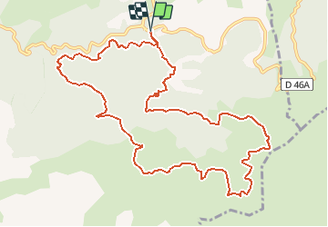
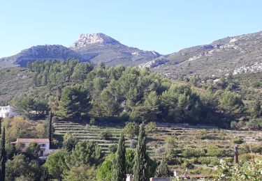
Trail Walking of 13.3 km to be discovered at Provence-Alpes-Côte d'Azur, Bouches-du-Rhône, Allauch. This trail is proposed by Coqorico.

Description

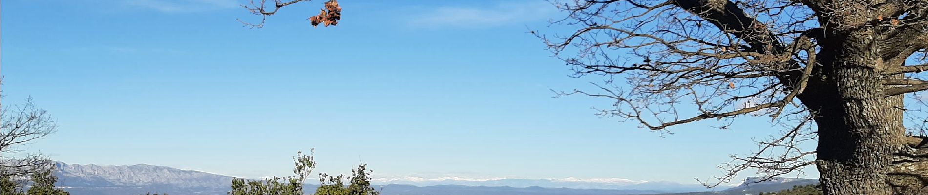
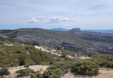
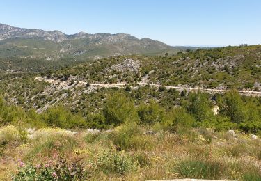
Jolie boucle dans les terres de Pagnol, offrant si le ciel le permet un panorama de la mer aux montagnes (Sainte Victoire bien sûr, Sainte Baume, sommets du Verdon et des Alpes, Luberon, Mont Ventoux).

Elevation profile

Photos

Positioning

Country:
France
Region :
Provence-Alpes-Côte d'Azur
Department/Province :
Bouches-du-Rhône
Municipality :
Allauch
Location:
Unknown
Start:(UTM)
705556 ; 4805075 (31T) N.

Comments

Please log in to post a review or rate the element


Belle randonnée au pays de Pagnol, avec un panorama de la mer à la montagne.


Trails nearby

Trail Walking Allauch - Domaine de Pichauris - Allauch - Photo
Walking
tracegps

Walking

Medium
(1)
Allauch, Provence-Alpes-Côte d'Azur, Bouches-du-Rhône, France
10.5 km | 15 km-effort
2h 30min
Yes
Trail Walking Allauch - le pic du Taoumé par Pichauris - Photo
Walking
GUIDE
amiral13

Walking

Easy
Allauch, Provence-Alpes-Côte d'Azur, Bouches-du-Rhône, France
13.3 km | 20 km-effort
4h 32min
Yes
Trail Mountain bike Allauch - les antennes du garlaban à modifier - Photo
Mountain bike
GUIDE
harydh

Mountain bike

Medium
Allauch, Provence-Alpes-Côte d'Azur, Bouches-du-Rhône, France
19.3 km | 28 km-effort
2h 8min
Yes
Trail Walking Roquevaire - Garlaban au départ de Lascours  - Photo
Walking
GUIDE
nadinebondoux

Walking

Difficult
Roquevaire, Provence-Alpes-Côte d'Azur, Bouches-du-Rhône, France
15.6 km | 26 km-effort
6h 1min
Yes
Trail Mountain bike Allauch - les antennes du garlaban - Photo
Mountain bike
GUIDE
harydh

Mountain bike

Medium
Allauch, Provence-Alpes-Côte d'Azur, Bouches-du-Rhône, France
19.3 km | 28 km-effort
2h 8min
Yes
Trail Mountain bike Allauch - de Pichauris au mont du Marseillais - Photo
Mountain bike
GUIDE
amiral13

Mountain bike

Medium
Allauch, Provence-Alpes-Côte d'Azur, Bouches-du-Rhône, France
14 km | 19.2 km-effort
2h 34min
Yes
Trail Walking Roquevaire - le mont du marseillais par le grand Vallon - Photo
Walking
GUIDE
amiral13

Walking

Difficult
Roquevaire, Provence-Alpes-Côte d'Azur, Bouches-du-Rhône, France
9.9 km | 15.9 km-effort
4h 50min
Yes
Trail Walking Roquevaire - Le Garlaban par le Grand Vallon - Photo
Walking
ARPF

Walking

Difficult
(1)
Roquevaire, Provence-Alpes-Côte d'Azur, Bouches-du-Rhône, France
10.1 km | 18.7 km-effort
3h 49min
Yes
Trail Walking Allauch - Pic du Taoumé - Photo
Walking
GUIDE
amiral13

Walking

Easy
Allauch, Provence-Alpes-Côte d'Azur, Bouches-du-Rhône, France
9.2 km | 15.2 km-effort
5h 5min
Yes


Close
My subscriptions