Trail Touring skiing Aiguilles - SRN Aiguilles Molines - Photo
 mayaud
mayaud

User

© OpenStreetMap contributors
Length
Length
10 km
Max alt
Max alt
1794 m
Uphill gradient
Uphill gradient
468 m
Km-Effort
Km-Effort  
15.4 km
Min alt
Min alt
1444 m
Downhill gradient
Downhill gradient
200 m
Boucle
Boucle
No
Creation date :
2021-02-14 14:24:27.86
Updated on :
2021-02-14 14:38:47.613

(0 Reviews)

Touring skiing
Touring skiing
4h00
Difficulty : Medium

Scan this QR Code to open this trail in the SityTrail application

FREE GPS app for hiking

Logo SityTrail SityTrail

IGN / Geographical institutes

Download SityTrail from the App Store Download SityTrail from Google Play

Logo SityTrail SityTrail World

The world is yours!

Download SityTrail from the App Store Download SityTrail from Google Play Download SityTrail on Huawei AppGallery

About

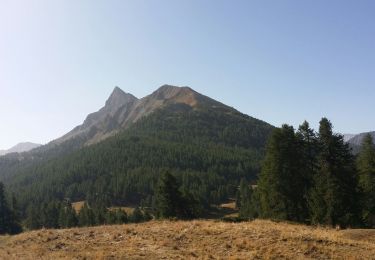
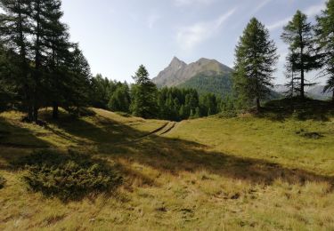
Trail Touring skiing of 10 km to be discovered at Provence-Alpes-Côte d'Azur, Hautes-Alpes, Aiguilles. This trail is proposed by mayaud.

Description

Ski de randonnée nordique : Aiguilles Molines Aiguille
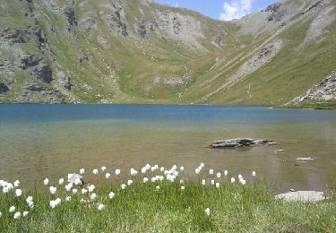
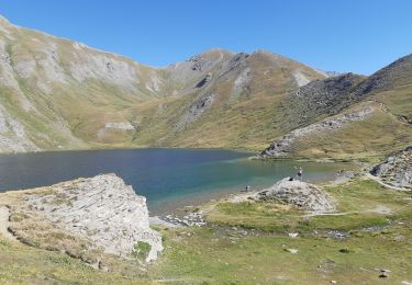
Etape de la Haute Route des Escartons

Elevation profile

Positioning

Country:
France
Region :
Provence-Alpes-Côte d'Azur
Department/Province :
Hautes-Alpes
Municipality :
Aiguilles
Location:
Unknown
Start:(UTM)
330736 ; 4960488 (32T) N.

Trails nearby

Trail Walking Château-Ville-Vieille - Queyras j1 - Photo
Walking
Ninie38MD

Walking

Medium
(1)
Château-Ville-Vieille, Provence-Alpes-Côte d'Azur, Hautes-Alpes, France
19.1 km | 36 km-effort
8h 6min
No
Trail Walking Château-Ville-Vieille - Ville-vieille - Ceillac - Photo
Walking
GUIDE
romanceline

Walking

Medium
Château-Ville-Vieille, Provence-Alpes-Côte d'Azur, Hautes-Alpes, France
17.4 km | 31 km-effort
6h 51min
No
Trail Walking Aiguilles - les lacs du Malrifs - Photo
Walking
GUIDE
amiral13

Walking

Very easy
Aiguilles, Provence-Alpes-Côte d'Azur, Hautes-Alpes, France
11 km | 21 km-effort
4h 44min
Yes
Trail Walking Aiguilles - lacs malrif à partir du lombard - Photo
Walking
francoisBerg

Walking

Medium
Aiguilles, Provence-Alpes-Côte d'Azur, Hautes-Alpes, France
9.8 km | 19.4 km-effort
3h 45min
Yes
Trail Walking Château-Ville-Vieille - 05-pointe-du-Rasis-13km-760m-aout21 - Photo
Walking
SyMA

Walking

Difficult
Château-Ville-Vieille, Provence-Alpes-Côte d'Azur, Hautes-Alpes, France
13.2 km | 23 km-effort
5h 32min
Yes
Trail Electric bike Abriès-Ristolas - d'Abries à Fond de cervieres  - Photo
Electric bike
jeff2

Electric bike

Medium
Abriès-Ristolas, Provence-Alpes-Côte d'Azur, Hautes-Alpes, France
14.5 km | 29 km-effort
6h 10min
No
Trail Walking Molines-en-Queyras - la rua  molines en queras - Photo
Walking
Nicolesophie08

Walking

Medium
Molines-en-Queyras, Provence-Alpes-Côte d'Azur, Hautes-Alpes, France
13.1 km | 23 km-effort
6h 49min
No
Trail Mountain bike Abriès-Ristolas - Q2 Abries - Belvédère du Viso - Valpréveyre - Photo
Mountain bike
patjobou

Mountain bike

Medium
Abriès-Ristolas, Provence-Alpes-Côte d'Azur, Hautes-Alpes, France
47 km | 63 km-effort
4h 1min
Yes
Trail Mountain bike Aiguilles - Site VTT FFC Queyras - Circuit n° 12 - La Queyrassine - Aiguilles - Photo
Mountain bike
tracegps

Mountain bike

Difficult
Aiguilles, Provence-Alpes-Côte d'Azur, Hautes-Alpes, France
16.5 km | 25 km-effort
1h 19min
Yes


Close
My subscriptions