Trail Walking Marolles-en-Brie - Marolles - Sucy - Chennevières - Ormesson 30 km - Photo

Marolles - Sucy - Chennevières - Ormesson 30 km

 chessyca
chessyca

User

© OpenStreetMap contributors
Length
Length
30 km
Max alt
Max alt
112 m
Uphill gradient
Uphill gradient
277 m
Km-Effort
Km-Effort  
33 km
Min alt
Min alt
29 m
Downhill gradient
Downhill gradient
276 m
Boucle
Boucle
Yes
Creation date :
2021-03-28 06:20:41.149
Updated on :
2021-06-21 06:57:34.89

(0 Reviews)

Walking
Walking
8h36
Difficulty : Very easy

Scan this QR Code to open this trail in the SityTrail application

FREE GPS app for hiking

Logo SityTrail SityTrail

IGN / Geographical institutes

Download SityTrail from the App Store Download SityTrail from Google Play

Logo SityTrail SityTrail World

The world is yours!

Download SityTrail from the App Store Download SityTrail from Google Play Download SityTrail on Huawei AppGallery

About

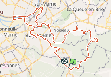
Trail Walking of 30 km to be discovered at Ile-de-France, Val-de-Marne, Marolles-en-Brie. This trail is proposed by chessyca.

Description

Superbe parcours au départ du haras de Marolles
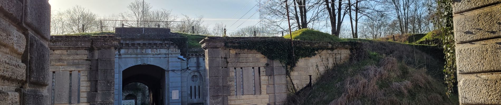
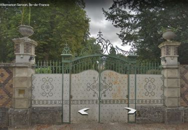
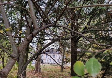
Passages dans les beaux parcs de la région en fleurs en ce moment.
Jolie balade en bord de Seine avec des maisons spectaculaires

Tracée et menée par Marc pour le Rcy

Elevation profile

Photos

Positioning

Country:
France
Region :
Ile-de-France
Department/Province :
Val-de-Marne
Municipality :
Marolles-en-Brie
Location:
Unknown
Start:(UTM)
467410 ; 5399389 (31U) N.

Trails nearby

Trail Walking Marolles-en-Brie - GRP CV-IDF 05 - Photo
Walking
clalaur

Walking

Difficult
(1)
Marolles-en-Brie, Ile-de-France, Val-de-Marne, France
13.5 km | 15.2 km-effort
3h 27min
No
Trail Walking Mandres-les-Roses - J 26 Mandres, Boussy , Brunoy le chemin des fresques  - Photo
Walking

Walking

Medium
(2)
Mandres-les-Roses, Ile-de-France, Val-de-Marne, France
12.2 km | 13.8 km-effort
3h 7min
Yes
Trail On foot Servon - J 01  11.97 km  les 5 châteaux  - Photo
On foot

On foot

Medium
(1)
Servon, Ile-de-France, Seine-et-Marne, France
11.7 km | 13.2 km-effort
3h 3min
Yes
Trail On foot Servon - R 04 - 8 km -  Servon, Santeny, Servon - Photo
On foot

On foot

Very difficult
(4)
Servon, Ile-de-France, Seine-et-Marne, France
7.9 km | 9.1 km-effort
2h 3min
Yes
Trail Walking Noiseau - depuis Noiseau - Photo
Walking
Bernardroland

Walking

Easy
(2)
Noiseau, Ile-de-France, Val-de-Marne, France
17 km | 19.1 km-effort
4h 35min
Yes
Trail Walking Yerres - BM Foret Regionale de Grobois 10km - Photo
Walking
GUIDE
jeanmarcMasson

Walking

Medium
(1)
Yerres, Ile-de-France, Essonne, France
10.4 km | 11 km-effort
2h 30min
Yes
Trail Walking Yerres - BM Foret Regionale Grosbois 10km - Photo
Walking
GUIDE
jeanmarcMasson

Walking

Medium
(1)
Yerres, Ile-de-France, Essonne, France
9.8 km | 10.5 km-effort
2h 23min
Yes
Trail Walking Yerres - J 43  Yerres Parc Caillebotte, île des Prévôts - Photo
Walking

Walking

Medium
(2)
Yerres, Ile-de-France, Essonne, France
11.4 km | 13.1 km-effort
2h 59min
Yes
Trail Walking Servon - JC 24 Servon , Villecresnes, forêt de la Grange   - Photo
Walking

Walking

Difficult
(2)
Servon, Ile-de-France, Seine-et-Marne, France
20 km | 22 km-effort
5h 6min
Yes


Close
My subscriptions