Trail Walking Glières-Val-de-Borne - Les Meffins - Col de Spée - Lavouillon - Les Meffins - Photo

Les Meffins - Col de Spée - Lavouillon - Les Meffins

 Kargil
Kargil

User GUIDE

© OpenStreetMap contributors
Length
Length
9.6 km
Max alt
Max alt
1675 m
Uphill gradient
Uphill gradient
958 m
Km-Effort
Km-Effort  
22 km
Min alt
Min alt
777 m
Downhill gradient
Downhill gradient
956 m
Boucle
Boucle
Yes
Creation date :
2021-04-18 08:00:56.053
Updated on :
2021-04-18 15:10:01.673

(0 Reviews)

Walking
Walking
4h30
Difficulty : Difficult

Scan this QR Code to open this trail in the SityTrail application

FREE GPS app for hiking

Logo SityTrail SityTrail

IGN / Geographical institutes

Download SityTrail from the App Store Download SityTrail from Google Play

Logo SityTrail SityTrail World

The world is yours!

Download SityTrail from the App Store Download SityTrail from Google Play Download SityTrail on Huawei AppGallery

About

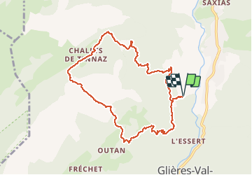
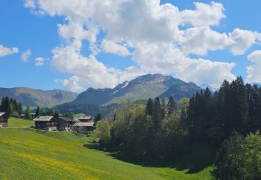
Trail Walking of 9.6 km to be discovered at Auvergne-Rhône-Alpes, Upper Savoy, Glières-Val-de-Borne. This trail is proposed by Kargil.

Description

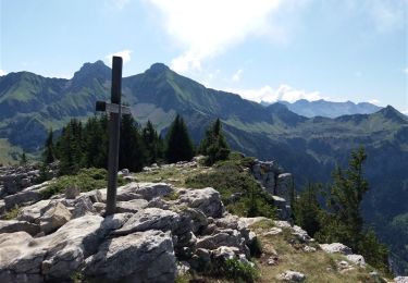
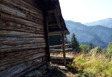
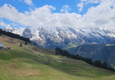
Belle randonnée de la mi-avril.
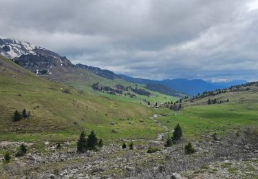
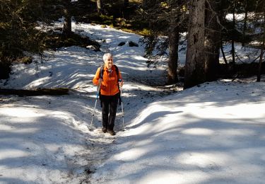
Descente du col bien enneigée aussi la trace ne suit pas forcément le sentier. Aucune trace entre Tinnaz et Lavouillon.
Un panneau alarmiste "sentier dangereux à vos risques et périls" ne doit pas inquiéter tout randonneur aguerri avec de bonnes chaussures. C'est même un intérêt supplémentaire pour un itinéraire sans difficulté.

Elevation profile

Photos

Positioning

Country:
France
Region :
Auvergne-Rhône-Alpes
Department/Province :
Upper Savoy
Municipality :
Glières-Val-de-Borne
Location:
Le Petit-Bornand-les-Glières
Start:(UTM)
297795 ; 5096988 (32T) N.

Trails nearby

Trail Walking Glières-Val-de-Borne - BARGY: ROCHERS DE LESCHAUX AU DEPART DE CENISE - Photo
Walking
djeepee74

Walking

Medium
(1)
Glières-Val-de-Borne, Auvergne-Rhône-Alpes, Upper Savoy, France
9.7 km | 15.3 km-effort
3h 30min
Yes
Trail Walking Le Grand-Bornand - Lac de Lessy depuis le Chinaillon  - Photo
Walking
lambert4zones

Walking

Medium
(1)
Le Grand-Bornand, Auvergne-Rhône-Alpes, Upper Savoy, France
13.2 km | 28 km-effort
4h 9min
Yes
Trail Walking Fillière - GLIERES: MONUMENT - CHALETS DES AUGES - GAUTARD - Photo
Walking
djeepee74

Walking

Easy
(1)
Fillière, Auvergne-Rhône-Alpes, Upper Savoy, France
8.8 km | 14.5 km-effort
3h 0min
No
Trail Walking Glières-Val-de-Borne - Petit Bornand - Pointe d'Andey 29/07/2018 - Photo
Walking
GUIDE
Kargil

Walking

Difficult
Glières-Val-de-Borne, Auvergne-Rhône-Alpes, Upper Savoy, France
12.6 km | 27 km-effort
5h 45min
Yes
Trail Walking Glières-Val-de-Borne - Refuge de Spé - Photo
Walking
Jocelyn74

Walking

Very easy
(1)
Glières-Val-de-Borne, Auvergne-Rhône-Alpes, Upper Savoy, France
3.7 km | 5 km-effort
Unknown
No
Trail Mountain bike Le Grand-Bornand - découverte du Chinaillon II - Photo
Mountain bike
duchaine.nicolas

Mountain bike

Difficult
Le Grand-Bornand, Auvergne-Rhône-Alpes, Upper Savoy, France
25 km | 38 km-effort
2h 36min
Yes
Trail Mountain bike Le Grand-Bornand - Balcon des Aravis - Photo
Mountain bike
duchaine.nicolas

Mountain bike

Medium
Le Grand-Bornand, Auvergne-Rhône-Alpes, Upper Savoy, France
27 km | 39 km-effort
2h 34min
Yes
Trail Mountain bike Le Grand-Bornand - Maroly - Colombière - Photo
Mountain bike
duchaine.nicolas

Mountain bike

Easy
Le Grand-Bornand, Auvergne-Rhône-Alpes, Upper Savoy, France
15.7 km | 24 km-effort
1h 32min
Yes
Trail Walking Glières-Val-de-Borne - GLIERES: TOUR DE LA MONTAGNE DES FRETES  mai 2023 - Photo
Walking
djeepee74

Walking

Difficult
Glières-Val-de-Borne, Auvergne-Rhône-Alpes, Upper Savoy, France
16.6 km | 26 km-effort
6h 30min
Yes


Close
My subscriptions