6.3 km | 9.9 km-effort
20210724 Serré Eyraud
Sugg
User
Length
5.1 km
Max alt
1492 m
Uphill gradient
142 m
Km-Effort
7 km
Min alt
1410 m
Downhill gradient
141 m
Boucle
Yes
Creation date :
2021-07-24 09:29:48.575
Updated on :
2021-07-24 12:08:07.1
2h22
Difficulty : Easy
FREE GPS app for hiking
About
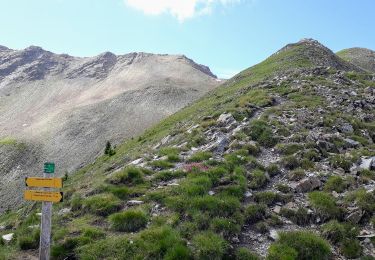
Trail Walking of 5.1 km to be discovered at Provence-Alpes-Côte d'Azur, Hautes-Alpes, Orcières. This trail is proposed by Sugg.
Description
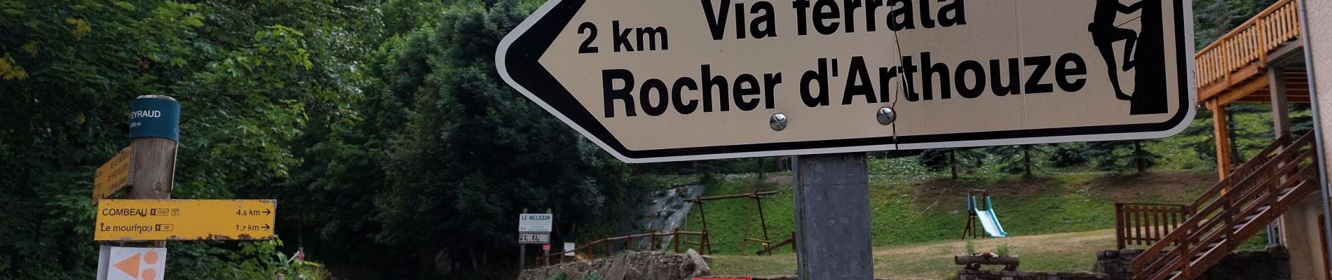
allez retour spot via ferrata Arthouze et Pic nic cool.
Positioning
Country:
France
Region :
Provence-Alpes-Côte d'Azur
Department/Province :
Hautes-Alpes
Municipality :
Orcières
Location:
Unknown
Start:(Dec)
Start:(UTM)
284287 ; 4950883 (32T) N.
Comments
Trails nearby
Le Forest des marches
Walking
Easy
(2)
Orcières,
Provence-Alpes-Côte d'Azur,
Hautes-Alpes,
France
1h 42min
Yes
Circuit de Costebelle
Walking
Very easy
(2)
Saint-Jean-Saint-Nicolas,
Provence-Alpes-Côte d'Azur,
Hautes-Alpes,
France
7.4 km | 12.1 km-effort
2h 16min
Yes
Roc Diolon par le col de Fressinieres 11/08/23
Walking
Very difficult
Orcières,
Provence-Alpes-Côte d'Azur,
Hautes-Alpes,
France
16.3 km | 32 km-effort
7h 21min
Yes
Balade Vallée Champoléon
Walking
Easy
Champoléon,
Provence-Alpes-Côte d'Azur,
Hautes-Alpes,
France
9.5 km | 12.2 km-effort
2h 40min
Yes
Col de Rouannette 22/07/18
Walking
Medium
Orcières,
Provence-Alpes-Côte d'Azur,
Hautes-Alpes,
France
9.3 km | 20 km-effort
3h 56min
Yes
Pont Ricous Pelissier Coste Belle Pont du Fossé
Walking
Easy
(2)
Saint-Jean-Saint-Nicolas,
Provence-Alpes-Côte d'Azur,
Hautes-Alpes,
France
11.3 km | 21 km-effort
1h 57min
Yes
08072013
Walking
Medium
(1)
Orcières,
Provence-Alpes-Côte d'Azur,
Hautes-Alpes,
France
10.5 km | 17.9 km-effort
2h 36min
Yes
Merlette Les Lacs
Walking
Easy
(1)
Orcières,
Provence-Alpes-Côte d'Azur,
Hautes-Alpes,
France
18.4 km | 32 km-effort
4h 39min
Yes
La recula 31.12.12
Snowshoes
Medium
(3)
Orcières,
Provence-Alpes-Côte d'Azur,
Hautes-Alpes,
France
11.1 km | 25 km-effort
4h 40min
Yes