Trail Walking Sixt-Fer-à-Cheval - Lac Vogealle depuis chalet de Boret - Photo

Lac Vogealle depuis chalet de Boret

© OpenStreetMap contributors
Length
Length
15.7 km
Max alt
Max alt
2026 m
Uphill gradient
Uphill gradient
727 m
Km-Effort
Km-Effort  
27 km
Min alt
Min alt
942 m
Downhill gradient
Downhill gradient
1231 m
Boucle
Boucle
No
Creation date :
2021-08-11 08:49:04.0
Updated on :
2021-08-11 18:33:19.143

(0 Reviews)

Walking
Walking
5h27
Difficulty : Very difficult

Scan this QR Code to open this trail in the SityTrail application

FREE GPS app for hiking

Logo SityTrail SityTrail

IGN / Geographical institutes

Download SityTrail from the App Store Download SityTrail from Google Play

Logo SityTrail SityTrail World

The world is yours!

Download SityTrail from the App Store Download SityTrail from Google Play Download SityTrail on Huawei AppGallery

About

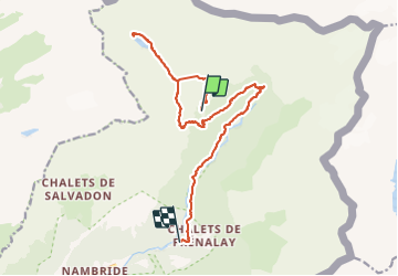
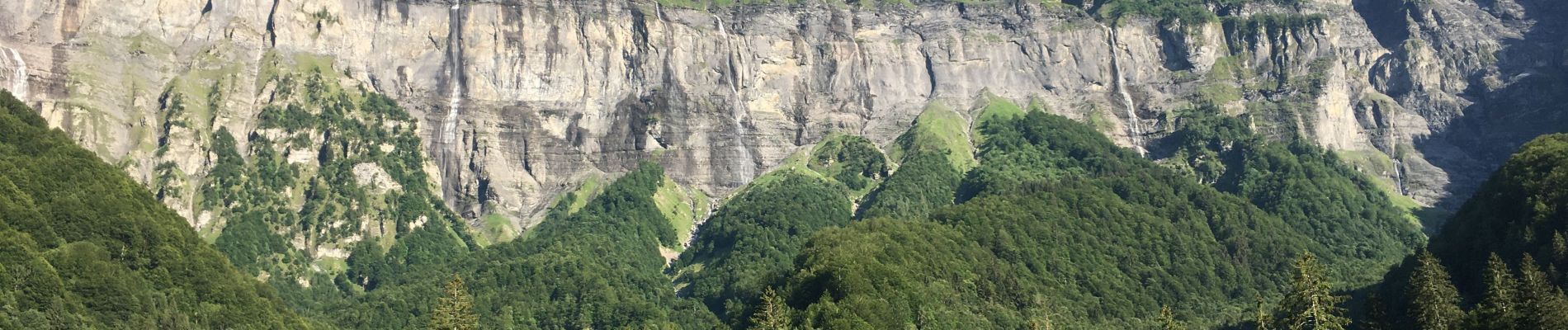
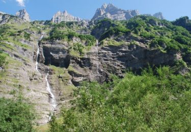
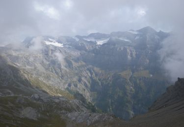
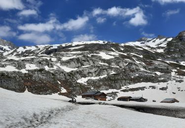
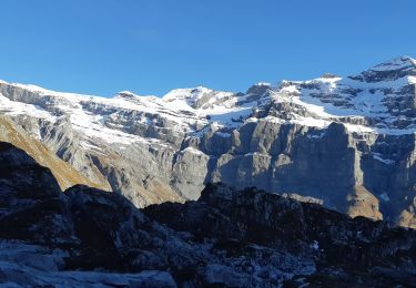
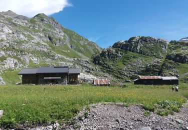
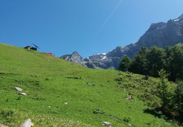
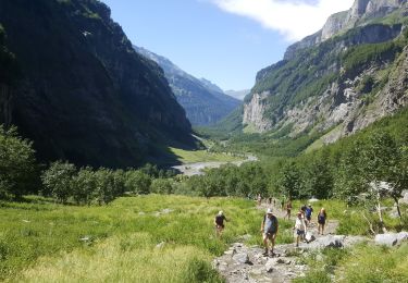
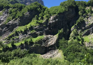
Trail Walking of 15.7 km to be discovered at Auvergne-Rhône-Alpes, Upper Savoy, Sixt-Fer-à-Cheval. This trail is proposed by Bearn64230.

Elevation profile

Photos

65 photos in total. Please click on a photo to see them all in the gallery.

Positioning

Country:
France
Region :
Auvergne-Rhône-Alpes
Department/Province :
Upper Savoy
Municipality :
Sixt-Fer-à-Cheval
Location:
Unknown
Start:(UTM)
333415 ; 5108046 (32T) N.

Trails nearby

Trail Walking Sixt-Fer-à-Cheval - Sixt Fer à Cheval et cascades - Photo
Walking
tracegps

Walking

Medium
(3)
Sixt-Fer-à-Cheval, Auvergne-Rhône-Alpes, Upper Savoy, France
9.3 km | 14.1 km-effort
3h 0min
Yes
Trail On foot Sixt-Fer-à-Cheval - GR de Pays Tour des Dents Blanches - Photo
On foot
PRO

On foot

Very difficult
Sixt-Fer-à-Cheval, Auvergne-Rhône-Alpes, Upper Savoy, France
41 km | 87 km-effort
19h 51min
Yes
Trail Walking Sixt-Fer-à-Cheval - Refuge de Vogealle et Bout du monde - Photo
Walking
GuyVachet

Walking

Very difficult
Sixt-Fer-à-Cheval, Auvergne-Rhône-Alpes, Upper Savoy, France
16 km | 30 km-effort
5h 50min
Yes
Trail Walking Sixt-Fer-à-Cheval - Le bout du monde Sixt fer à cheval - Photo
Walking
daniel34

Walking

Medium
Sixt-Fer-à-Cheval, Auvergne-Rhône-Alpes, Upper Savoy, France
11.9 km | 18.7 km-effort
3h 10min
Yes
Trail Walking Sixt-Fer-à-Cheval - lac de la Vogealle par le pas du Boret - Photo
Walking
arianespace

Walking

Difficult
Sixt-Fer-à-Cheval, Auvergne-Rhône-Alpes, Upper Savoy, France
19.2 km | 35 km-effort
8h 0min
Yes
Trail Walking Sixt-Fer-à-Cheval - SIXT-PASSY: PAS DU BORET - VOGEALLE - BOUT DU MONDE - Photo
Walking
djeepee74

Walking

Difficult
Sixt-Fer-à-Cheval, Auvergne-Rhône-Alpes, Upper Savoy, France
15.1 km | 30 km-effort
6h 15min
Yes
Trail Walking Sixt-Fer-à-Cheval - SIXT PASSY: PAS DU BORET - BOUT DU MONDE - Photo
Walking
djeepee74

Walking

Difficult
Sixt-Fer-à-Cheval, Auvergne-Rhône-Alpes, Upper Savoy, France
10.7 km | 18 km-effort
3h 45min
Yes
Trail Fishing Sixt-Fer-à-Cheval - Sixt fer à cheval - Photo
Fishing
jeff2

Fishing

Very easy
Sixt-Fer-à-Cheval, Auvergne-Rhône-Alpes, Upper Savoy, France
12.1 km | 17.9 km-effort
3h 37min
No
Trail Walking Sixt-Fer-à-Cheval - Randonnée du Bout du Monde - Photo
Walking
so.duchateau

Walking

Medium
Sixt-Fer-à-Cheval, Auvergne-Rhône-Alpes, Upper Savoy, France
10.7 km | 16.1 km-effort
3h 21min
No


Close
My subscriptions